Summiting Mount Baker (Koma Kulshan) via a self-propelled bike ski trip has been my primary objective for the past year. On every clear day in Vancouver, Baker peaks out of the horizon, prominent in the skyline. My winter revolved around preparing for this: gaining experience with technical ski objectives, multi-day winter camping, crevasse rescue, wilderness first aid, and multiple bike-ski trips to get ready. Easter weekend gave me a rare four-day window off of grad school April 17th-21st, so everything was lined up. I found a crew of 5 keeners and was just finishing recovery from a knee flare-up. Then the forecast rolled in – a perfect weather window from Tuesday to Friday, followed by a storm moving in on Saturday. The crew held onto hope that it would shift, but the closer we got, the worse it looked. By Wednesday, we made the call to bail on the objective. Disappointment doesn’t begin to cover it. To grieve the demise of the objective, we turned to John Baldwin’s Exploring the Coast Mountains on Skis to salvage the long weekend.
The forecast was strange: sunny skies in Vancouver, but clouds and precipitation swirling around nearly every mountain around us – Baker, the Coquihalla, Whistler, the Duffey, and north in Lillooet. (The fabled Capricorn Mountain looked especially tempting, but even that forecast looked questionable.) Oddly enough, the best weather seemed to be in the Tantalus Range. Mount Pelion stood out as a highly recommended spring ascent in Baldwin’s book. Listed at 21 km round trip, the route was described as a two-day trip or a strenuous one-day mission. Our plan: bike 100 km to the trailhead Friday, reach snowline that evening, summit Saturday, and descend and bike home Sunday. After Baker fell through, a few folks dropped, leaving just Corey Monteith, Vivian Liu, and me. Vivian, still recovering from a 26-hour ski mission the weekend before, planned to join for the bike leg only.
You can learn many lessons in three long days. One of the biggest ones being that a guidebook written 15 years ago doesn’t account for the snowpack of today. We figured mid-April would be a safe bet, since the book recommends March through May, but the conditions told a different story. If you’re looking for updated beta on a mid-April 2025 approach to Mount Pelion (and by extension, the approach to the Tantalus Traverse), read on.
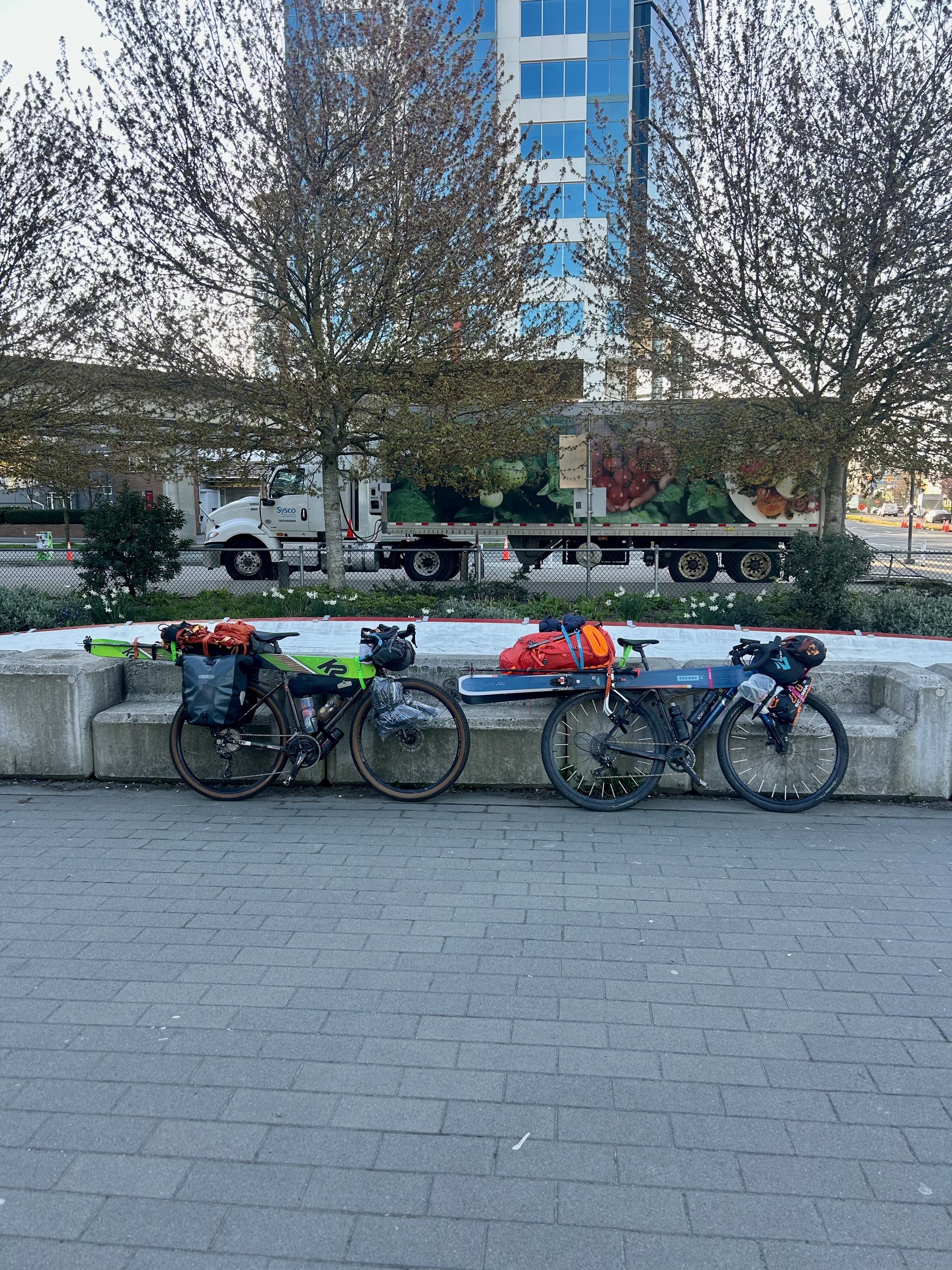
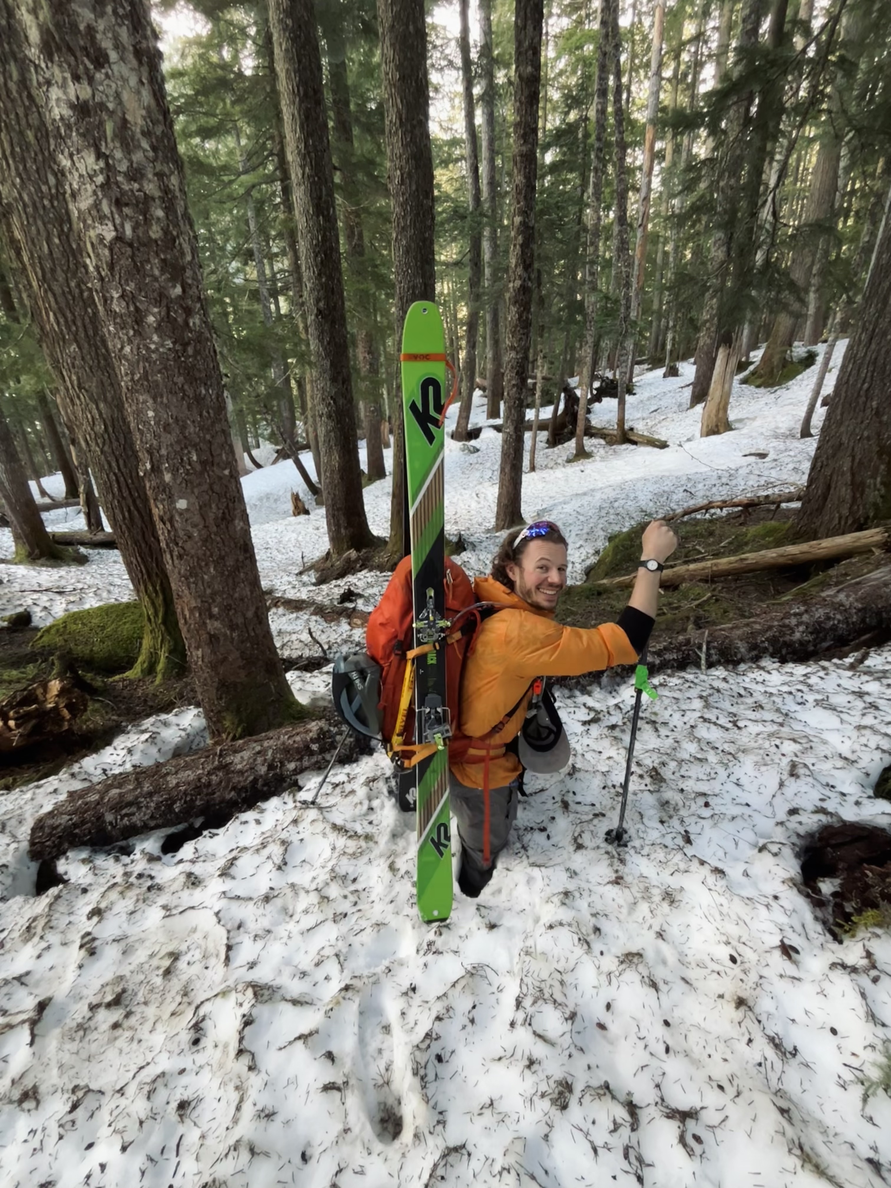
Packing for a multi-day bike-ski trip makes you hyper-aware of what’s essential and what counts as a luxury item. I went as light as I could without cutting corners on safety: full glacier kit, ski crampons, boot crampons, ice axe. Things I left behind included goggles, coffee, hiking boots, hut booties, tent stakes, and a day 2 lunch. My luxury item was a pair of fresh socks for every day. I got home from work at 8 p.m., finished setting up my bike by 10, mapped out the approach with a pencil on a printed-out cal topo map, and finally wrapped up packing around 1 a.m. At 7 am the next morning, I rolled down the hill toward Science World with my fully loaded, 95-pound bike. The start felt smooth, and I tried not to think too hard about the hills to come on the Sea-to-Sky. The weather was beautiful and sunny, and I did my physio stretches while waiting for Corey. We pedaled along the Seawall and tackled our first hill ascending through the Stanley Park Causeway onto the Lions Gate. Flats and downhills are generally the same speed; it’s just the hills that are slow, but we kept it steady, and it felt doable.
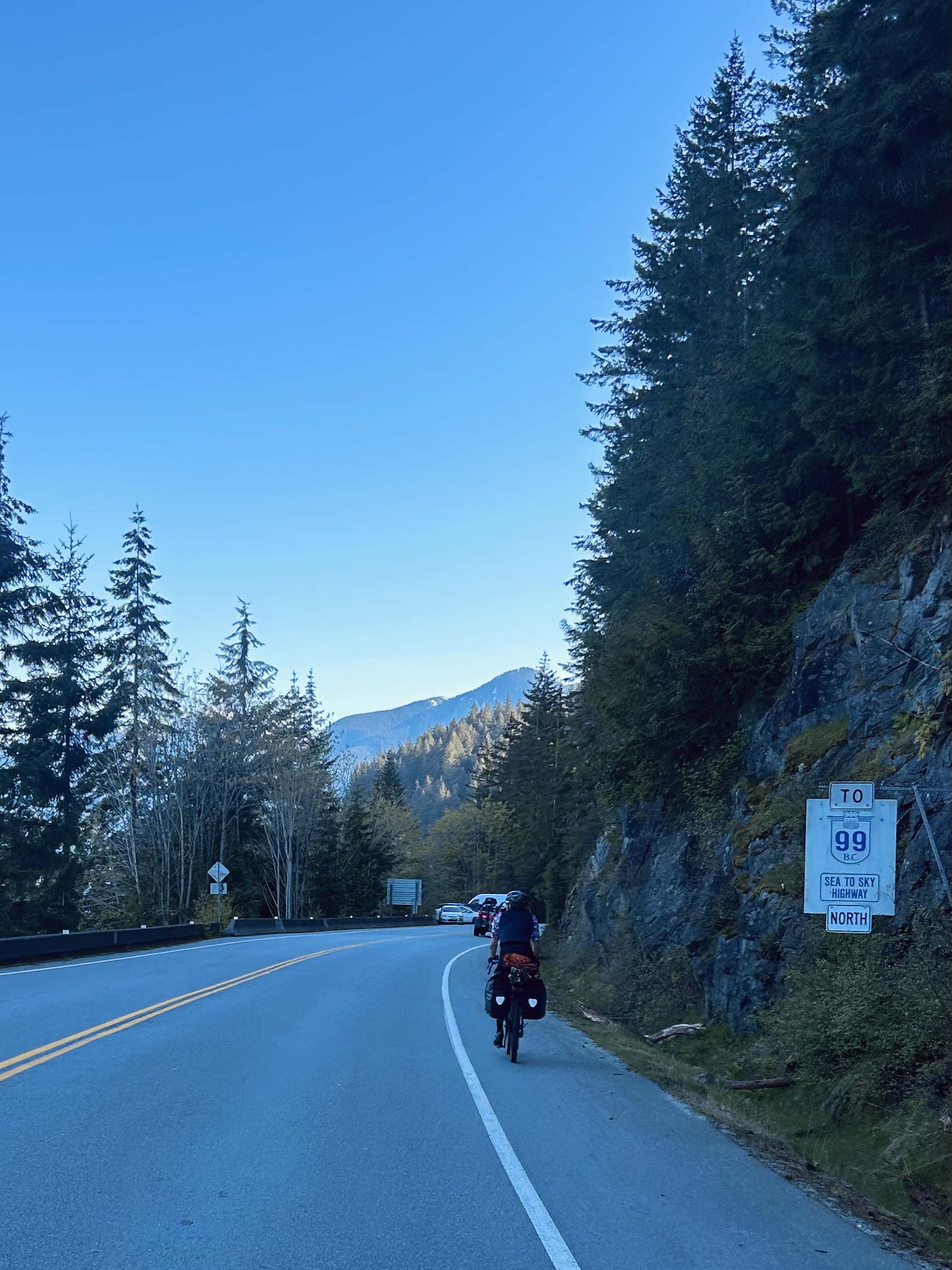
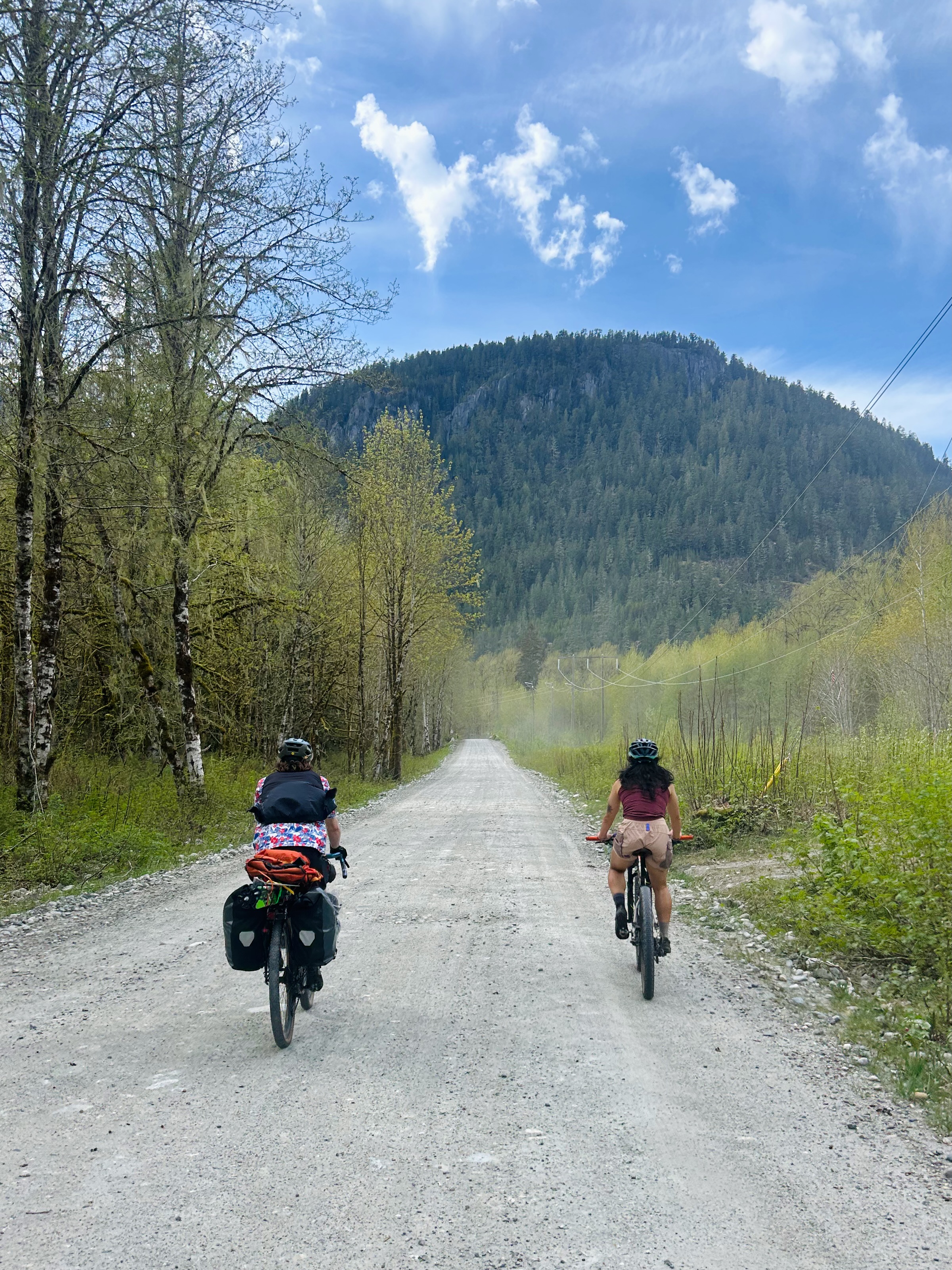
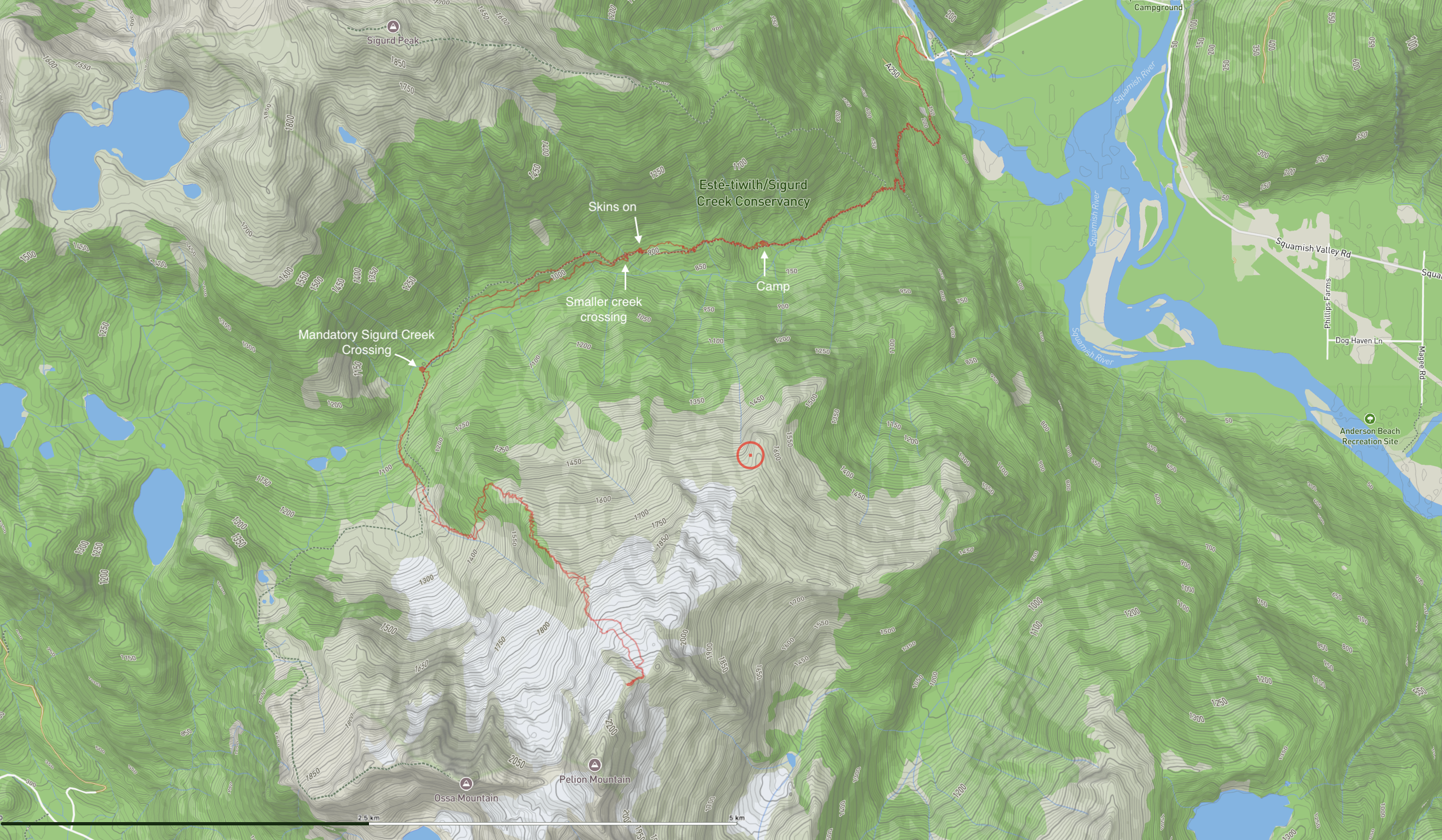
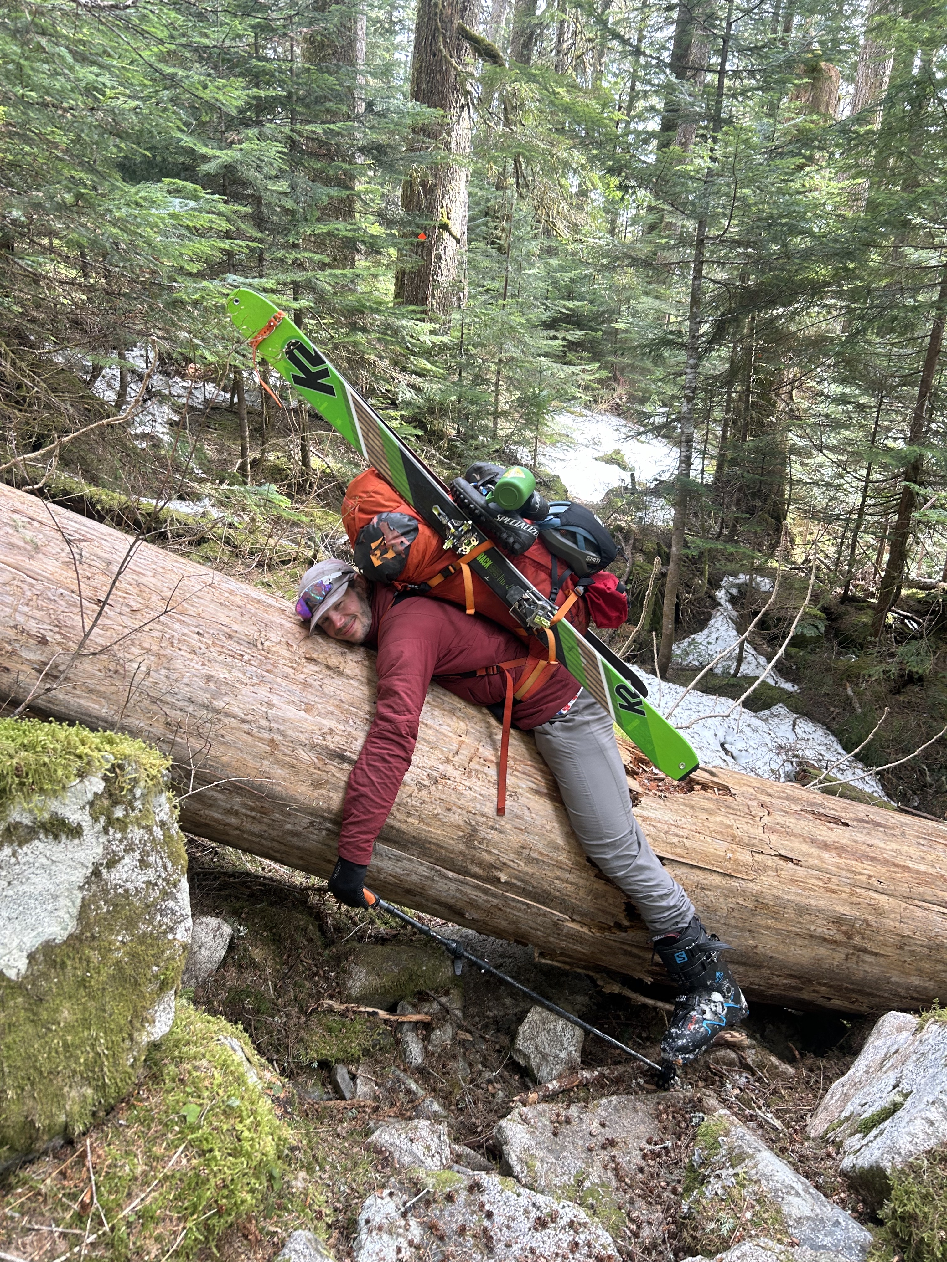
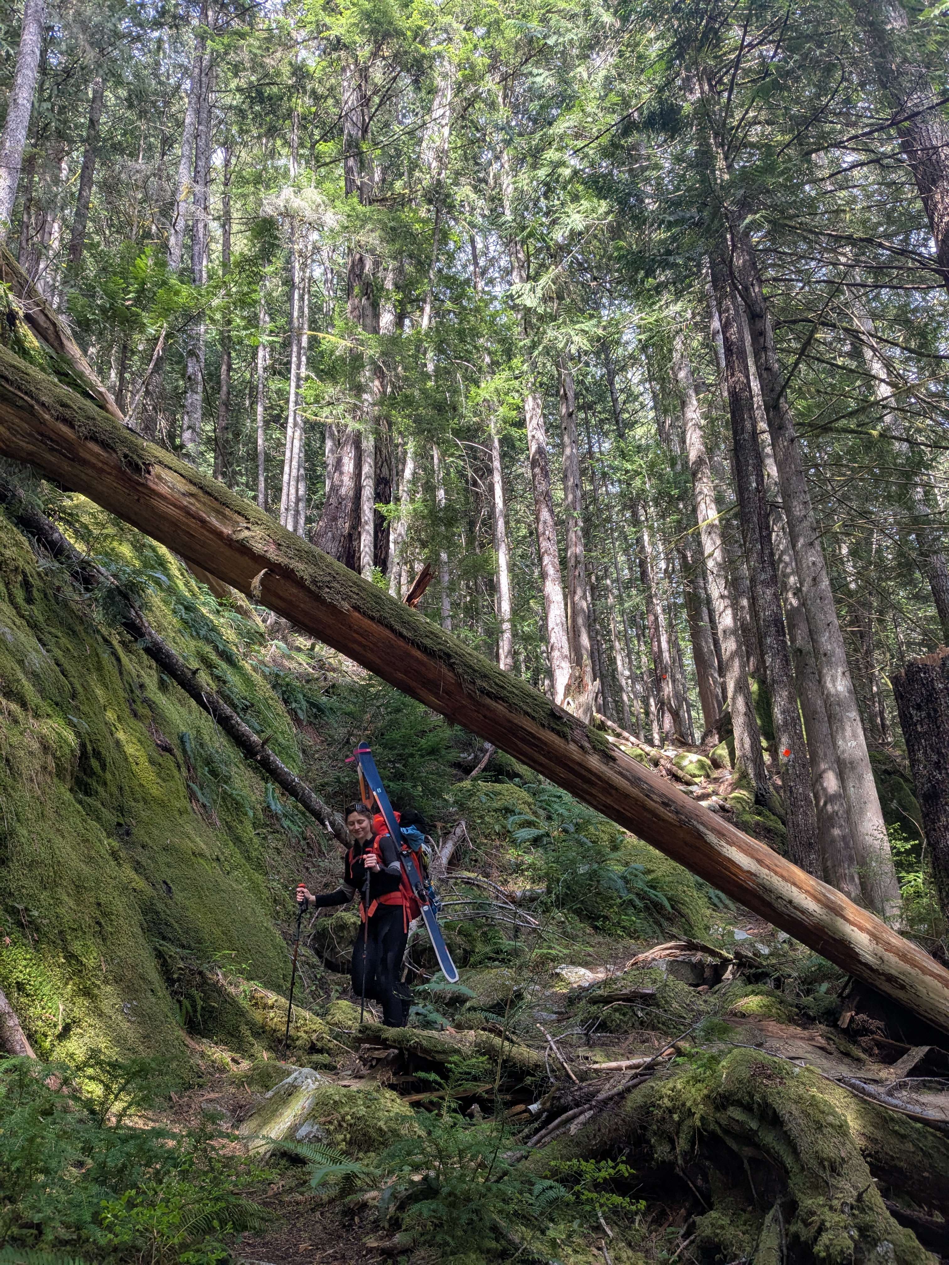
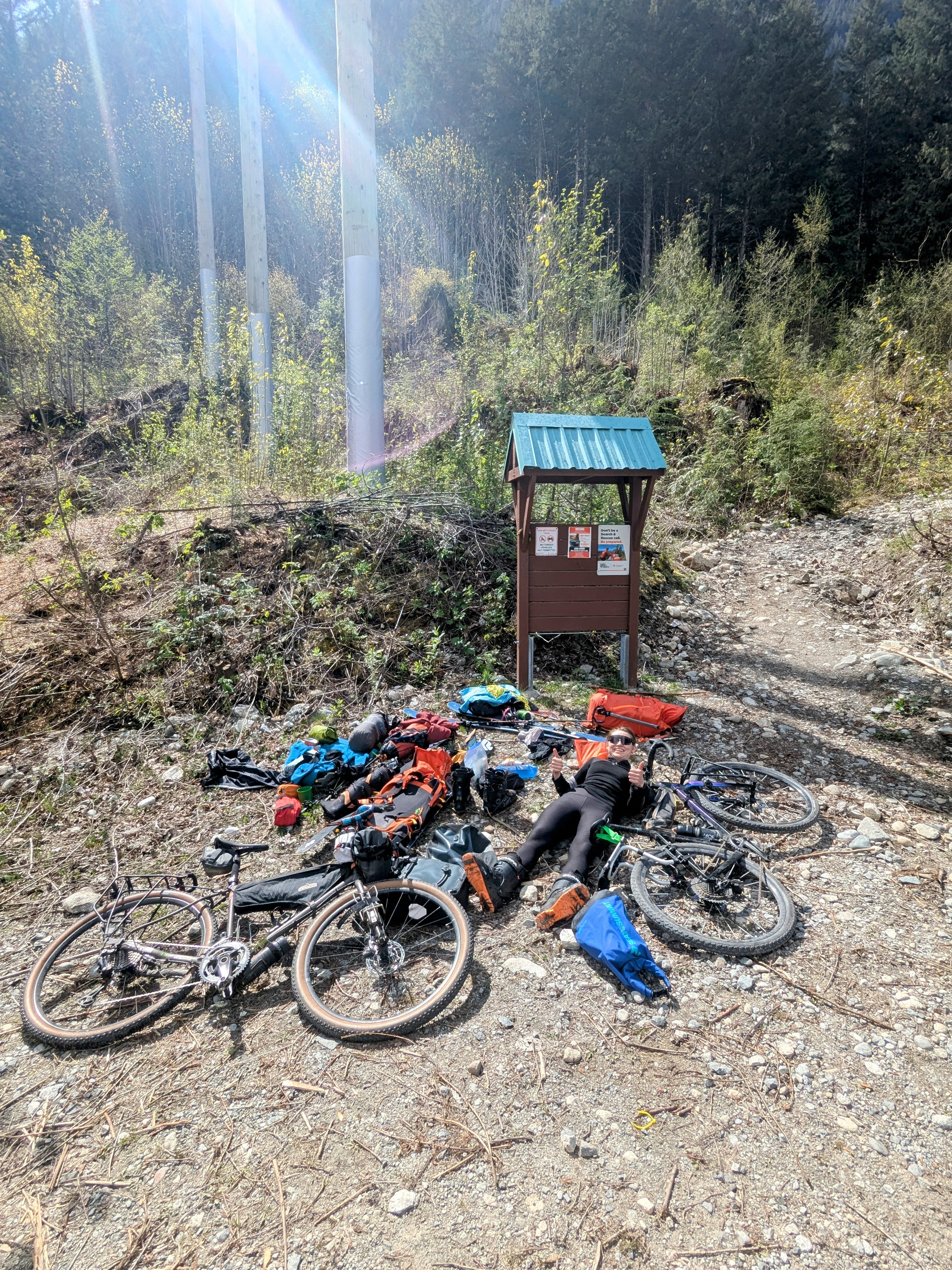
Once we made it to Horseshoe Bay, we merged onto the Sea-to-Sky. I was a bit terrified of biking on the highway, but with some music, I was able to calm down and focus on the lovely scenery. We stopped for coffee at Lions Bay and got some satisfaction passing cars stuck in traffic. The shoulder is actually decent, with the only sketchy section being the ascent to Murrin Park, but after that it was smooth sailing. We arrived in Squamish around 12:30 p.m. Vivian met us as Nesters as we scarfed down half a chicken and snacks. We chatted about ski and traverse plans as we basked in the sun, Vivian filling us in on the beta for Supercouloir. After refilling our bottles and topping up on snacks, we headed up the Squamish River Valley. We got to the Ashlu bridge quickly and found the Sigurd Creek trail at the high altitude of 80m. All hopes of biking up any more elevation immediately went out the window; it was a full hiking trail from the start. Vivian treated us with fresh fruit, and we took a moment to rest and ponder. A point of regret was that neither of us brought hiking shoes. I decided to fully commit to my ski boots for the hike, while Corey decided to test out the ability of his cycling shoes. We transitioned, said goodbye to Vivian, hid our bikes in the bushes, and began hiking around 5 pm.

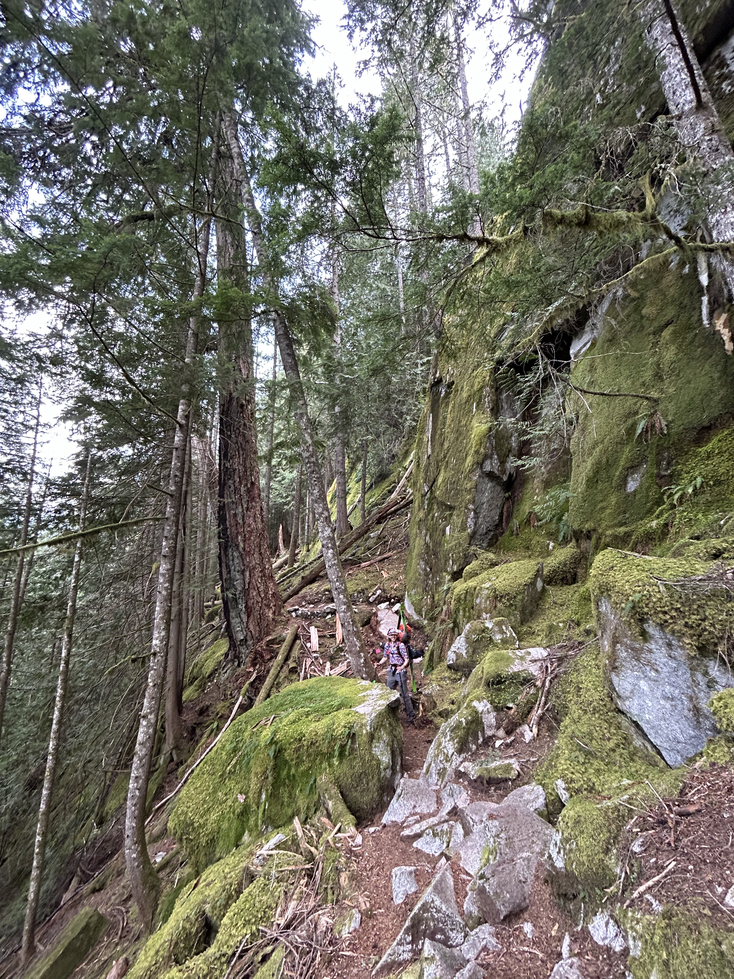
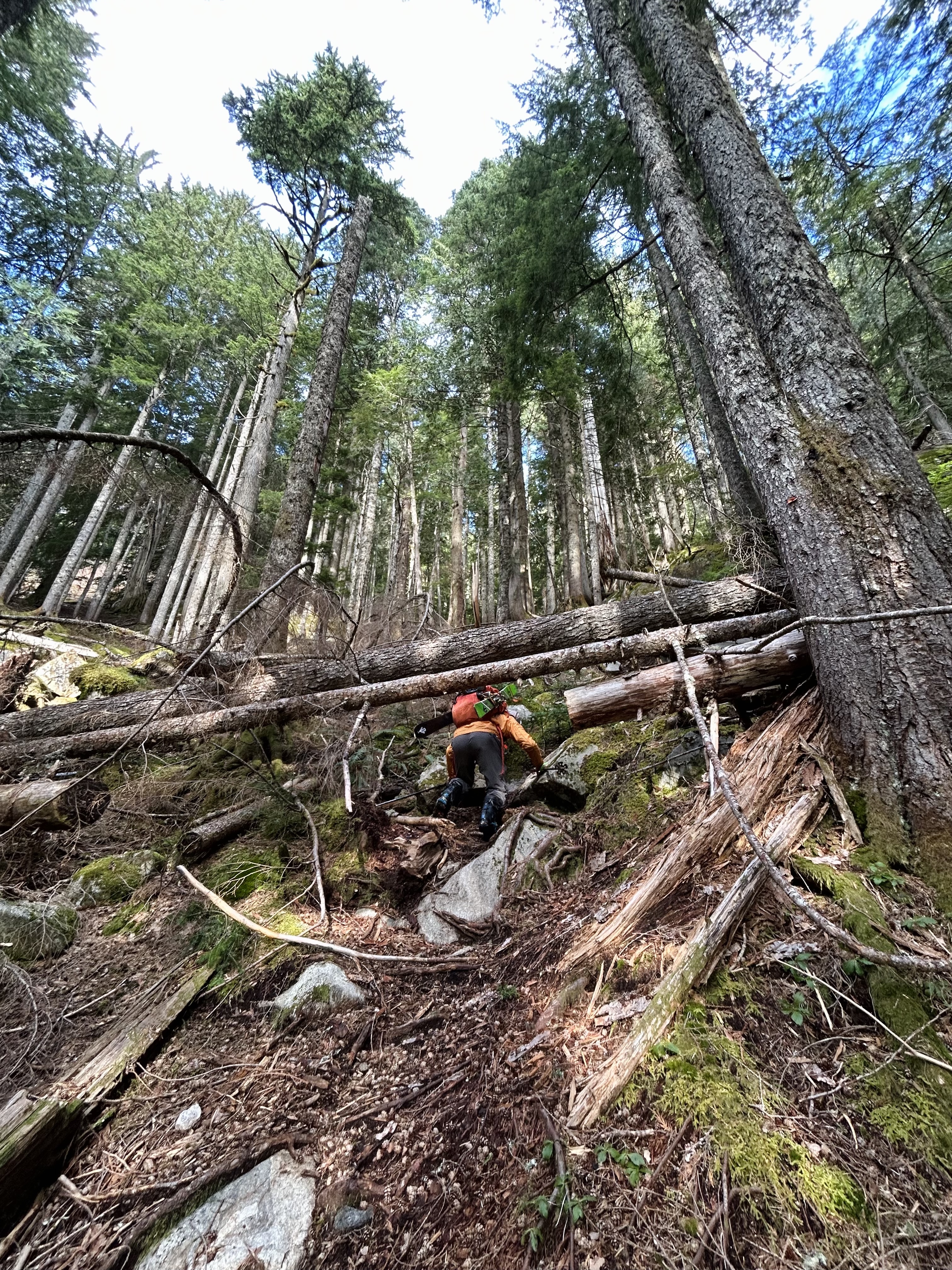
The trail almost immediately started gaining serious elevation, and we scrambled up boulders and switchbacks, testing the traction on our respective footwear. The snowline seemed impossibly far away. Finally, at 700m snow started appearing. It had taken us 3 hours to go 6 km. However, we also started feeling raindrops, and daylight was fading. We had been hoping to get to 1000m, but decided to camp early to avoid camping on soggy snow. After we set up the tent and ate dinner, we discussed our next day. I knew earlier starts were better, but I was worried about the scale of the next day and my ability to recover, so I asked for a 7 am start, and Corey agreed. I fell asleep about 20 seconds after my head hit the pillow.
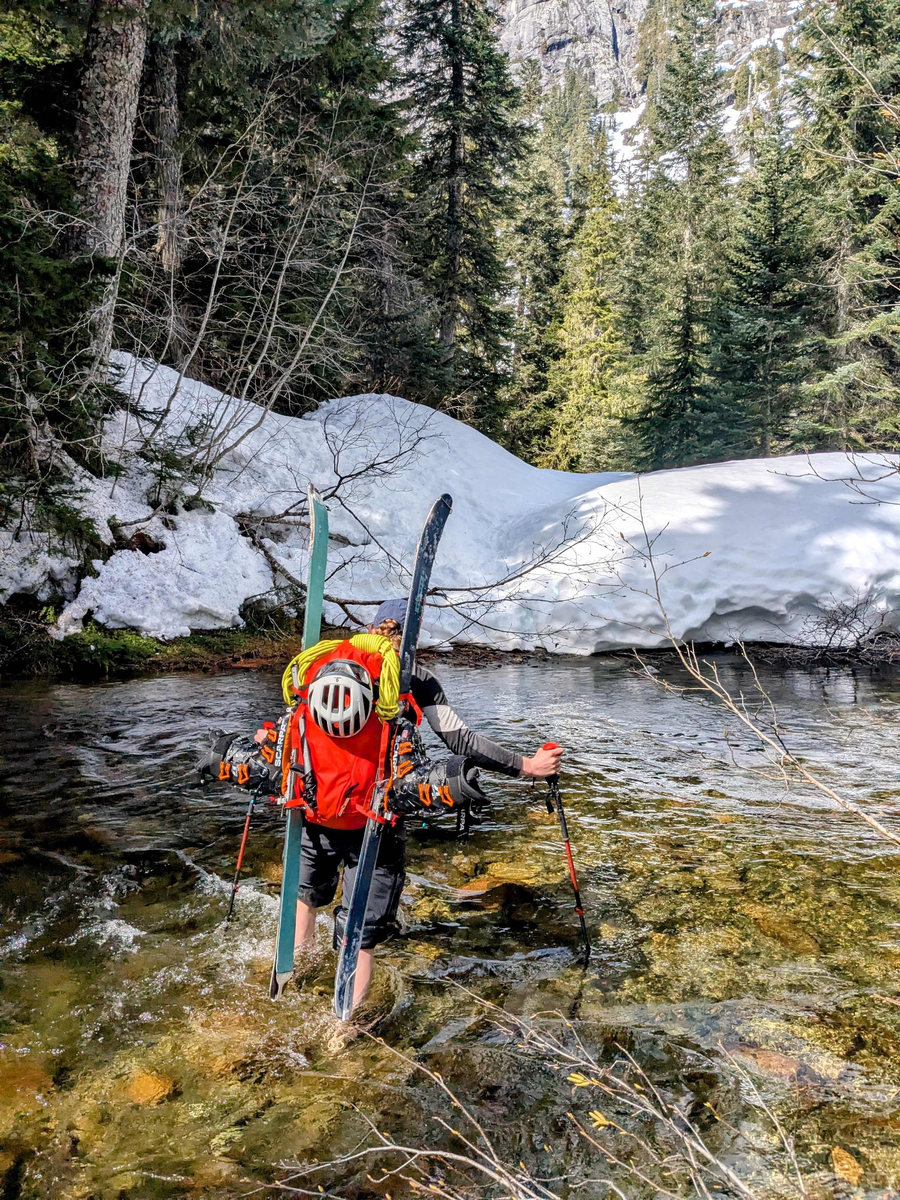
We woke up, made oatmeal and coffee, and packed our daypacks. The mountain peaks were covered in clouds but sunlight filtered into our camp. We were hopeful. We left around 8 am and started the hike up, starting the day with skis still on our backs. Eventually, the snow started covering more ground, and we started postholing, so we finally put on our skis around 1000m and skinned on. There were lots of little creeks, but they all had some thin snow bridges. The valley was peaceful and full of wildlife – we caught sight of a bobcat checking us out before bounding away up the mountain. At 11 am, we made it to the signage for the Sigurd Creek footbridge. To our dismay, there was no bridge, just some tracks that went down one side of the snow and back up the other. After a bit of disbelief, we came to terms with the fact that we would be fording across the river. We awkwardly set up our A-frames on the riverbank, trying to avoid standing on snow with our bare feet and getting our gear wet with the meter of space we had. I went first; the water was faster than I was expecting, but the cold was less shocking than I feared, and before I knew it, I was on the other side. We dried our feet with our shirts and kept on moving.
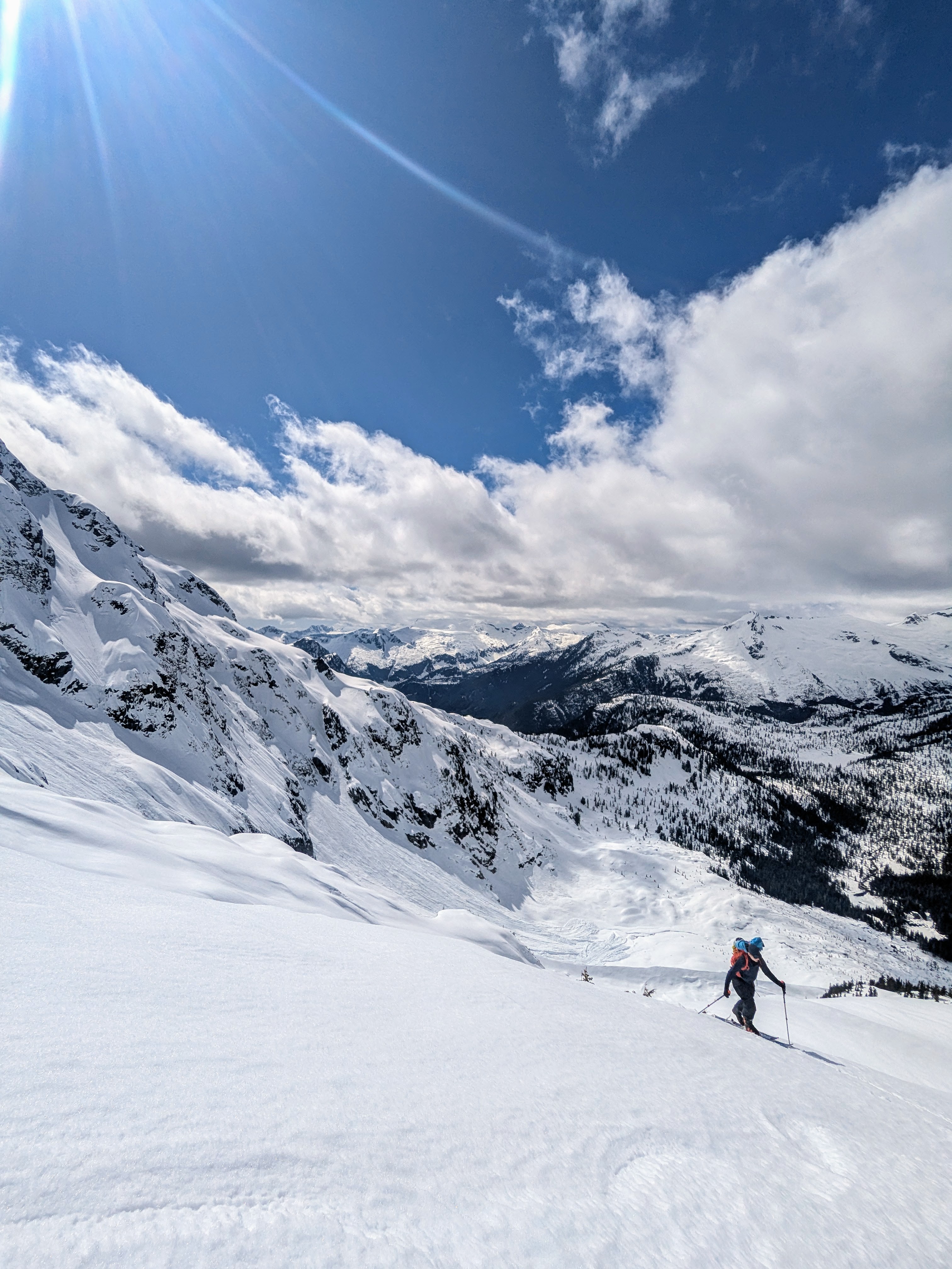
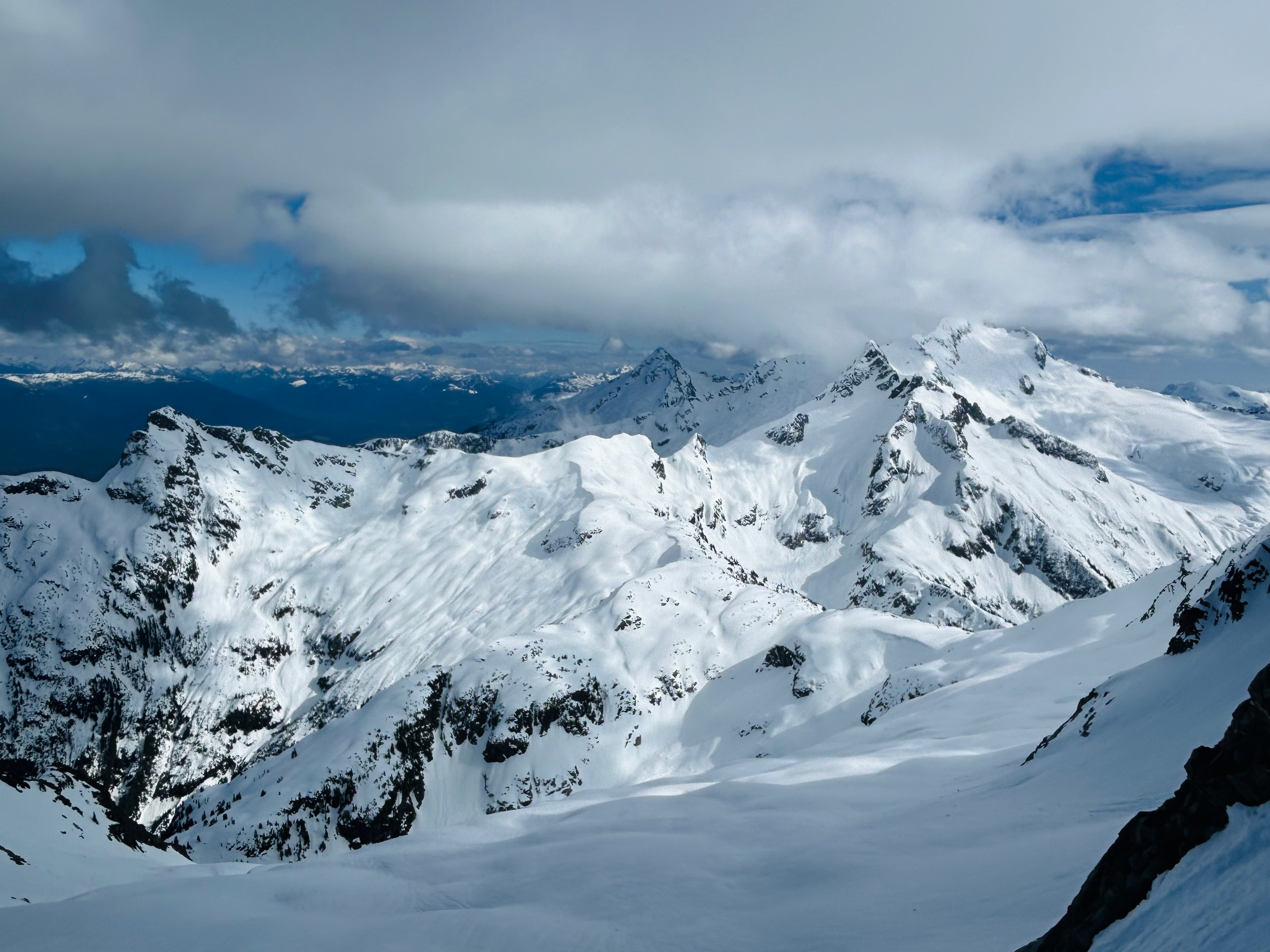
After the creek, the true ski ascent began. Soon we made it to the open basin as the sun-baked snow turned soft and slushy. We were greeted with the imposing sight of the Ossa mountain face, complete with a large slide that had ripped across much of its north face, reminding us of the consequences of this terrain. We picked our way around avi debris to ascend around the tree line to the northwest ramp at 1500 m. We discussed risk while eating lunch around 1:30 pm. I felt guilty that our late start had been the wrong call, but we decided to start up the ramp, assess conditions as we went, and turn around if the snow felt too soft or the clouds closed in. Luckily, the clouds held off, and the snow firmed up, so we made it to the northern col in no time. At the top of the col, we met a pair of skiers who had been planning to do the Tantalus Traverse, but got held up because of the weather. We had seen them the day before at the trailhead. Not needing to transition from biking to skiing gave them a one-hour headstart on us, but with their fresh legs and proper shoes they had made it all the way to the open valley the night before. They recounted to us that they woke up for an alpine start, only to face horrible visibility and icy snow conditions, which stopped their traverse attempt. Maybe our late start might have actually worked out in our favor.

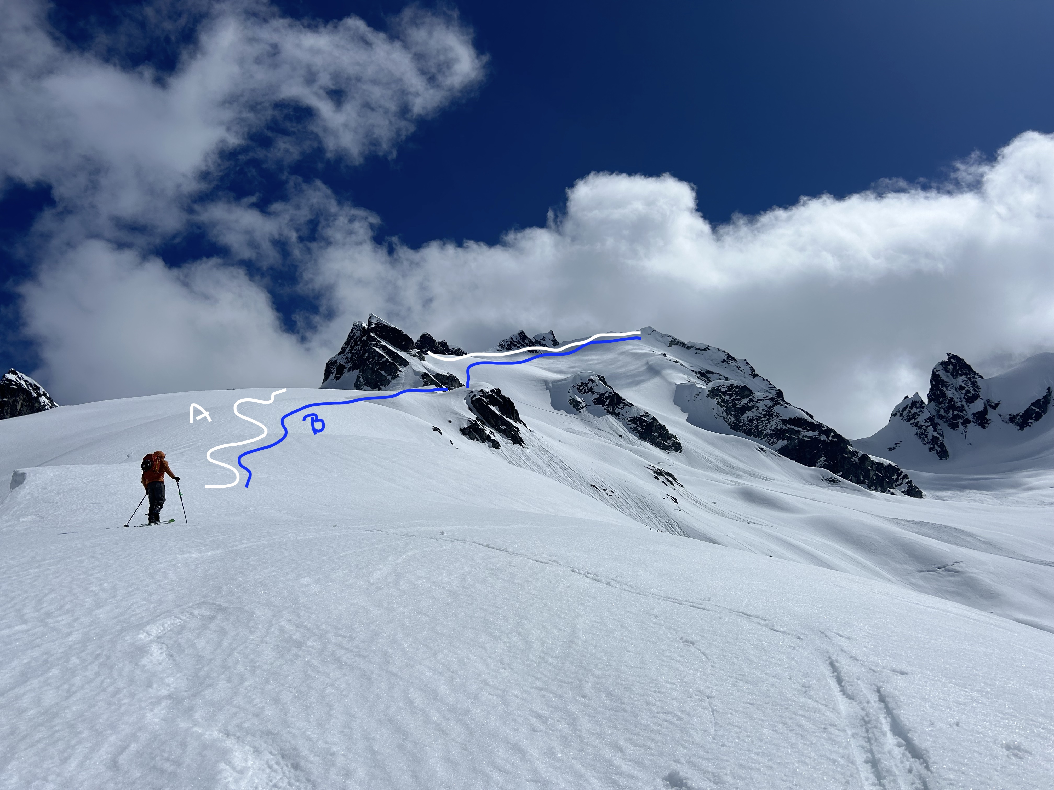
Looking toward the summit, we couldn’t see the “notch” the guidebook described. Instead, we saw exposed rock and sparsely covered chimneys separated from us by a 50 deg slope. This wasn’t the only piece of misleading beta—we were already at 19 km one way, nearly double the 21 km total distance listed in the book. We asked our new friends we’d met if they knew the route. They’d done the ascent the previous year and pointed us toward the correct chimney, warning us that it was steep and exposed. “A fall would definitely be fatal,” they casually mentioned. They proposed an alternative route (Labeled B in the picture) but as we had already gained the col, we decided to take a cautious look on the official route (A). We ditched our skis, strapped on our boot crampons, took out our ice axes, and made our way over. The crystalline snow disintegrated like sugar under our steps and didn’t inspire confidence. The main chimney was thinly covered and clearly wouldn’t hold weight, so we poked around for an alternate line, settling on a more exposed rocky section to the right, which lured us in with its solidness.


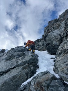
The snow surrounding the rock was weak, and a sort of snow-bergschrund had formed, and as we stood beneath the face, we paused. We talked about the “bail game” (shoutout to Noah Macdonald for the excellent article): success in the mountains isn’t just about reaching the summit, it’s also about knowing when to walk away. You haven’t truly claimed a peak unless you’ve also played, and won, the bail game. We decided to see how the rock felt and then make a call. Corey climbed a few meters up; I followed, carefully trusting my crampons and axe on the exposed granite. As I took off my mittens to get a better grip, it started to become apparent this wasn’t really just scrambling – we were edging into mixed terrain, with poor snow and no real protection. Even if we could climb up, the descent would be a problem. We only had a 30-meter rope, meaning any rappel would have to be less than 15 meters unless we rigged a rope block. We checked the time: it was 5 pm and we still had 12km and several creek crossings between us and camp. We were in over our heads: it was time to bail.
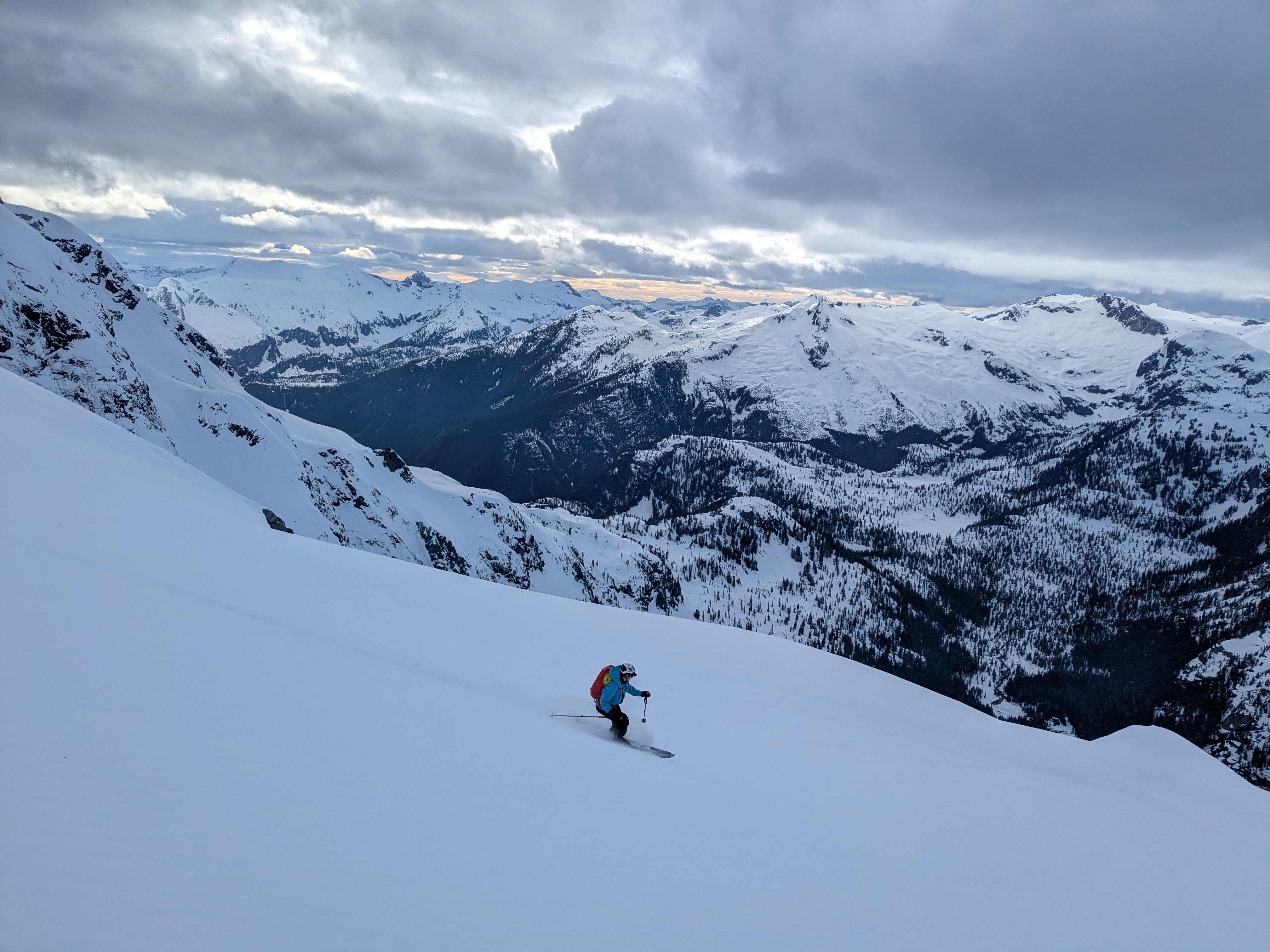
We carefully retraced our steps and breathed a sigh of relief when we made it back to our skis. Our friends greeted us with a handful of M&Ms and wished us luck and we began the descent down the glacier. The snow had crusted over, but the views were absolutely breathtaking. As we dropped lower, the snow softened into smooth, fun turns, and we cruised down to the creek crossing with only a bit of sidestepping. After mild procrastination faff and some hyperventilating, we crossed back over, feeling relieved to have our biggest obstacle behind us. The long exit still loomed, but in theory, the slight downhill grade should make it skiable. In practice, the rolling traverse meant most of it required skinning. Oh well. We made good time until we hit another issue. The snow bridge over the second-biggest creek we’d crossed earlier had melted out during the day. As dusk settled in, we weighed our options. Eventually, Corey anchored me while I carved off the overhanging bank into the creek, creating a mini snow bridge we could cross. From there, it was smooth sailing: skins off, skis out, and a final hike into camp. The sky cleared as darkness settled, stars twinkling overhead. Dinner tasted incredible and slipping into my sleeping bag felt even better.
We set our alarm for 7 am and we had a slow morning of enjoying our oatmeal with mini eggs (hoppy easter) and coffee. We packed up camp, loaded up our bags, and started the hike down. It was a lot easier with gravity on our side, but picking our way down the rocks in our ski boots still took a long time. Finally, the river came into view, and we were back at our bikes a bit after 1 pm. We collapsed onto the ground for a bit, dreading the transition faff. A sprinkle of rain thwarted a potential nap and kicked us into gear. We transitioned slowly as the mental and physical fatigue from the past two days began to settle in. We eventually got moving and packed everything up. My body protested at first, so I took a few breaks for physio stretches, but my legs gradually warmed up. We rolled into Squamish around 5 pm. Rain clouds loomed and the roads were slick, but we somehow dodged getting wet. Once again, our late start seemed to work in our favor, and a rainbow welcomed us as we arrived.
After a stop at McDonald’s, we put on music and started on the Sea-to-Sky back home. Kendrick’s good kid mAAd city and Charli’s brat made the hills melt away. We put on high-vis gear, got our lights flashing, and continued as the sunset faded into the night. Horseshoe Bay flew by, we pedaled across Lions Gate around 11, and I made it home just before midnight.

I learned a lot on this trip. Most notably, how climate change and smaller snowpacks are reshaping skiing and route beta. We encountered more obstacles than expected – creek crossings, melted-out trails, long distances – that highlighted the ruggedness and unpredictability of the Tantalus Range. The journey was a lesson in patience: taking things one step at a time, staying calm, and solving problems thoughtfully. In the end, this trip challenged us in ways Baker likely wouldn’t have: more route-finding, more uncertainty, more decisions made deep in a truly remote place, and more time walking to access the snowline. Traveling through such a wild and significant landscape brought a sense of connection that made the experience deeply rewarding.
More than anything, I’m grateful to live on this land and to move through its wildness and power under my own effort. The Esté-tiwilh / Sigurd Creek Conservancy is a protected old-growth forest, vital habitat for eagles, salmon, grizzlies, wolves, and mountain goats, and a place of deep significance to the Squamish Nation. The conservancy plan calls for a halt to further development and a phase-out of heli-skiing by 2026. Esté-tiwilh, pronounced us-tut-ee-wayth, means “the great beauty and power that surrounds us, and that we should strive to be in harmony with.”
I hope to carry that perspective forward – into future trips, and into a more thoughtful relationship with the land.
nails