On the traditional unceded territory of the Tla’amin people
In short: 178km, 4.5 days, heavy weight fast packing is a stupid concept especially when you wear approach shoes, the sunshine coast is home to some beautiful and unique terrain and wildlife. People are awesome, I love to spend time away from them.
The Sunshine Coast Trail (SCT) has been on my radar for sometime, and more than that, the stretch of coast from Saltry Bay to Lund that the trail follows has been imprinted on my being through many drives to and from my families Cabin. My fondness for arbutus trees and coastal breezes pulled my sights from the light, fast, and technical adventures that capture my imagination, to the long slow adventures that this hut to hut trail would promise to be. This past June my Mom suggested it off hand as something to do, three days later I was enjoying a BC Ferries breakfast while making my way up the coast.
The trail comes out to roughly 180km and is typically done in nine days. I have a short attention span and weak legs so I decided rather than carry food for ten days I could pack for five. My thought was I could average 45km per day for four days, and then have food for an extra night should I need. I spent the better part of a day dividing the trail into manageable chunks, figuring out how I’d get from the ferry to the trail and home, and stocking up on ramen.
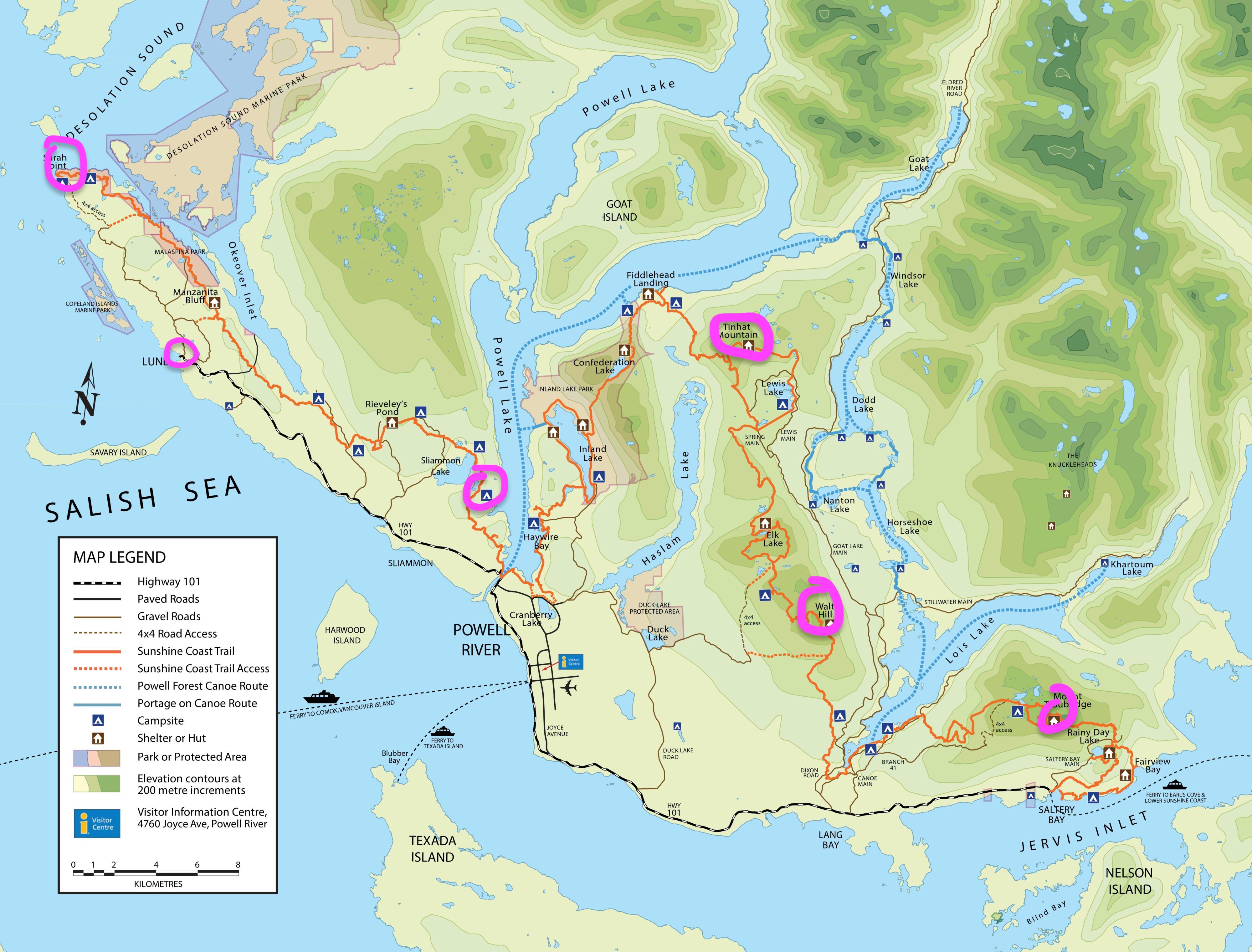
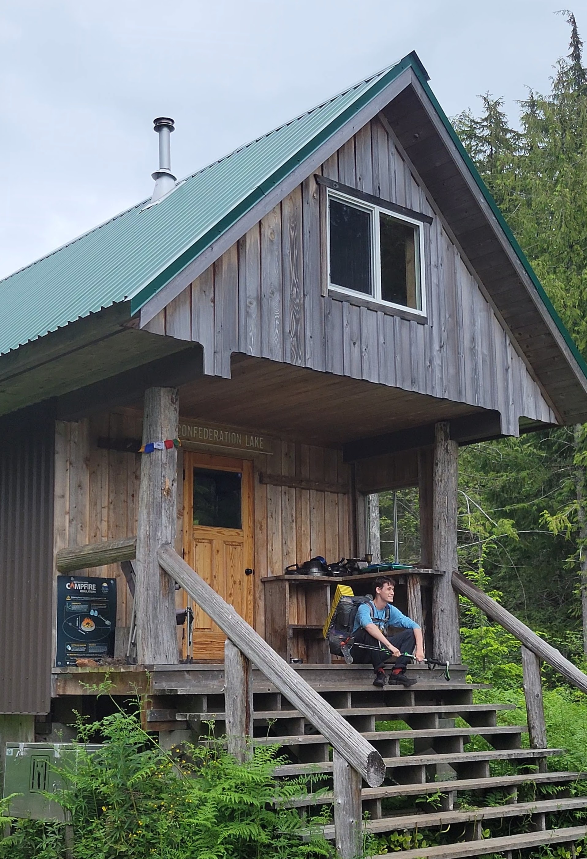
Campsites: 1-Troubridge, 2-Walt Hill, 3-Tinhat, 4-Camp S of Slimmaon Lake, 5-Sarah Point
My Mom had the morning off and drove me to the ferry terminal, she wished me luck and headed back home to Abbotsford. While I have a particular disdain for making my way through public with my climbing, skiing, or hiking pack, I seem to do it quite often. A lady on the first ferry said I “look equipped” and the cashier on the second said I “must be a very good hiker.” While I cannot argue with the first (see gear notes), I have always laughed at the description “a good hiker.” Maybe it’s because my friends make fun of me for my hobby being going for long walks, but that is what I have come to view hiking as, just a long walk, and I don’t think there’s much hierarchy in walking.
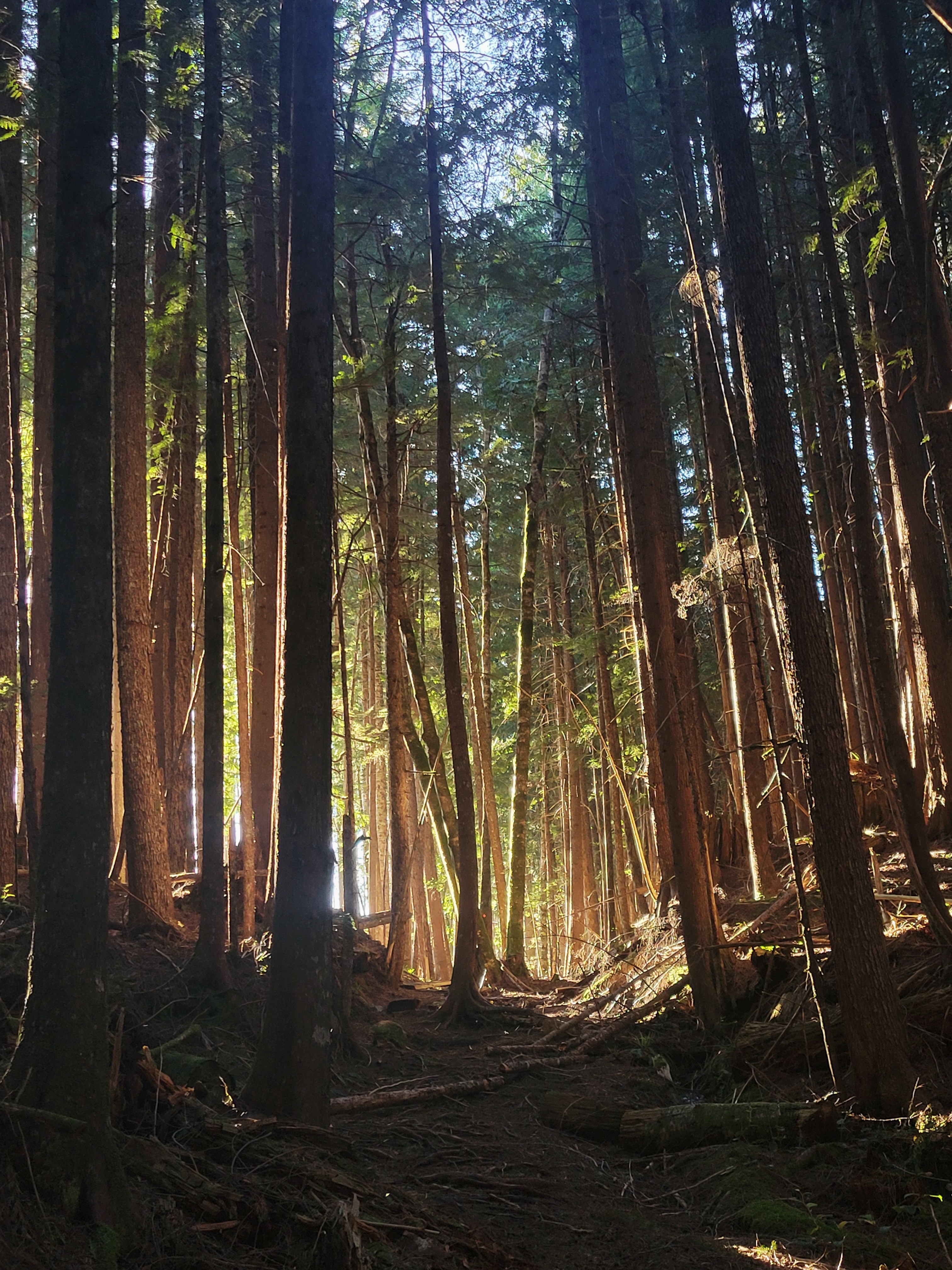
I hope my soul can glow like back lit leaves
Nor did I feel like a very good hiker when I was later sat at the Southern Trailhead of the SCT, trying to work my jammed hiking pole free of itself. Three minutes of swearing and I began Hiking, electing to choose the steeper but more scenic route that hugs the coastline. The warmth of the orange glow cascading through the evergreen canopy encouraged an over-eager pace, I made it to the first hut in time to enjoy a late lunch of a salami bagel. I found joy in the simultaneous similarity and variety of browns in each tree trunk and each broken twig, onwards. I finished my day at the Mount Troubridge Hut 18kms in, I set up my bed upstairs, and briefly rolled out my calf, the tension in which has caused some achilles issues that would snowball throughout the trip. I fell asleep before sunset, and before dinner.
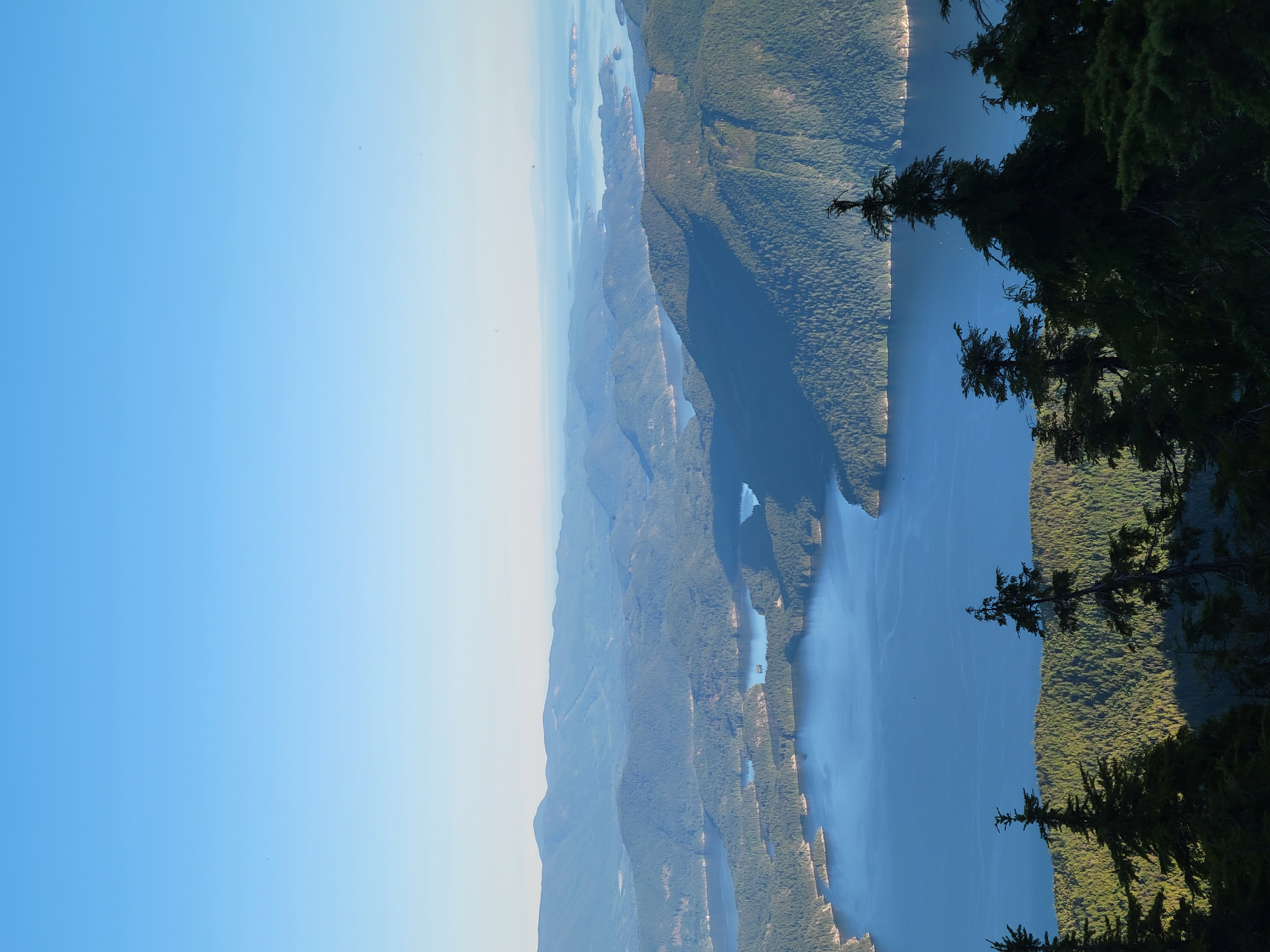
Day One Ocean and Inland lake Views
The next morning I awoke in a caloric deficit, and righted that with a four-cheese bagel filled with too many slices of Genoa, and not enough mayo. I brushed my teeth (my toothbrush proudly cut in half) and began walking, my left achilles was worked, although nothing seemed seriously wrong, so I made a point of reducing strain on that leg. Day two would be all downhill for the morning to get back to near sea level, and then a climb up Walt Hill. I’d been looking forward to this trip for a number of reasons (and if you’re my grandmother please stop reading here), a major one of which was the space it would allow me to take a relatively small dose of pyscilocybin, something I hadn’t done on my own in a very long time. As I sat at a lake chewing the earthy substance into a swallowable pulp, a fellow in his later 50s came up the trail, I slipped my empty bag into my pocket and forced the mud down my throat. We then chatted for the next half an hour, by the end of which I could feel myself slipping. He left and I continued my walk down, the next party I ran into I was able to have a short conversation with, in which they asked far to many questions and I was feeling gripped while trying to answer coherently and without drooling. They wished me on my way, and I wished the same, and for the next six hours of descent to Lois Lake I pondered the lessons of each facet of my life, my friends, family, and partner that inspire me constantly, my schooling, and all the trail showed me, including a lovely frog friend I met while staring at a leaf. I could also feel how empty my body grew as I continued, which would motivate an increase in force feeding myself protein bars and trail mix every hour. I reached the Lois Lake at noonish, and while it was beautiful I had the sneaking suspicion it wasn’t naturally so. Hiking along it’s boarders was moving into and over small v-shaped valleys, through second growth evergreens and crossing logging roads. A thing I love about backpacking is the intimacy you come to share with the nature that envelops you, the nature of the SCT however began to tell a sad story of human impact as I reached the west end of the lake, where a tall damn had flooded the valley for ease of extraction of lumber, and now hydropower. This observation remained as I climbed up and out of the valley, hugging green belts between clear cuts in varying stages of regrowth. The further I pushed through the day the less my thoughts were able to drift and I buried myself in the podcasts I’d downloaded. Listening to Chantel Astorga’s stories of running out of water while soloing El Cap, really put into perspective my own struggles throughout the day, and motivated me through the last bit of the climb, as I summited Walt Hill at sunset, shared a quick conversation with a couple I allowed the hut, as I set up my tent looking back at Troubridge. I enjoyed service that night, and called my girlfriend while eating ramen (with olive oil mixed in for extra calories, I do not recommend. Hearing her voice was a brilliant conclusion to the day. Day 2, 35km, 125km Remaining
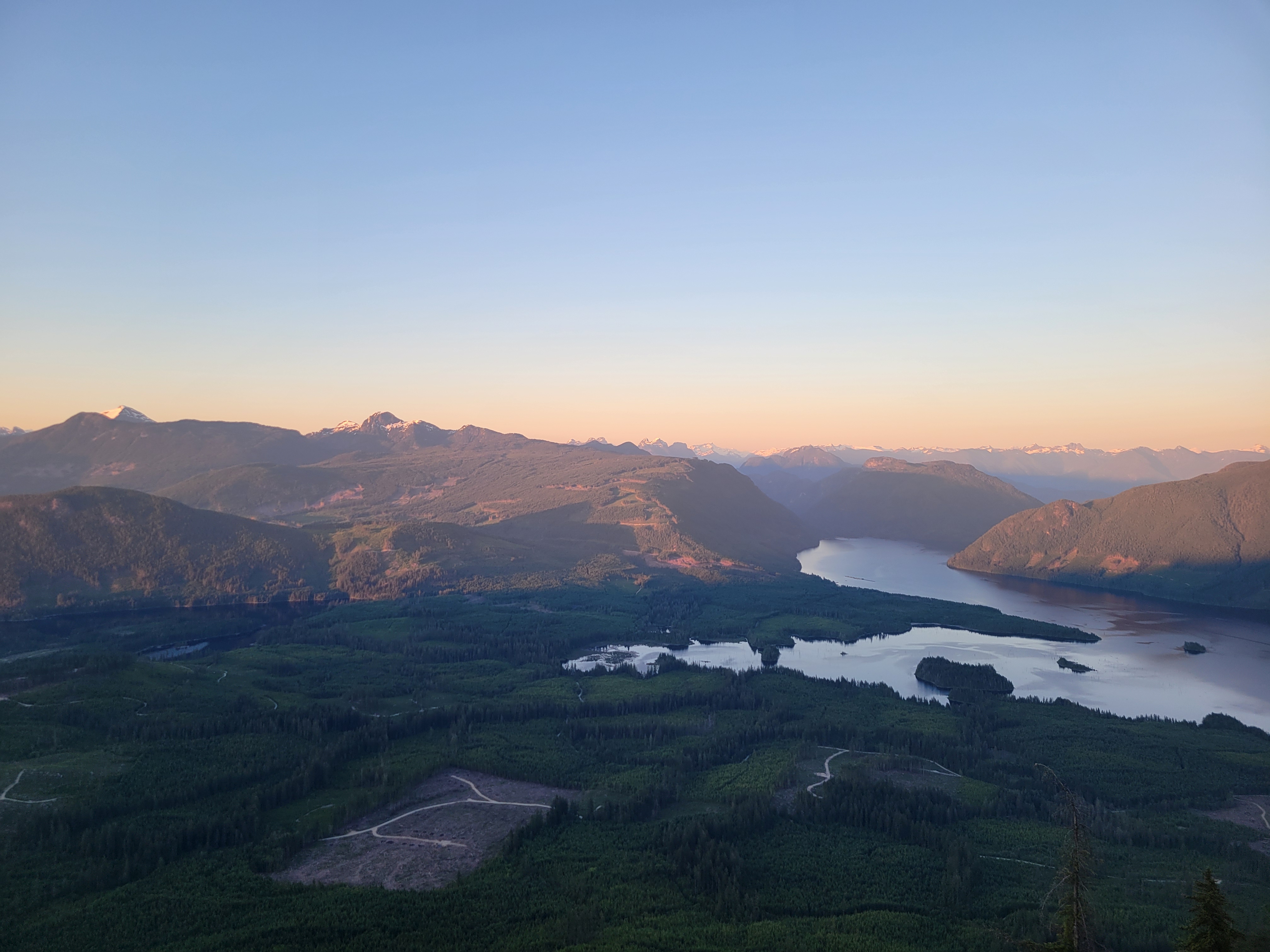
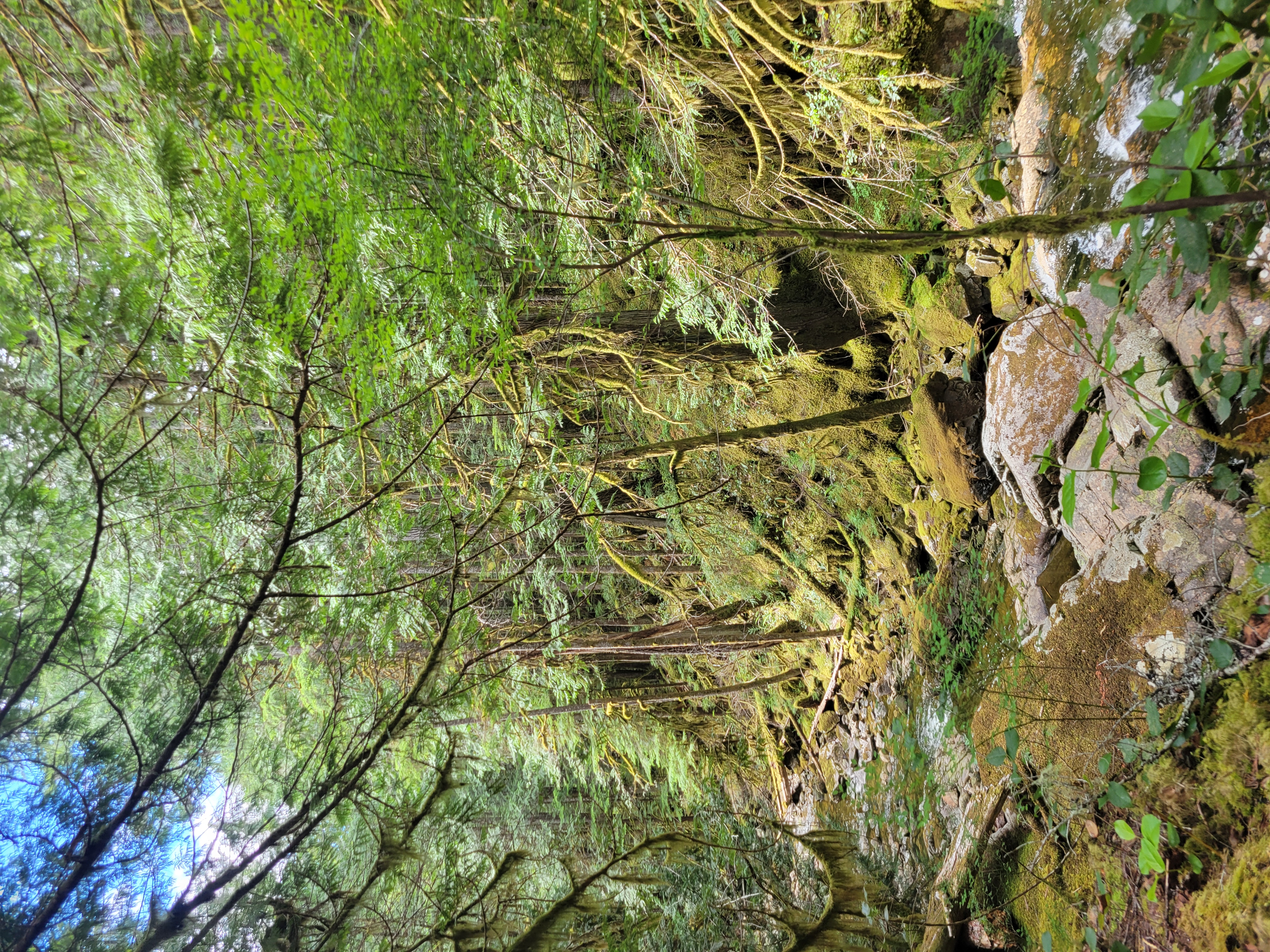
Clearcuts, old growth, and reforestation, the coast of BC holds many stories
I woke relatively early the next day, and from my sleeping bag, debated the if an alpine start was necessary for a trail that was entirely sub-alpine. I went back to sleep, a sub-alpine start would be at 8:30, at which time I ate, brushed my teeth, tore down the tent and was moving by 9:30. My right calf now was quite worked, I had over compensated for my achilles issue with my other leg and now had a funny shuffle in my step until everything was warmed up. This day would offer the most vertical I would face for the rest of the trail, and more than anything I’d completed so far, the morning was another slow descent to sea level. The trail wound its way through recently logged lots, and down old rail grades where rusted cables snaked from the ground. I had to stop a few times to rest my legs, but also remove my shoes, they had begun to dig into my heel, a problem that I wouldn’t solve until my ascent of Tricouni the next month. I ate dinner and soaked my feet in the cool water of Lewis Lake, and eyed the thousand plus meters I still had to climb up Tin-Hat that evening. Ferns painted my legs with freshly fallen rain, I summited drenched in sweat at 10pm while listening to a podcast about the life of J. D. Salinger (great author, shit human). I ate fishy crackers and peanut m&ms until I fell asleep. Day 3, 35km, 90km Remaining.

The gloomy glow of rain on distant peaks
The next morning it rained, and waited in my tent for a momentary break to pack up, and get moving, I summited Tin-Hat, the trails highpoint, and realized I had gotten off my intended track, no matter, I down-climbed the west side of the peak, praying on the strength of moss and men as I eased myself from ledge to ledge with few difficult sections. This was the only moment I was slightly happy to be wearing approach shoes. I bushwhacked my way back to the trail, music came on instead of a podcast that I thought I had queued, and I proceeded to make a decision that would haunt me for the next two weeks, and likely again when my knees fail in ten years, I ran down Tin-Hat. Some thousand meters in maybe six kilometres, I made my way to the next hut, and tried to keep up some momentum on the way back up to confederation lake, where I had to take of my shoes and rest for half an hour, my legs were shot, I stretched, massaged my feet, took some very classy timer photos and continued shakily to inland lake. The trail would cross an access road, however there was a sign that said the SCT would be closed between Anthony island and Inland Lake Campground, and that’d I was to detour along the access road. I listened to Peter Croft and his own disaster style of nutrition experimentation while I limped the long ways down the road, the hard gravel worsening all the problems I was already having. This day would take my through the town of Powell river where I hoped to rest, but more so eat, visions of iced tea and fried food had a magnetic draw on me. Some bikers zipped by but a couple paused and we chatted briefly, they said they were headed to their truck, and that if I was just hiking along the road, might as well catch a ride. I debated this, I felt like departing the trail in a truck would be a kind of failure. Failure to who? Failure of what? These two questions held no answers, I was indebted to no one but myself in doing anything, and I felt I was doing plenty. Besides I was already off the trail, and the draw of a cold drink within the hour, made me gladly accept his offer. I continued to walk and about twenty minutes later threw my bag into their back seat, and enjoyed conversation and air-conditioning. In Powell River I enjoyed the wonders of public transit and picked up some supplies (chocolate and weed, hedonism on trail). I wandered back onto the trail, and stopped for dinner at the Shingle Mill, a pub on the trail just north of the Powell River Townsite. I enjoyed conversation with a passionate fellow that approached me and asked about the trail, and told his own stories about his time in the areas nature. I had discretely slipped my shoes off at the restaurant, assuming any class I had was hidden behind stench of pot and the stains on my shirt, so I struggled to get those back on and paid my bill. The next leg would be largely on the Tla’amin reserve so I took a moment and asked permission to enter through a tobacco offering, then punched out the last 7km of the night, eventually haphazardly setup my tent at Little Sliamon Lake, and slept for nine hours. Day 4, 40km (skipped 5km by hitch hiking), 45km remaining.
one of the many aforementioned timer photos
On day 4 I had also found out that I would have friend leaving Lund (the closest town to the north terminus) at eleven o’clock, which meant if I wanted to get home in as cheap and timely a way as possible, I would need to hike 45km on day 5, which fortunately was on relatively relaxed terrain, and then wake up early the next day to make it the 11 km back to the town of Lund via a maze of forest service roads. Hard work now for an earlier rest day is always a decision I’m in favour of, and so I slept in, allowing my body all the rest I could before the big push of the last two days.
Babbling brooks for soaking sore feet and parched lips
Day 5 went by in a blur; the further north I got, the more people I ran into. Sarah Point marks the northern trailhead, and is the start point for the majority of hikers looking to do a section, or the whole trail. It also is far more accessible than the rest of the trail, so I ran into a great many day hikers, including one fellow who helped establish the incredible trail and hut system that makes up the SCT. I rested at the end of every kilometre, and struggled to my feet, as trail runners zoomed by me. This made me debate the style and comfort of my adventure, ultimately with the milage I was hoping to achieve I should have taken a more fast packing approach to the trail. More thought into the food I brought, which I had plenty extra, less comforts, better shoes. Ultimately better shoes would’ve probably shifted this trip from the masochistic trudge to a more fluid adventure. My dad has told me stories of a family friend who attempted to run the length of the trail in a single push, something far beyond my capabilities, but jogging the downhill and flats with a lighter pack would’ve made the goal pace much more graceful then it ended up. Alas, I ate dinner at the Manzanita Bluff hut, overlooking Savary Island, where I spent my summers growing up. I had lost my fork at some point, and a group of guys from the island lent me one, to eat my rice and french-onion soup combo. I stood around a fire with them in the rain. The weather was pretty spotty for this trip, to the point that cowboy camping would’ve resulted in disaster, this last day was determined to see me out with rains all night. The sun began to set and I still had sixteen kilometres to complete. While in a brief window of phone service I found some motivation in my partners voice, when the call cut out I continued, the finish line was in view. I find hiking at night to be a very deep experience. Navigating by moon and starlight as much as possible to preserve my night vision and protect the environment form the LED blade of my headlamp. I find it forces your attention into a near flow state as you navigate the trail by feel, while this sounds like a slowed process I was able to maintain a pretty steady pace. The rain had soaked the vegetation and in turn me, I was too cold to stop and every minute I took was slowly sapping the amount of sleep I’d get that night. I grinned at fishing boats as I reached the coast. I struggled immensely to find the Sarah Point hut amongst the tent platforms, but at 2am I arrived, by 2:30 I was passed out on the floor, my wet clothes hung up on a chair.

My island home Savary
My alarm went off two and a half hours later, I stepped outside into the day already bright. I was to make it to Lund by eleven, it was roughly 10km, but I wanted to have as much time to get there as possible, thank goodness too because when I powered on my phone at the first fork in the road to check the map, I realized two very critical problems. One, the map used by all my mapping apps (as well as my copy of the BRMR) were very out of date, and a new development revealed what might be a short cut directly to the main road connecting this development with Lund. The Second was that my phone had not charged over night, I checked my powerbank, it was dead. I was about to lose my main form of communication as well as navigation (even though it wasn’t proving particularly helpful). I sent a message to Bryan, my pick up, saying I’d be in Lund 11:30. Off the trail, and now sneaking through active development the beauty of the adventure was mostly faded. Now I had an objective to reach and a timing in which to do it. I may or may not have ignored a number of “no trespassing” and “authorized access only signs” in favour of the most direct route, corroborate by the mental image I had taken of the map before my phone died, and avoided eye contact with arriving workers. On the map there looked like a small collection of summer homes and a marina, with low stoke, I had placed hope that this would offer up an alternative to walking the whole distance to Lund. As I got close, I realized it was a very boujie gated community, one that I wasn’t prepared to intrude upon to ask for a ride. Apparently my fear of the upper class continues to outweigh my fear of over use injuries, so I continued, up semi sized switchbacks, as trucks blew past me all headed in the wrong direction. Finally, a sputtering old F150 coughed its way past me, I waved down the driver desperately, they pulled over. When I came up next to the window the I realized my saviour was a kid that would’ve looked out of place in a highschool. He asked where I was headed, I said Lund, he was too. I was suspicious at his comfort in picking up a grimy hiker, but I suppose with my limp I looked less than harmless. Turns out he was from that community not far behind, well he was from whistler, was in grade ten at one of the private schools on the island, and spent his summers on between the family boat and cottage. I laughed when he said his grade, shit, my hero couldn’t even legally drive, but this is the sunshine coast, and in a truck that old, and backroads like these, it’s a good place to be a lawless teen. He told me of his tennis tournaments with an inspiring vigour, I told him of my distain for tennis. We agreed skiing was pretty damn kool, and that I didn’t look like a rugby player (six years starting). We arrived at the general store in Lund where he was known by name, and I was eyed suspiciously. I thanked him, and headed into the store looking for any shoes besides the ones that my feet had begun to mold to. Six bucks for a coffee crisp and some children’s flip flops (the closest to my size) seemed decent enough, they then told me there was a shower out back I could use, which I did, scrubbing the past five days from my skin. I grinned as I scalded my skin. I re-dawned my filthy clothes, hid my backpack in a bush, and walked over to Nancy’s Bakery, a staple of my childhood, where I enjoyed a reuben, iced tea, and a brownie I’d been thinking about since starting the trail. Life was good, I reclaimed my pack, and fell asleep in a patch of grass. My phone buzzed, Brian was ready to go.

A brilliant trail through resilient land
It was a good drive home, I expected to nap, but the conversation was far too good to miss. I’ve known Brian since I was born, his kids are the closest thing to siblings I’ve got, when I returned from my solo ascent of Baker to an empty house, I walked the hundred meters to his door where we had a beer and I regaled him with my exploits. We shared stories of adventure, of love, of good food, and of physical achievements. He’s a huge inspiration to me, and I think my stories give back to him in many ways. When I look back at this trip, it is this drive home that fills me with the most joy.
I struggle greatly to make room for others in my life, it is this stubborn self-centredness that makes me enjoy solo adventures so very much. But solo adventures are best had when you come home and share them. While I am immensely thankful for this time to myself, I am most filled with joy when I can share my stories with the people that empower me to do such things.
There are many things I have included in this story, and many I haven’t; many I have remembered, and many I have forgotten; this is the way things are. I am grateful to the Tla’amin people for looking over this land as long as they have, and the settlers who knew to cherish it. I am grateful for the hard work done on these huts and trails, and the vegetation and critters that continue to assert themselves despite our intrusions. I am thankful for this time to myself, and I am thankful for the people that give me time. I am not proud, but full of joy for this adventure and all it has brought me. I thank you for listening to my story. In the language of the lands people, čɛčɛhaθɛč; in the language of my people, t’oyaxsii’m ‘niin.
Gear:
Big 3: Gossamer Gear Mariposa 60L, Big Agnes Copper Spur UL 2 Person, Sea to Summit Spark (Borrowed from dad, specifics unknown)
Others: Thermarest Z-lite sol, Black Diamond Expedition 3 poles, Katadyn BeFree 1L, Arcteryx Vertex Alpine Shoes, MSR Pocket Rocket Deluxe Stove, Petzl Swift RL Headlamp
Food: Cliff Bars, Beef Jerky, Olive Oil (Leaked, promptly dumped), Miniwheats, Ramen, Dried soup+instant rice, dried mashed potatoes, peanut butter, bagel+salami+prepackaged mustard/mayo, Gummies (lots), assorted other bars, poptarts, cornnuts, GORP
Points to Improve and Points to Sustain:
- Figure out proper food portioning and nutrition, I didn’t want to eat half the time because wasn’t stoked on the food I had, find a way to be stoked
- Better shoes, consider ultralight backpacking as an opportunity to embody fast and light fluid movement with and through terrain, not as a battle.
- Tent was a good call considering variable weather.
- Don’t bring a notebook, you used it twice.
- A red light headlamp would be nice.
- Great pre-planning and dividing of the route.
I intend to republish this on a personal blog eventually, but it will live here as I am proud the report is finally done, and it’s great to procrastinate studying (I’m going to fail japanese!)
Sounds like a sick trip! Great read too
Been waiting for this trip report for a while and it did not disappoint! That sounds like quite a profound experience Noah! Thank you for sharing it with us.
I really enjoyed reading your trip report!