Trip Dates: May 17th-30th, 2024
Participants/Authors: Simeon Faehndrich, Thomas Morrissey
Early in the morning of May 17th, we (Simeon Faehndrich and Thomas Morrissey) left Vancouver armed with skis, crazy carpets, nine days of dehydrated food, and plans to explore that weird little triangle at the far NW corner of BC occupied by Tatshenshini Alsek Provincial Park.
The Plan
The area had been on Thomas’ radar for a while as having a nice combination of fairly large peaks, very sparse beta, and reasonable proximity to a highway. The only beta we had other than topo and sat. maps was a) a vague approach route that we knew had been skied in 2011, b) a list of peaks that we knew had been climbed in 2003 (with no associated route descriptions), and c) our own list of the most conspicuous peaks which had not been climbed by the 2003 party.
The Drive
The drive up was a long haul: two 16 hour days which we broke into ~4 hour shifts, with mental stimulation provided by Spotify and by the >20 bears (and various other animals) hanging out on the road shoulders. We also had our work cut out for us to eat the entire unabridged contents of Simeon’s fridge, which he had emptied just prior to our departure. By the evening of the 18th we wound up parked near the Dalton Cache border crossing powering through the last of Simeon’s chickpeas and cantaloupe, and staring hopelessly at our huge, partially-assembled packs.
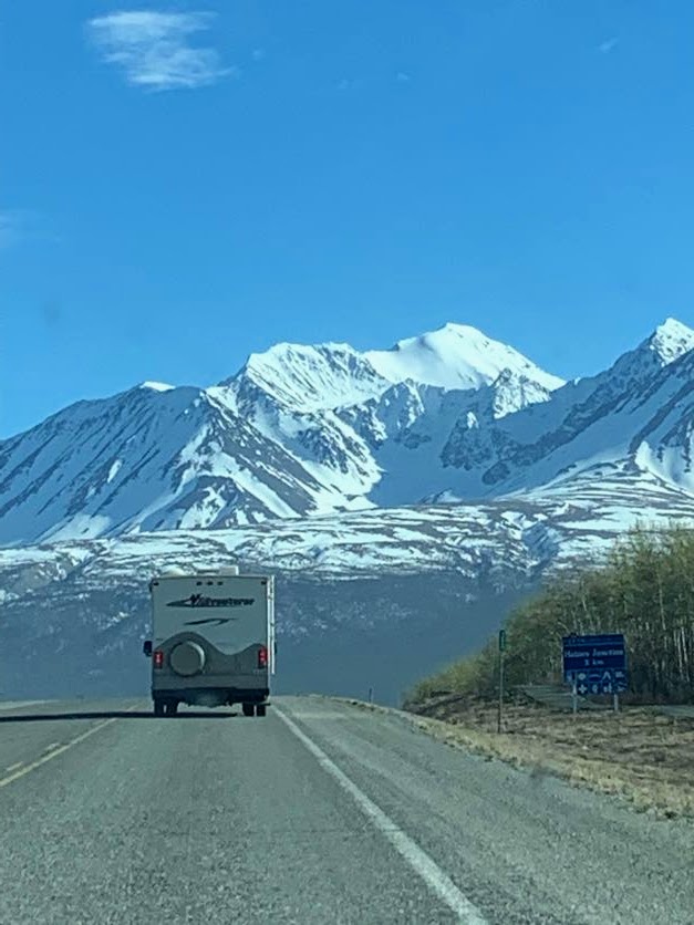
Edge of Alsek Ranges rising dramatically above the Alaska Hwy. Good way to lift the spirits after two days of driving
Day 1
The next morning (the 19th) our first major obstacle was the Klehini River, which we had to cross in order to begin an ascent of Jarvis Creek/Glacier. A few hundred meters above the Jarvis-Klehini confluence we found a series of wade-able braids. Thomas was only able to cross the largest of these braids after breaking his pack into two loads, since the combined weight was enough to dramatically reduce his balance. On the far side of the river, we stashed an inflatable boat (thanks, Hannah) in case the river increased in size over the course of our trip. Luckily we only had to carry our fully-loaded packs a few more km (gravel bar -> alder ‘shwhack -> choss hill) before finding continuous snow just above the toe of Jarvis Glacier. Here we broke out the skis and transferred our 20 lb food bags onto our freshly-fabricated crazy carpet sleds. We then made slow but steady progress up the slush-covered glacier as the afternoon grew progressively wetter, whiter and windier. Camp that night was located near 1100m.
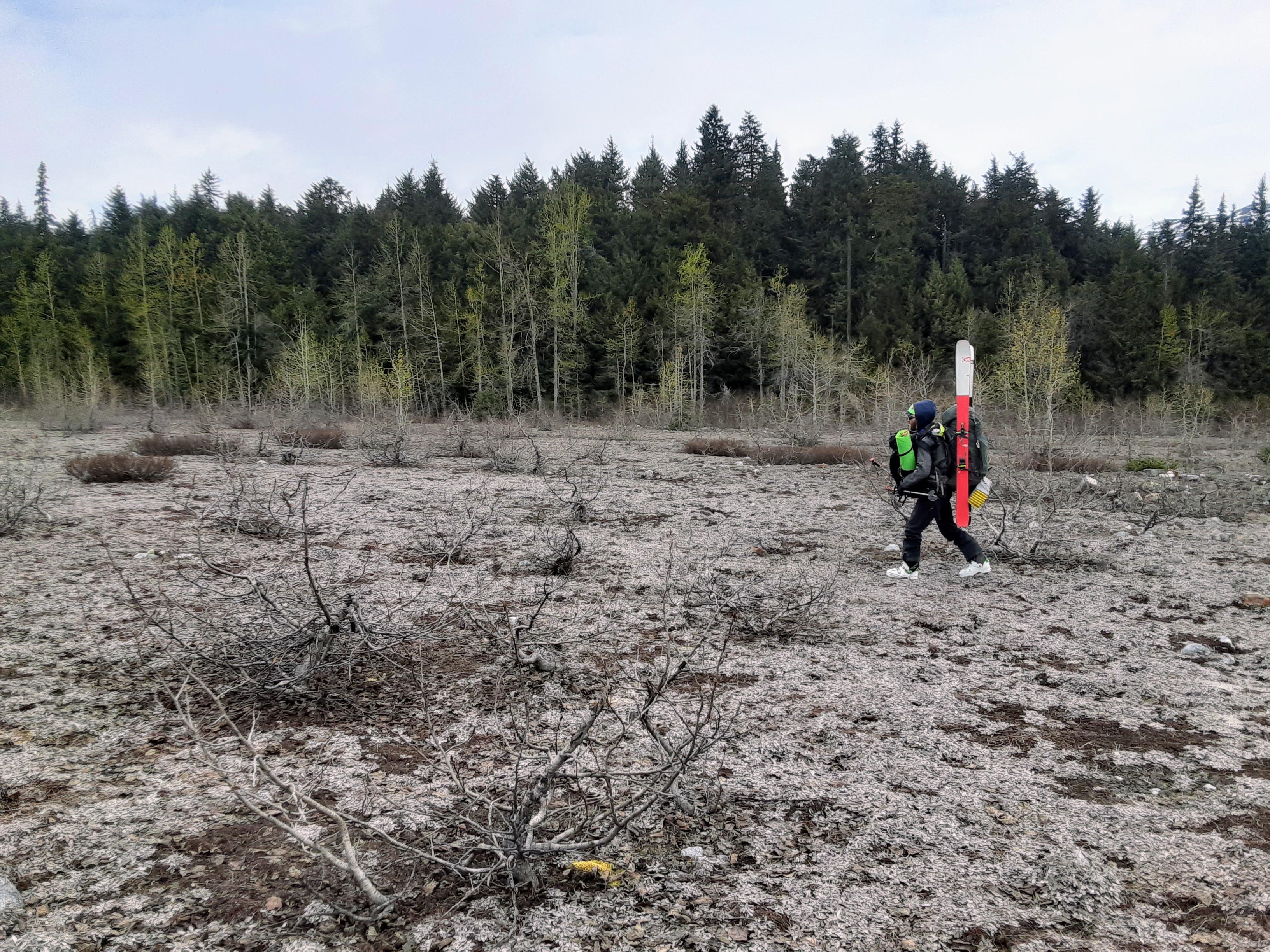
Simeon with his full nine-day load
Day 2
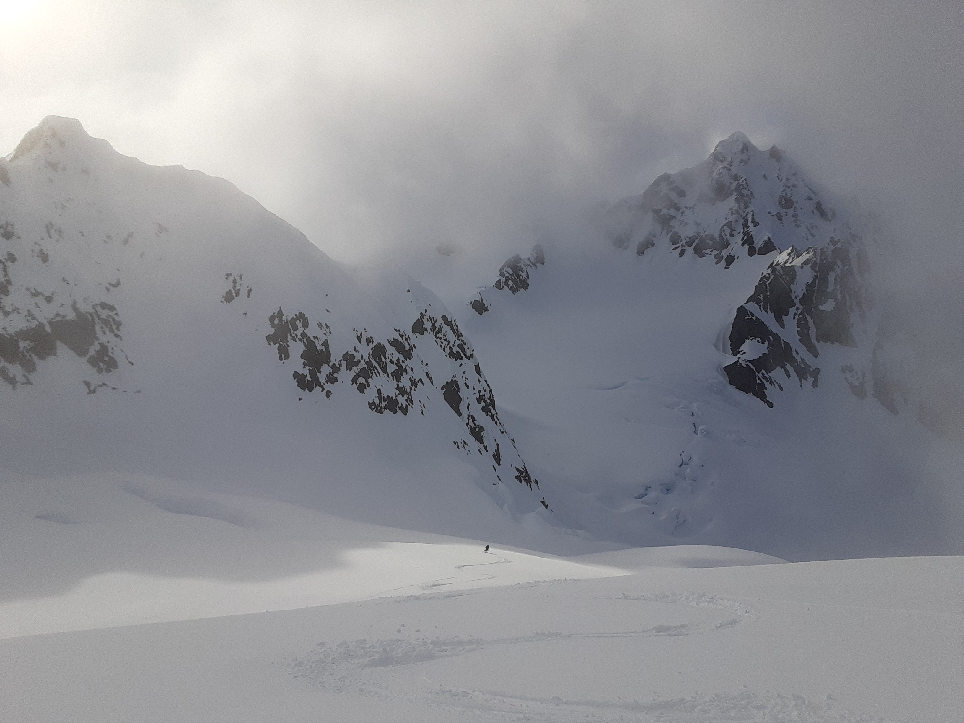
On the 20th we got a slow start after sleeping in to wait out a mild overnight snow/rain storm. We weren’t actually skiing again until noon, and even then we were feeling a bit lethargic as we dragged our heavy sleds through the flat light to a deep cirque at the top of one of the glacier’s branches. At this point the cloudbase began to lift around us, gradually revealing the size of the surrounding walls and the snowfield which we’d have to ascend next. After 30+ steep kickturns we were able to yank our sleds up the narrow band of safety between windslab on the left and rockfall on the right, and reach the col at the top of the cirque. Here we finally found ourselves at the E edge of the Buckwell Glacier.
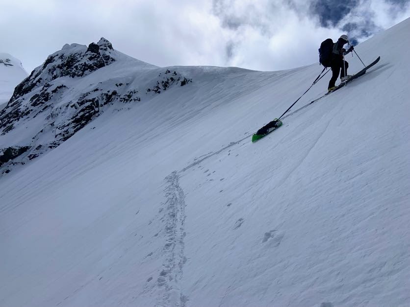
Kicktuns with sleds
It was still cloudy, but the cloudbase appeared to be lifting so we decided to take a shot at climbing Mount Bigger*, which was currently somewhere up in the clouds to our north. We skinned up onto some chunky avi debris, then transitioned and quickly punched a bootpack up a rockfall-prone gully and into the clouds. After a flatter section, more steep booting was required to ascend to a notch in the SW ridge above 2400m. The ice and sastrugi proved fairly gripping for Thomas, who had forgotten his crampons in Vancouver and was consequentially forced to chip steps the old fashioned way. Above the col, softer snow eased the technicality of the travel, although the steepness did briefly reach 50 degrees on one or two rolls. Finally above the clouds, we watched in awe as they broke around and below us, revealing more and more of this serrated, icy world. We put on skis on the summit at the comically late hour of 9:00pm, but at this latitude we still had plenty of remaining daylight. Some conservative skiing led us back down our ascent route to our overnight gear, which we moved about 1 km further down onto the Buckwell Glacier. We finally crawled into sleeping bags around midnight (no headlamp necessary).
Glimpses of grandeur on the upper SW ridge of Mount Bigger
Day 3
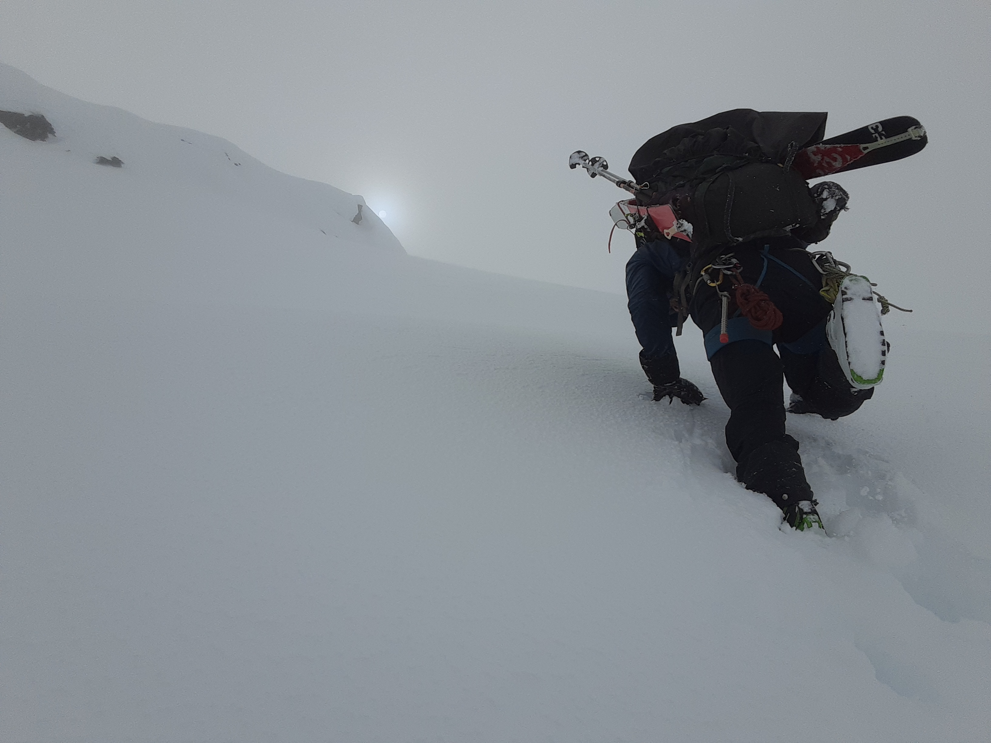
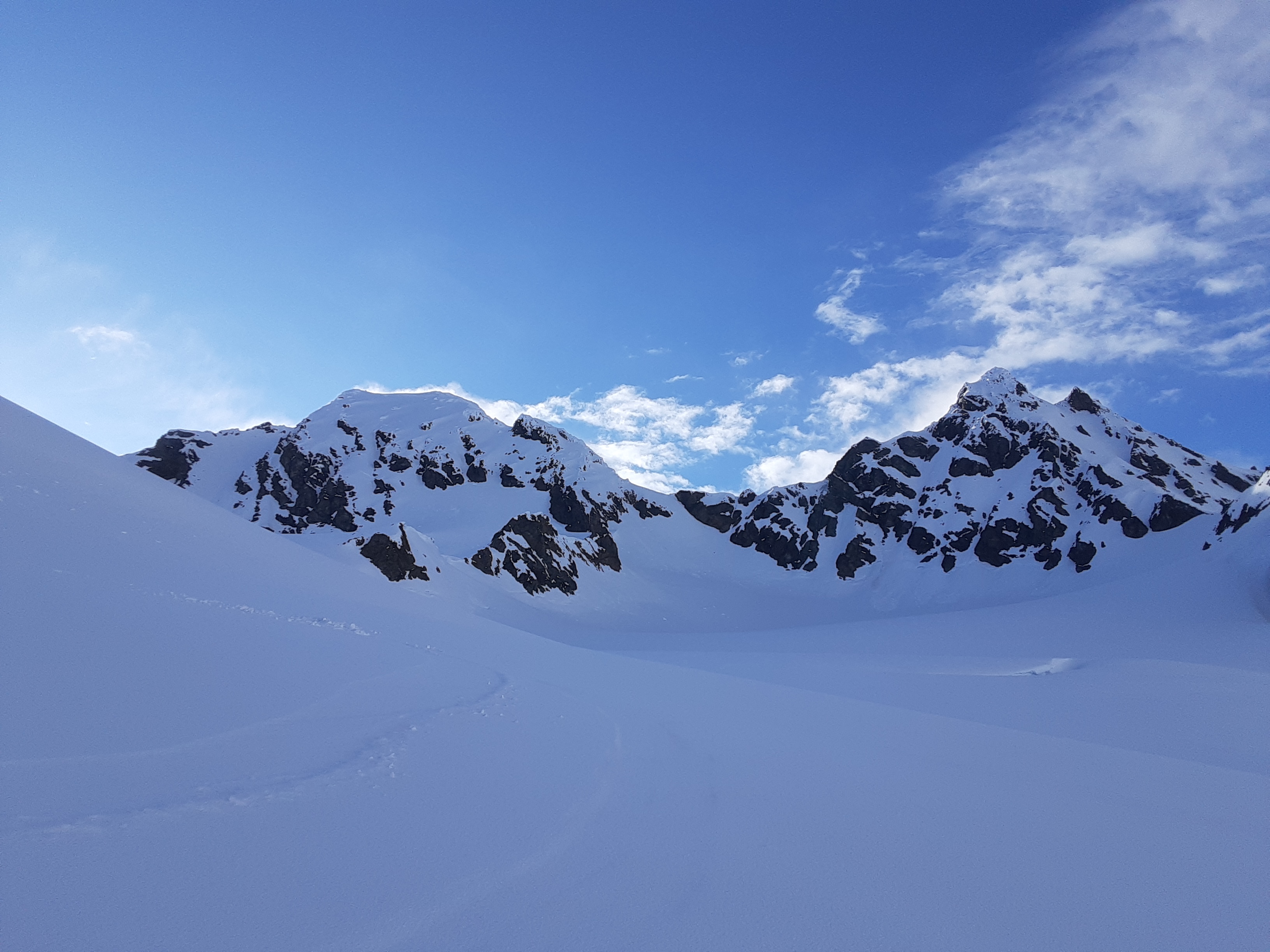
Based on the the pretrip forecasts, we expected the 21st to be have good weather. It did not disappoint! After breakfast we plastered on sunscreen and chapstick, and headed for the base of Buckwell Peak*, the summit of which we could see from camp.
In our pretrip map studies we had considered the E face as a possible ascent route. The upper face turned out to be split by an attractive couloir which went to the top, but the complex jumble of seracs below made the face rather unappealing. We figured we would have a better chance of success climbing the NE ridge, assuming we were not stopped by any cornices. Simeon led some crusty kickturns up to the base of the NE ridge (~2300), and Thomas led a bootpack that went left of a ‘schrund and then left of a cornice to gain the upper ridge. The summit block was massively corniced on the N side and exposed on the S side, and we chose to boot to the summit, staying well below the ridgecrest until the very top. Some of the snow on this final pitch was quite soft but with some effort we were able to excavate solid steps deeper in the snowpack. At last we stood atop the highest point in the Alsek Ranges, with blue skies, no wind, and mountains stretching to the horizon in every direction. In the foreground, we had a nice view of Mount Bigger from an aesthetic angle. In the distance we could pick out Mts Barnard and Fairweather to the SW and Mts Hubbard (which we thought was Mt Logan) and Vancouver (which we thought was Mt St Elias) to the NW.
Slogging a section of steep bootpack on Buckwell Peak. Mount Bigger (climbed 15 hrs earlier) seen in the top left corner
Buckwell Peak summit panorama looking west
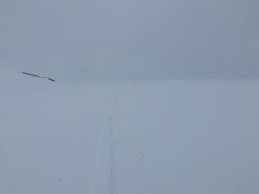
Downclimbing from Buckwell Peak summit. Camp is 1200m below on the glacier flats near the left edge of the photo, but too small to see
For our descent, the couloir on the upper S face was tempting, but the snow on that aspect appeared to be mostly breakable crust. We figured that the more prudent ski route would simply retrace our ascent. Back at the base of the E face, Simeon finally got to enjoy the full-length sit-down lunch that had eluded him the day before. Back at camp a few hours later, we also had an excellent tortellini dinner with plenty of olive oil! We got an updated forecast and learned that the next two days would have marginal weather. Rather than sit around waiting for the summits to clear again, we decided to use these coming days to drag our sleds further into the icecap.
Day 4
The morning of the 22nd came with firm snow and a high cloud ceiling. The glacier below our camp was barely steep enough to ski down with skins off, resulting in a fast first 10km. We crossed some pretty fresh bear tracks, making us wonder what a bear was up to in this barren environment. At the conjoined heads of the Tsirku and Tkope glaciers, we turned W to find ourselves at the edge of an incomprehensibly large icefield. This is the part of the trip where we really started to notice how warped our senses of distance and space were by the uniformly immense scale of the terrain. We would start skinning past what at first appeared to be a small rock or snow feature, only to find that we were still passing the same feature half an hour later!
Looking across the massive icecap that feeds the Tsirku, Carroll, and Tkope glaciers, among others.
The visibility continued to decrease throughout the day, but the snow stayed hard and the brisk wind stayed at our backs for the most part. We passed any dull moments by trading song lyrics and poetry recitations. On the far side of the Tkope, we began a very gradual uphill toward the Peshak Glacier. The visibility was now low enough to make things a bit spicy: Thomas skied off a 2m windlip with sled in tow, leaving him unscathed but in poor spirits for the rest of the day. Our route ahead involved a ~1700m pass which we navigated haltingly in the inconsistent visibility. At this point, we had skied 30km and decided to make a somewhat early camp near 1200m at a fork of the Peshak. We spent a good amount of time staking out a tarp in front of our tent in preparation of a wet morning the next day.
Day 5
As predicted, the next day was quite damp, with a steady supply of wet snow melting onto the tent and tarp. We had a slow morning reading and snacking under the tarp while we waited for the whiteout to ease. When we did finally start skiing at 2:00pm, the isothermal slush was so deep, and the air so warm and humid that our lungs, legs, and pores were all operating at full capacity. As we got closer to the next pass on our route, we finally experienced a few sunbreaks giving us glimpses of some nearby walls and icefalls. A brief sidetrip through slush postholes, ‘dino eggs’, and muddy shale (we were still knocking bits of mud off our ski boots the next day) brought us to the top of a relatively short but still notable peak at 2027m. Back down at the pass we had a ~25 min wait before a brief sunbreak offered safe passage down to the glacier flats below. We still found ourselves navigating by repeatedly rolling snowballs below us in order to discover any microterrain hidden by the flat light. One more transition to skins and we made it up to a campsite on some glacial flats under an impressive 1000m wall.

On top of Peak 2027
The endless supply of massive terrain
Day 6
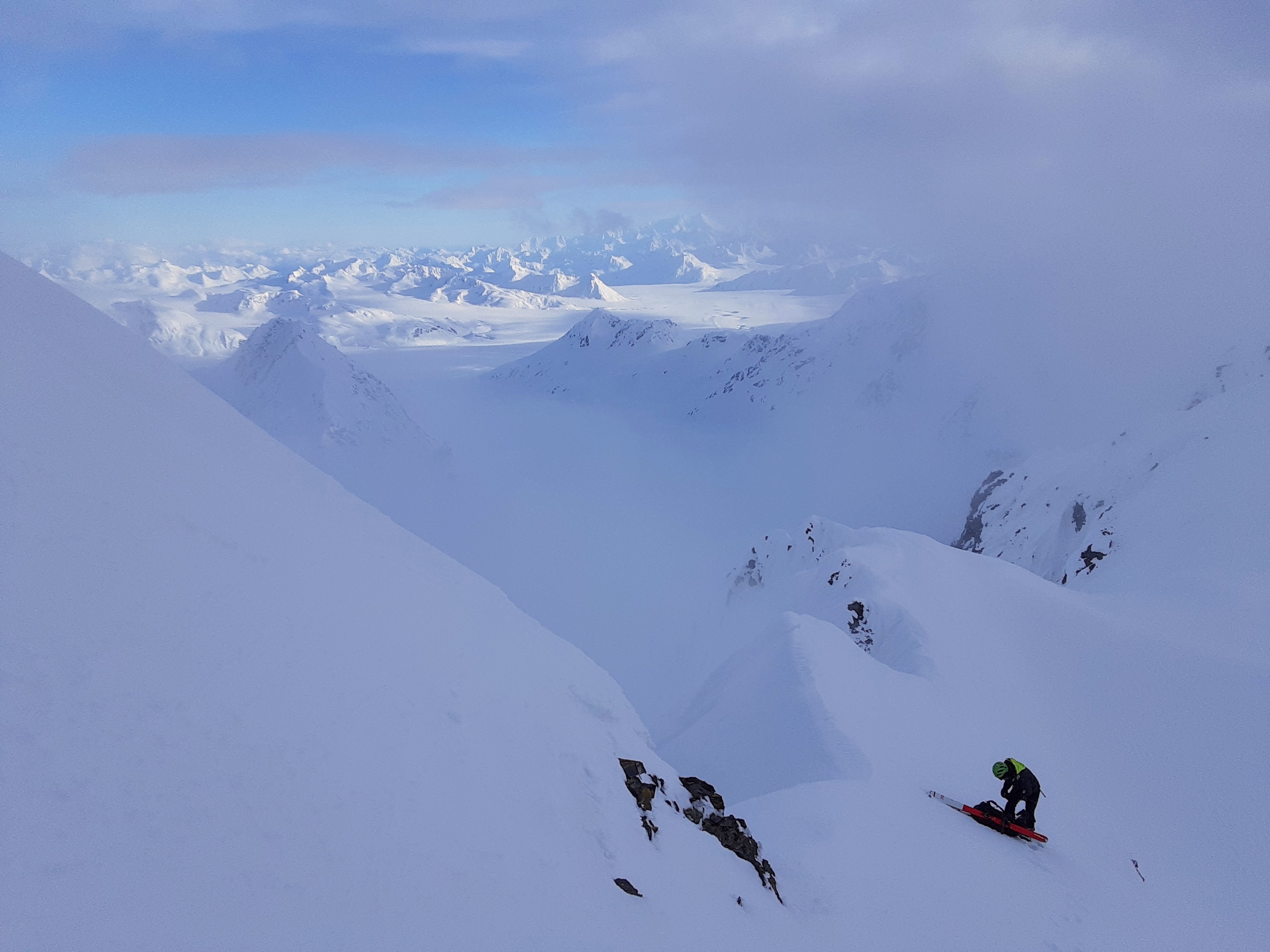
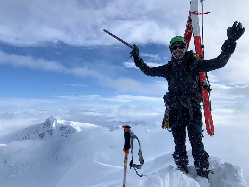
We woke at 6:00am to clear skies and executed a relatively fast (still >1hr) morning routine in our excitement for a big summit push. We were on our way to the ultraprominent Peak 2702, sometimes referred to as ‘Basement Peak’. One final pass granted access onto the Towagh Glacier, the top of which covered the NW flank of our objective. After some discussion, we decided to skin roped through the icefall at the left edge of the lower NW face, which actually went quite smoothly. More low-technicality snow brought us up to the base of the summit block at 2450m. Here we were treated to our first views to the SW, where the vista was dominated by the awe-inspiring Mt Fairweather and its coterie of surrounding peaks. The icefields between us and Fairweather were coated in a cloud inversion, and one branch of this inversion had began slowly chasing up behind us as we ascended. A brief bootpack up some icier snow and a few more kickturns and we were on the summit… or were we? The true summit appeared to be a snow-covered, cone-shaped rock on the far side of a short section of exposed, corniced ridge. Luckily we were able to find some solid snow to build a ski anchor on our side of the ridge, and then take turns belaying each other across the backside of the cornice to the top (our 30m rope was juuust long enough). >1000m of skiing sent us down into and eventually through the clouds, and back to the Towagh Glacier flats at the base of the peak.
Icefall on the lower NW face of Basement Peak. We ascended via a left-to-right traverse

The spectacular Mt Fairweather looms above the cloud inversion
Basement Peak summit. That’s Buckwell Peak in the far left background
Now began our long trek back toward the Haines Hwy. We didn’t want to simply retrace our steps from the way in, so we instead began to make our way down the Tisatka Glacier. The lower portion of the glacier was mostly covered in a patchwork of snowfields and rock outcroppings. A creek flowing on/under the glacier had carved out little sections of ice canyon which more or less bisected the valley. As we neared the Tisatka-Tkope confluence, we had to take skis off a few times given the lower elevation and increasing amount of exposed rock. We followed some wolf tracks for awhile, and eventually sighted the makers of these tracks trotting across a gravel bar below us. We found a nice (abeit quite windy) camp on a sandbar just before the confluence.
Navigating through the broken toe of the Tisatka Glacier
Day 7
There were no peaks on the agenda on the 25th; the main task was to ascend the Tkope River and Glacier from 700m back up to icefields at 1200m. This may not sound like a very long day, but it sure felt long. The space warp was in full effect today, with each faint, foggy landmark being so massive and/or distant that their position never appeared to change, giving us the impression of skinning on a treadmill. The low elevation also meant that there was plenty more trailbreaking in deep slush. We could tell this was one of our least eventful days because Thomas finally started running out of songs to sing to pass the time. We did eventually make it back to the icefield near the top of the Tsirku Glacier.
Typical view during the afternoon
Day 8
Upon leaving camp on the 26th, we had a few hours of nice vis: our section of icefield happened to be situated between cloudbanks, giving us a direct line of sight which made for efficient travel across the remaining flats. Things changed once we began ascending, with longer and thicker periods of whiteout.

Retracing four-day-old steps toward the Buckwell-Tsirku confluence. The marked peaks are those that we summitted later in the day.
After a 700m climb we reached one of the cols above the S edge of the upper Herbert Glacier. We had just enough vis to see the beginning of what we thought would be the most feasible route to the top of nearby Peak 2352, a summit which we suspected of being unclimbed. We dumped our sleds and made our way up behind a gendarme, across a sidehill, up a steep gully (on boots now), up a steep and deep snow face, across a bridged ‘schrund (rope came out briefly), and up a sastrugi-encrusted ridge to the top! We got to the summit of Peak 2352 in a whiteout, but just as we were about to head down again we got a brief gap where we could see the tops of the clouds around us and one or two ridges and glaciers far below us. We took a long break to chip all of the ice out of Simeon’s dynafit boots before inserting the removable tongue for the ski down. While we claim no naming rights over the area, we like the name ‘Shaa Xʼwánlʼóot’ (“boot’s tongue mountain”).
Booting up Peak 2352
S side of Peak 2352 (left) and a subpeak (right) during a cloudbreak
The clouds appeared to be burning off, so we decided to go for a second peak (2240+ m), this one on the SW side of the col where we had dropped our sleds. Of course, just as we started up this peak, the clouds and snow came back with a vengeance and forced us into a good bit of stop-and-go, guess-and-check travel. After booting up to just below the summit ridge, we traversed gingerly across to a final arete of low density snow. This final push to the summit had Thomas out of his comfort zone since the whiteout made it difficult to assess the extent to which any steep slope was supported or unsupported. Nevertheless, we soon stood on the summit just as the clouds finally began to break up again. This sudden transition from blurry whiteout to clear sunshine inspired the name ‘Shaa Waḵdáanaa’ (“eyeglasses mountain”). We actually had some nice type 1 turns on the way down! We continued down the Herbert Glacier to camp near the base of Mt Henry Clay. For this final night we stayed up late making a chocolate milk dessert with some of our leftovers.
Rejoicing on the summit or peak 2240+ (we were in a full whiteout 1 min earlier)
Nice turns and visibility on the way back down
Day 9
On the 27th we skinned up a snow ramp from the Herbert Glacier to a col on the shoulder of Mt Henry Clay. We wanted to climb to the summit but the whiteout at the col was so severe that we couldn’t find our way down the other side, much less up to the peak. We ended up huddling behind a snow wall for 2 hours until we finally caught a glimpse of light ahead of us that we followed down to lower, less-cloudy terrain. A combination of skiing and freeheeling got us back to the toe of the Jarvis Glacier where we took off skis for the last time. We then commenced choss wobbling, alder clambering, and gravel trudging back to the Klehini crossing. A lot more alders had leafed out in the past week, so it felt like we were coming back to a world transformed in our absence. The Klehini was running slightly higher than on the way in, but we found a slightly better place to cross so that we didn’t have to deploy the boat after all. At the highway, we threw our packs in the van and motored down to Haines where Simeon achieved his dream of swimming in the bay, and where we were able to find decent food even after 8:00pm.
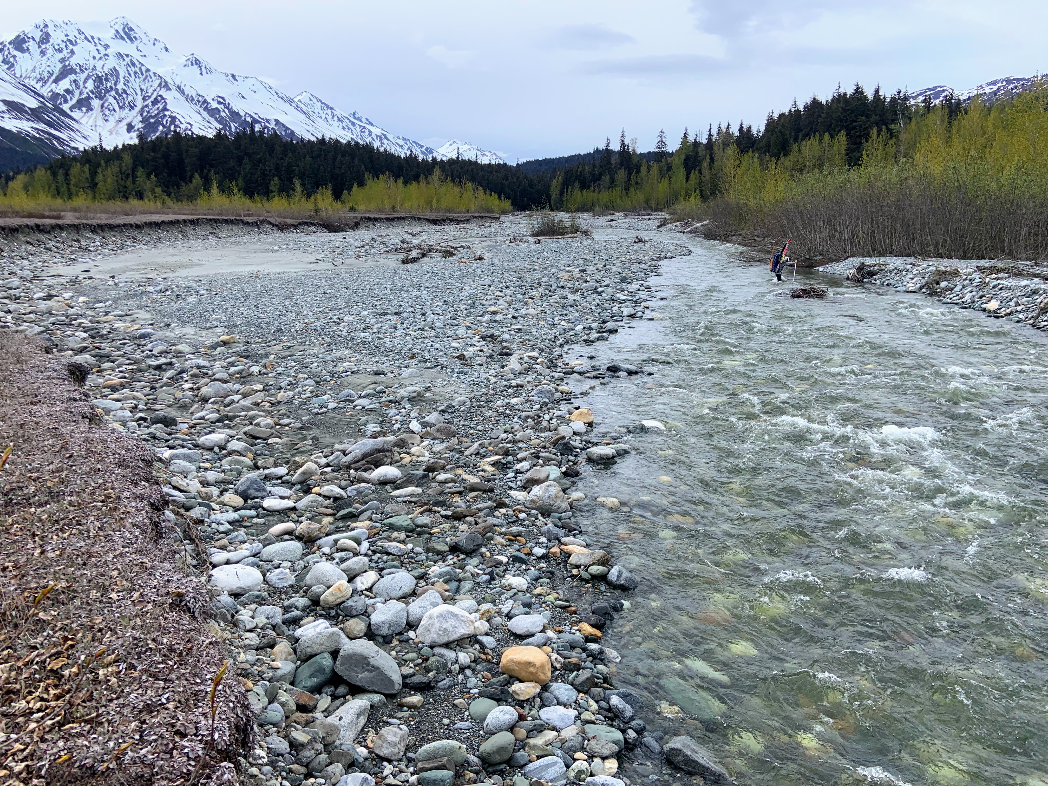
Crossing the Klehini (this is just the first braid)

Haines, AK
The Drive (again)
The drive back took a bit longer than it had a week before; we were probably both a bit less motivated to step on it. We still made it back to Vancouver at noon on the 30th, with more than 36hrs to spare before Thomas’ flight to the East Coast.
Reflections
For both of us, this was our first time using sleds to haul gear. We found that our sleds (which were basically a less-reinforced version of a John Baldwin design) were pretty durable considering some of the terrain we dragged them through. We did get a few tears in the plastic but nothing that couldn’t be fixed with duct tape. We also discovered that having elasticity in the tow line is an essential feature if you care about ergonomics (i.e. you don’t want your hips to get jerked around with every step). The sleds also mostly eliminate the possibility of making ‘nice’ turns on the downhill, but we were able to descend up to 35 degree slopes without too many wipeouts. It’s difficult to imagine having to carry this same combined amount of food and gear all on our backs; we certainly would have covered much less terrain that way.
We were pretty lucky on this trip with weather and snow conditions. Even though there were a lot of days of bad vis, we also got some windows of excellent weather, which cannot be taken for granted in this particular part of the world. More importantly, the snow never fell more than 5-10 cm in any one storm. Combine this with the warm temps, and we never had to deal with any storm slab problems. There were certainly some natural wetloose cycles happening, but we generally felt we were able to navigate in ways that limited our avalanche exposure to at most a few key moments per day.
We each brought at least 3500 cal/day (although Simeon didn’t count precisely) so we stayed quite well-fed, but did end up eating pretty much everything we budgeted each day. It would be interesting to see if taking a bit less food and planning to ration the last couple of days could make a noticeable difference in pack weight.
Foods that we brought too much of: powdered milk; onion flakes. Foods we wanted more of: Salt or salty chips etc. To add to dehydrated meals; candy bars. Foods with the best calorie-to-weight ratio: Olive oil (duh).
* A note on peak names: The official BC topo maps identify Peak 2579 as ‘Mount Bigger’. However, these maps are notorious for placing official names, originally assigned to major peaks, onto less-significant peaks nearby. The Bivouac database (and the many other maps which have since referenced it) accepted the official location of the ‘Mt Bigger’ name, and also gave the name ‘Buckwell Peak’ to the 2721m peak nearby. However, we found a CAJ article that refers to Peak 2579 as being “6.5 km east-northeast of Mount Bigger”, implying that the ‘Mt Bigger’ name actually refers to the larger peak. For consistency, we will uniformly refer to the peaks by their Bivouac names.
Epic trip; great report!
Glad to hear the detail on this one! Stoked you sent
Mega!
So cool! Love seeing things in this neck of the woods!
This would be a good slideshow…