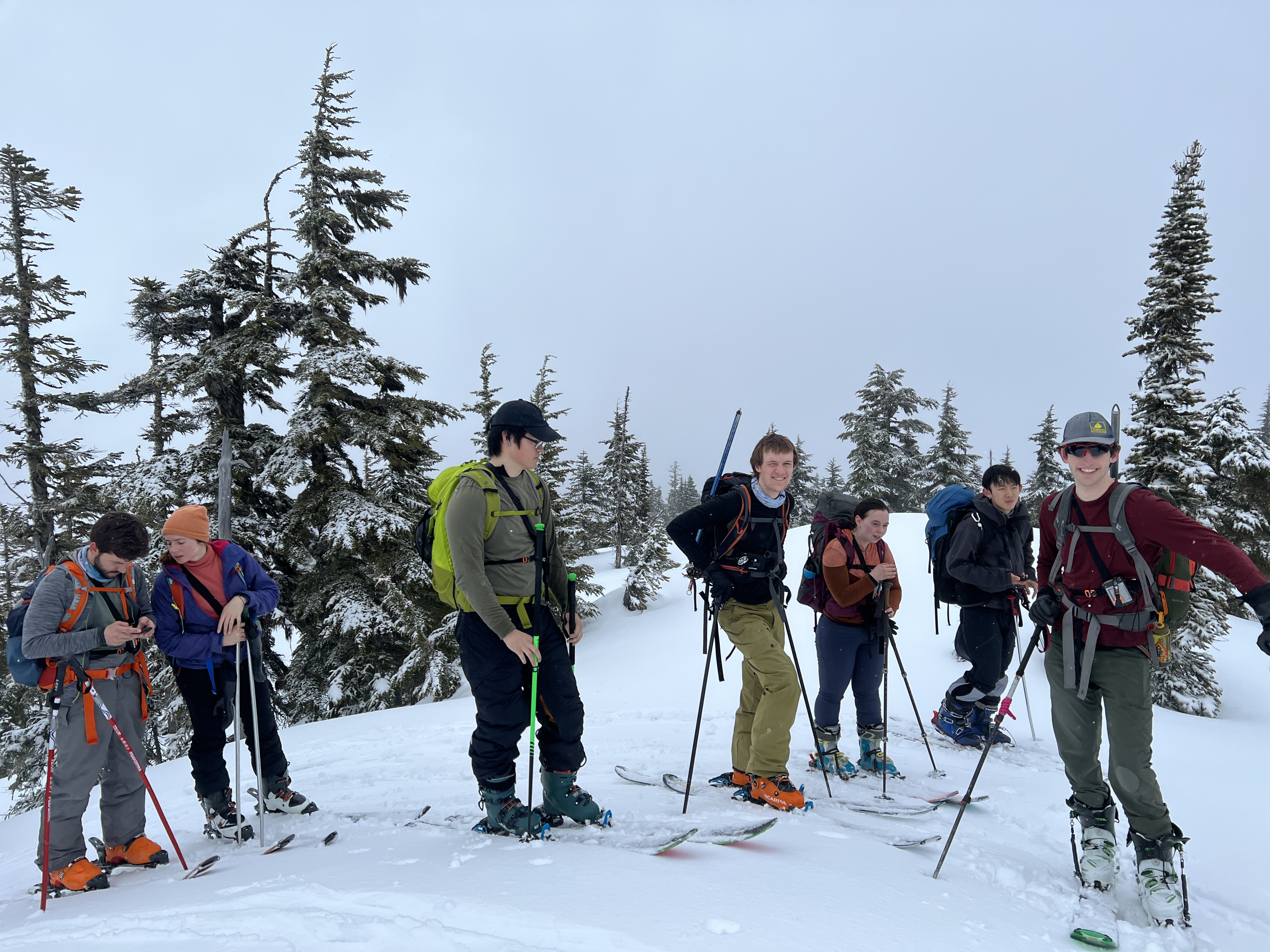
Participants: Mozi Lu, Camille Heslot, Clement Fraisse, Haley Foladare, Jacob Grossbard, Albert Yip, Alexander Hudyma Yu
As we near the end of the ski season, it feels like an appropriate time to reflect upon our adventures. This has been my first backcountry skiing season, and I’ve had some fantastic days out. I’ve skied champagne pow, beautiful bluebird days, and scenic tours of places I’ve only ever seen in the summer. April 8th was not one of those days.
The weekend was supposed to be the fifth Steps To The Neve trip when we finally embarked on the famed traverse. I had originally planned to go on Zac Wirth’s trip up there the weekend before, but a patch of bad weather had ruined those plans. So I elected to wait a week for the Steps trip instead. The weather worsened considerably over the Easter weekend, however, so a contingency plan was needed. Many of us were still eager to get out, and the weather seemed to be relatively stable on the Coquihalla and in the Duffey. None of us were super eager to head to the Duffey through Sea-To-Sky traffic, so we chose the Coquihalla instead.
A quick consultation with John Baldwin’s guidebook showed us a few cool objectives south of the Highway, including Portia Peak, a 17 km round-trip ridge traverse that gave us the option to do an overnighter or a day trip. A long and faffy pre-trip led to us deciding on a day trip there, with the option to bail and ski off of Needle Peak or Flatiron if Portia proved to be too committing. The stage was set for a straightforward and decently easy day trip. Right?
We made it to the Zopkios Rest area around 9:00am on Saturday. At this point, we realized we were probably too late to make it to Portia. Haley, Jacob, and I brought ice axes based on the beta from Steven Song’s trip report to Portia. We figured if we didn’t make it there, we could also attempt the short Class 2 / 3 scramble to the summit of Needle. And if they didn’t end up getting used, at least we were getting some weight training out of it. It was a moist day out, and quite misty on the Coquihalla. Visibility would be less than ideal.

The Moist Parking Lot. Photo Credit: Albert Yip
We set off up the trailhead and found a skin track that looked decently trafficked. About 100 m into our journey, however, Jacob and I realized we were on the wrong side of a creek that flowed down from the north face of Needle. We instead wanted to be west of the creek, where the trail gained a steep ridge and followed it to the shoulder of the mountain. We naively kept going, however, thinking the skin track would cut across the relatively flat creek basin at some point and make its way up the proper ridge. There are a few key takeaways from this decision. First: Just because there’s no slope angle shading doesn’t mean a route is flat or straightforward. Second: Creeks are almost always in gullies. A couple hundred more meters up what was clearly the wrong side of the valley, we noticed the gully getting lower and lower, and us getting higher and higher. The ridge across from us (that we were supposed to be on) also was getting higher and higher, and crucially, steeper and steeper. We decided we’d have to cross now or never and try to contour around back onto the ridge. Luckily, the creek was decently frozen and quite small, and we found a good snow bridge about 20 m from where we dropped into it. Contouring back up to the ridge required a lot of side hilling and navigating some tight trees. It wasn’t quite a bushwhack, but I was starting to regret bringing the ice axe that got caught on every branch. But at 11:00am, two hours after we started, we were finally on the trail we were supposed to be on.

Mozi rocking the Tele Skis. Photo Credit: Albert Yip
Portia was definitely not in the cards, Flatiron seemed unlikely, and Jacob gave us a 60% chance we’d even make it to the Flatiron/Needle col. I disagreed (optimistically and naively). We were only about 2 or 3 km from the col, and on a ridge that looked like it mellowed out towards the top. I had faith that our group would get there and misplaced faith that we’d even get a bit of the way up Needle. The ridge did indeed begin to mellow out, and part of the way to the sub-alpine we broke for lunch. Mozi kindly offered us delicious homemade banana bread he had packed up. I wish I could have taken more, but I had another path to take. I had lugged up a half-pound Reese’s peanut butter cup that I had gotten for Easter. This beast had 1200 calories, and I was eager to see if it could be a reliable source of fuel on longer traverses.
Lunch on the ridge. Photo Credit: Albert Yip
Fighting this demon nearly killed me, but I was able to down the thing in one sitting. It was time to continue. Fueled by the half pound of peanut butter and chocolate churning around in my stomach, I led the pack up into the subalpine. By then, visibility was terrible, and sleet was blowing in our faces. We regrouped and decided that we’d just make it to the col and transition, as there wasn’t much else to do in the area with the time we had left. The col itself was very anticlimactic, and the west ridge of Needle to our left taunted us as we transitioned. I hope to make a summit attempt someday, but that was not the day to do it. The wind was picking up quite intensely, and visibility was non-existent. The ski down looked like it would be less than ideal, with the ridge consisting of a lot of up and down sections. Just as we began to send everyone down, Albert caught an edge and wiped out in front of us. I heard an exasperated “oh shit” from Jacob. My eye then caught Albert’s really nice ultralight ski speeding down the slope and careening off a lip towards the Coquihalla highway.
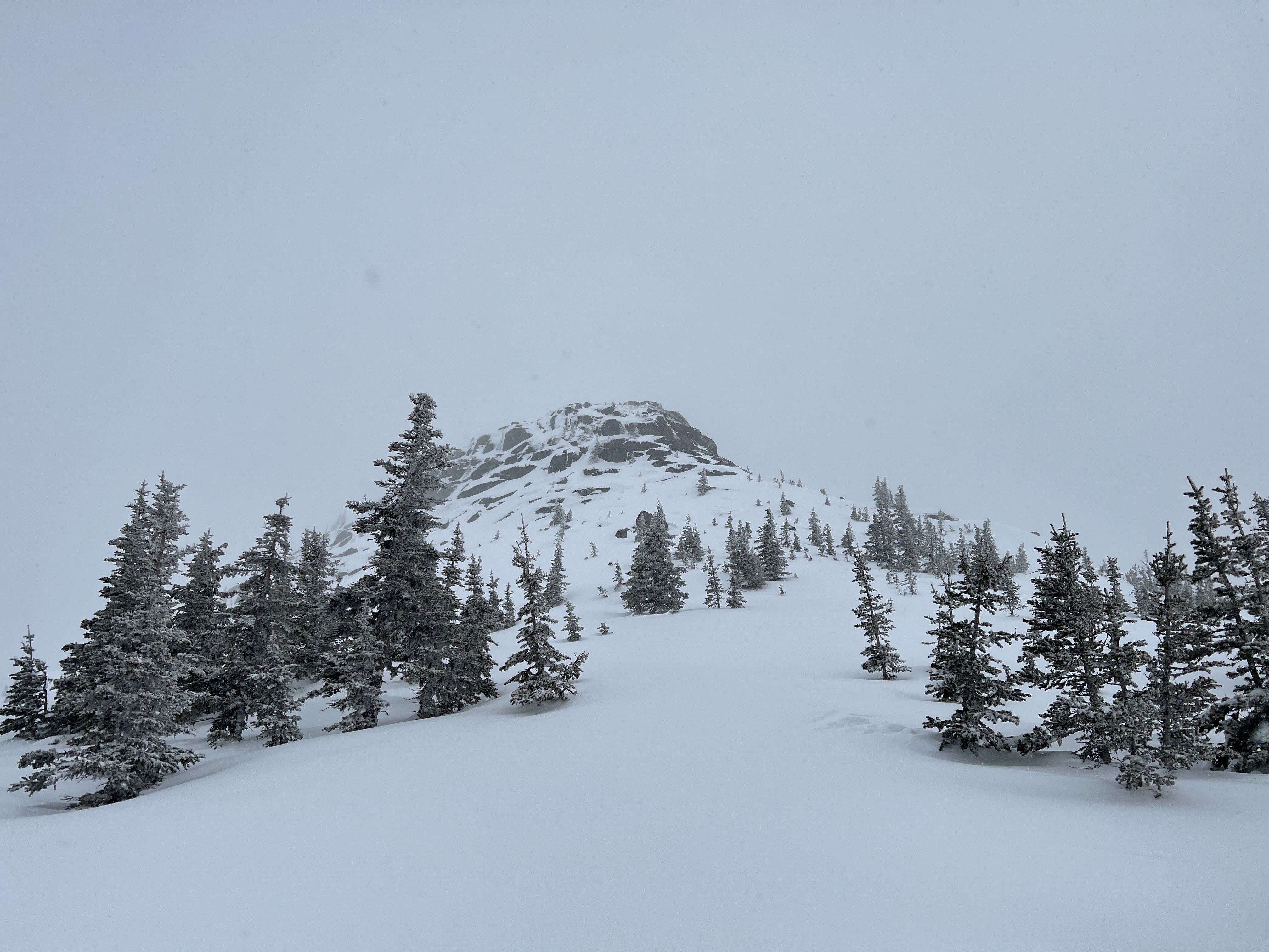
The west face of Needle. Photo Credit: Albert Yip
For the next 30 minutes, Jacob, Mozi, and I scanned the lip for any ski tracks while Haley helped get everyone back down the ridge. Upon digging a small snow pit, Jacob decided that the snow was a bit too unstable and the terrain a bit too steep to go looking for the ski, with the windslab and rain crust it was resting on sliding quite easily. We marked the location on our maps and continued down the ridge. It was around 2:45 PM at this point. Albert was forced to boot pack down while Clement carried his ski.
The rest of us began the rolling descent of the ridge, stopping frequently to give everyone a chance to regroup. I was up at the front with Xander following old down tracks when all of a sudden our trail got a lot steeper and tighter than I remembered. We stopped and pulled over, and heard Jacob call from behind us, telling us we were slightly into the drainage of the creek from earlier. Below us was going to get a lot steeper, and we’d be best to try and contour left to regain the ridge. I pulled out my phone and confirmed this on Gaia, and so Xander and I attempted to traverse left. We kept losing elevation doing this, however, and eventually, we heard Jacob yell from behind us that we may have to try and boot back up to the ridge. In hindsight, we should have probably done one of two things. Either we should have kept our skis on and kept contouring left, or we should have backtracked to the rest of the group. It was clear that we wouldn’t all be able to keep skiing on these steeper sections, so backtracking would have been the best play. Instead, Xander and I saw Jacob traversing above us, and we figured boot packing up to him was the solution.
A couple of minutes into our boot pack had us lose visibility of Jacob. The snow got real steep real fast. There were a few sections where it hit either 45º to almost 50º, and we were wallowing in it barely gaining any elevation. The runout was also littered with trees and rocks, making the potential for a fall or slide pretty high consequence. The answer was to keep traversing along the contour, using our ski poles to self-belay. After about an hour of this, we finally climbed about fifty meters and regained the ridge and skin track. I shouted a couple of times to see if the others were still close by. We heard Haley yell in response, and Jacob blow his whistle. I blew mine in response and considered trying to ski back up to find them. At that point, Xander got a phone call from the rest of the group. They told us they’d be an hour or so regaining the ridge, and gave us the option to wait where we were or ski back down a kilometre or so to the cars to wait for them there. I had no real idea where the others were, or where they’d regain the ridge, and both Xander and my phones were about to die, which would cut off our means of communication. I was pretty confident in Xander and my ability to ski down now that we had found the skin track, so I told them we’d meet at the cars.
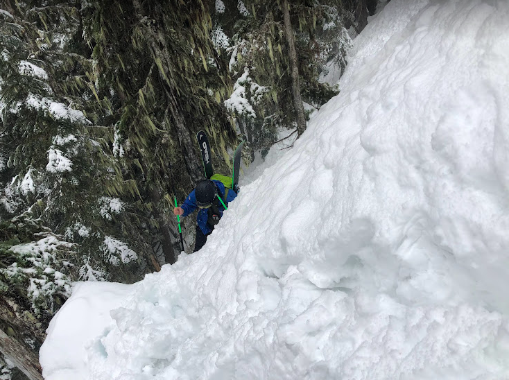
Xander bootpacking to the ridge. Photo Credit: Lucas Braun.
Xander and I set off and made it to the parking lot around 5:09pm. We ordered chicken burgers from the food truck there (I was somehow willing to eat one after my gargantuan peanut butter cup), and warmed up in the bathrooms. The others eventually made it down at 6:30pm. We were all pretty relieved to see each other, and decided to go to Rolly’s Diner in Hope to recover and debrief. All in all, our day trip to Portia Peak ended up being a roller coaster that took us a grand total of 3.6 km from the trailhead.
Takeaways:
-If you find out you’re on the wrong trail, consider backtracking before you try to carve your own path. We didn’t end up saving time by cutting across the creek gully or by boot-packing up to the ridge, and some sections got a bit hairy when we could have just as easily back-tracked up known terrain.
-Bring radios on trips, no matter how short. There were a couple of cases where our groups got split up, and it would be good to have more reliable communication than yelling, phone calls, or whistle blows.
-Don’t fall into the slope angle shading trap. Just because it’s not on the map doesn’t mean it’s mellow terrain.
-INVEST IN SKI LEASHES
-Start a bit earlier if possible.
-Keep skiing with experienced people. I learned a lot from Jacob and Haley on Saturday, and I also questioned some of my own assumptions in the backcountry. It’s always good to be able to confer with people who know more than you.
-Reese’s Peanut butter cups are disgusting. TBD on if they’re good traverse food or not.
Oatmeal cookies are the best traverse food/ No stove required.