After previously huffing and puffing along the Howe Sound Crest trail last summer in the rain/clouds, I (Amy) have been determined to give the HSCT another go. So Mykal B.W. and I set out on a sunny August weekend to hike the trail as an overnighter from Cypress to Porteau Cove.

Howe Sound from Unnecessary Mountain
The Howe Sound Crest Trail is a 29 km point-to-point hiking/trail-running trail stretching from the Cypress Mountain Parking Lot to Porteau Cove (Porteau Cove Road). The trail passes over/by many of the prominent peaks of the North Shore and Sea to Sky areas including St. Mark’s Summit, Unnecessary Mountain, the Lions (Ch’ich’iyúy Elxwíkn’ or the Two Sisters), Mount Harvey, & Brunswick Mountain. (Note: This trail is in the traditional territory of the Musqueam, Squamish, & Tsleil-Waututh Nations. While I couldn’t find information on the traditional names of the other peaks, it was very cool to learn the story of Ch’ich’iyúy Elxwíkn’ & would recommend giving it a google if you haven’t before!).
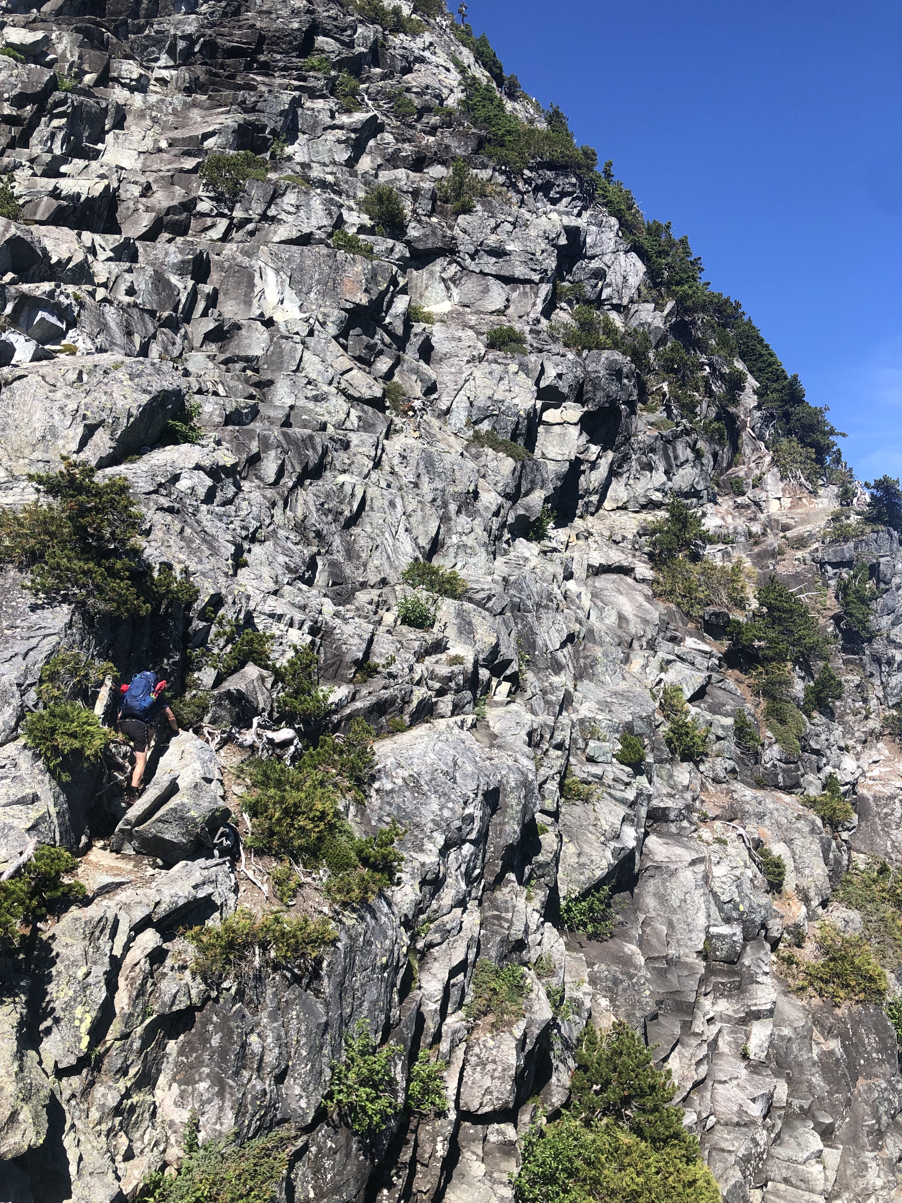
The trail is notorious for lots of ups and downs adding to a significant elevation gain (1800m from Cypress –> Porteau). The elevation is quite a bit more in the other direction (Porteau –> Cypress) as you start near sea level in Porteau Cove but we were keen to take the free elevation gain at Cypress. The HSCT is a technical hike involving careful footing and the use of chains/ropes over sections with some exposure. Terrain can become quite slippery if it rains, and snow often stays on the trail till late summer. Aside from exposure to heights, the trail also is quite exposed to the sun making proper sun-protection important and finding water sources difficult in the late summer. If camping, there is no food-storage facilities so make sure to bring stuff to store your food/smellies safely from bears (we opted for a bear canister) as there are frequently bears on the trail (thankfully no bear encounters this time around).
With all this in mind, we set out on a Saturday morning from the Cypress parking lot around 10am after some help from our friends to set up a car shuttle from Porteau Cove. There were lots of fellow hikers for the first 5km or so towards St. Mark’s Summit but once we past this point, the number of hikers dropped off significantly and the trail gets more rugged. We encountered our first big down-and-up between St. Mark’s and Unnecessary Mt with potentially the biggest section of continuous elevation gain coming up to Unnecessary Mountain (hence why it is an unpopular mountain). We breaked for lunch at Unnecessary Mountain and said goodbye to our friends who were just day-hiking up to this point.
West Lion Scramble
We continued on towards the Lions/Sisters at 10.5 km as this was our intended camp spot for the night. Beyond Unnecessary, there was little forest coverage making it a sunny, hot hike. We had each packed 2L of water with the intention of melting and treating snow pack as our water source up until Magnesia Meadows (at 14.5km where there is a more consistent water source). We knew there was still snow in some sections from trip reports but not much, and relying on this later in summer/early fall might not be a good call.

Sunset & Dinner on West Lion

Funky light on East Lion
We scrambled up the West Lion following the marked route up the SE side. There were other groups climbing up as well, so we were careful of rockfall. There were 2-3 tricky bits where slipping could have some serious consequences but otherwise was quite straight forward.
After some tasty veg chili and unreal sunset views of Howe Sound and the Lower Mainland, we set up our tent and crashed for the night. Note: Many folks opt to camp at Magnesia Meadows as there is a relatively reliable water source and splits the days a little more evenly. We were quite keen to see sunset/sunrise from the West Lion and opted for a much bigger second day.
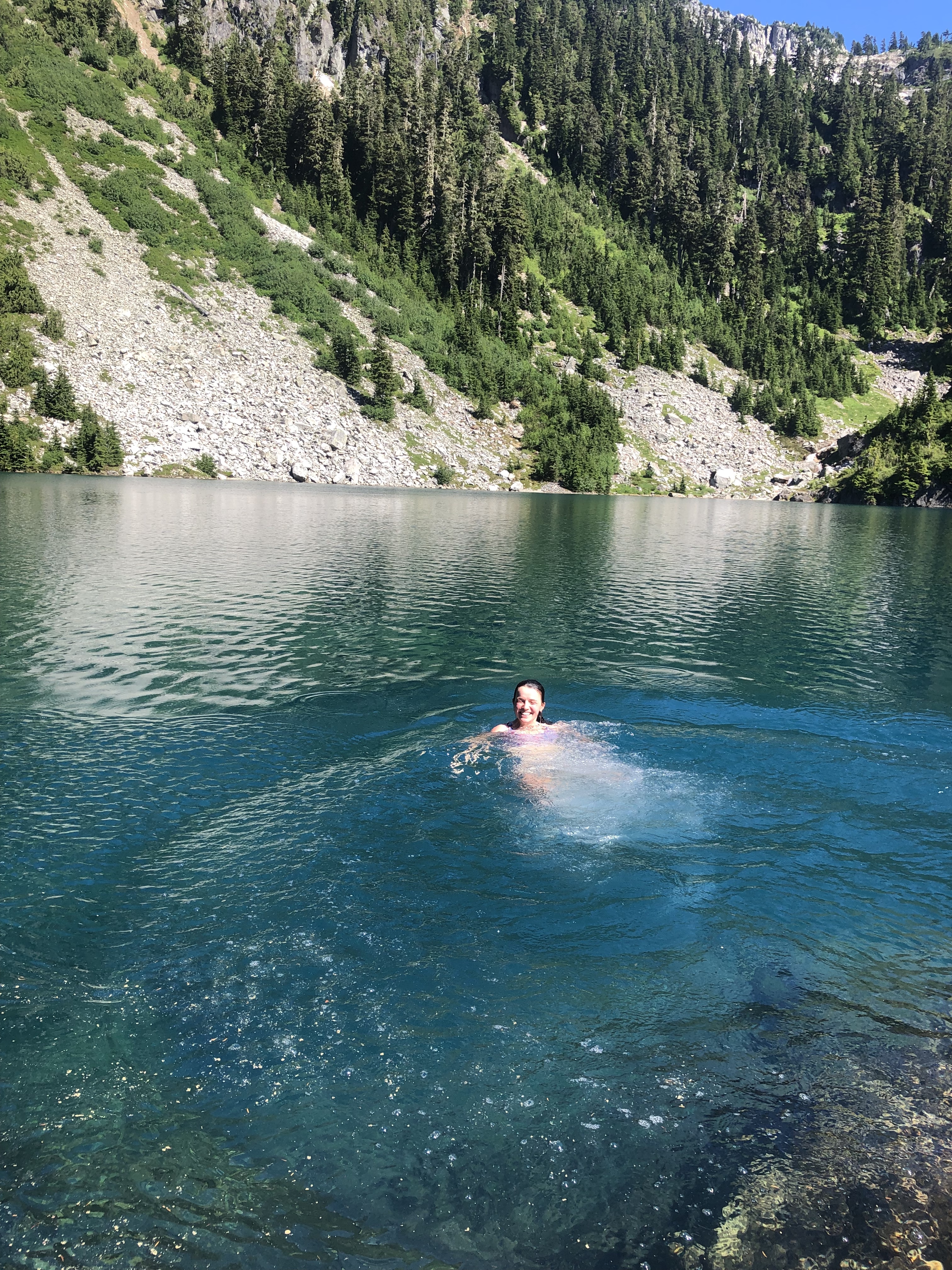
Chilly swim in Brunswick Lake
After some breakfast s’mores to get us going, we set out on day 2 knowing we had a lot of ground to cover (approx 18 km). The day started with the tough up and down Thomas, James, and David Peaks which left us pretty wiped coming into Magnesia Meadows. We took a long snack/water break and cooled ourselves off in the water pools around the camp before setting out again. We rounded Brunswick and descended down towards Brunswick Lake beginning the great descent. We saw the nice blue water of Brunswick Lake and after 1.5 days somewhat dehydrated in the hot sun, we couldn’t not go for a swim.
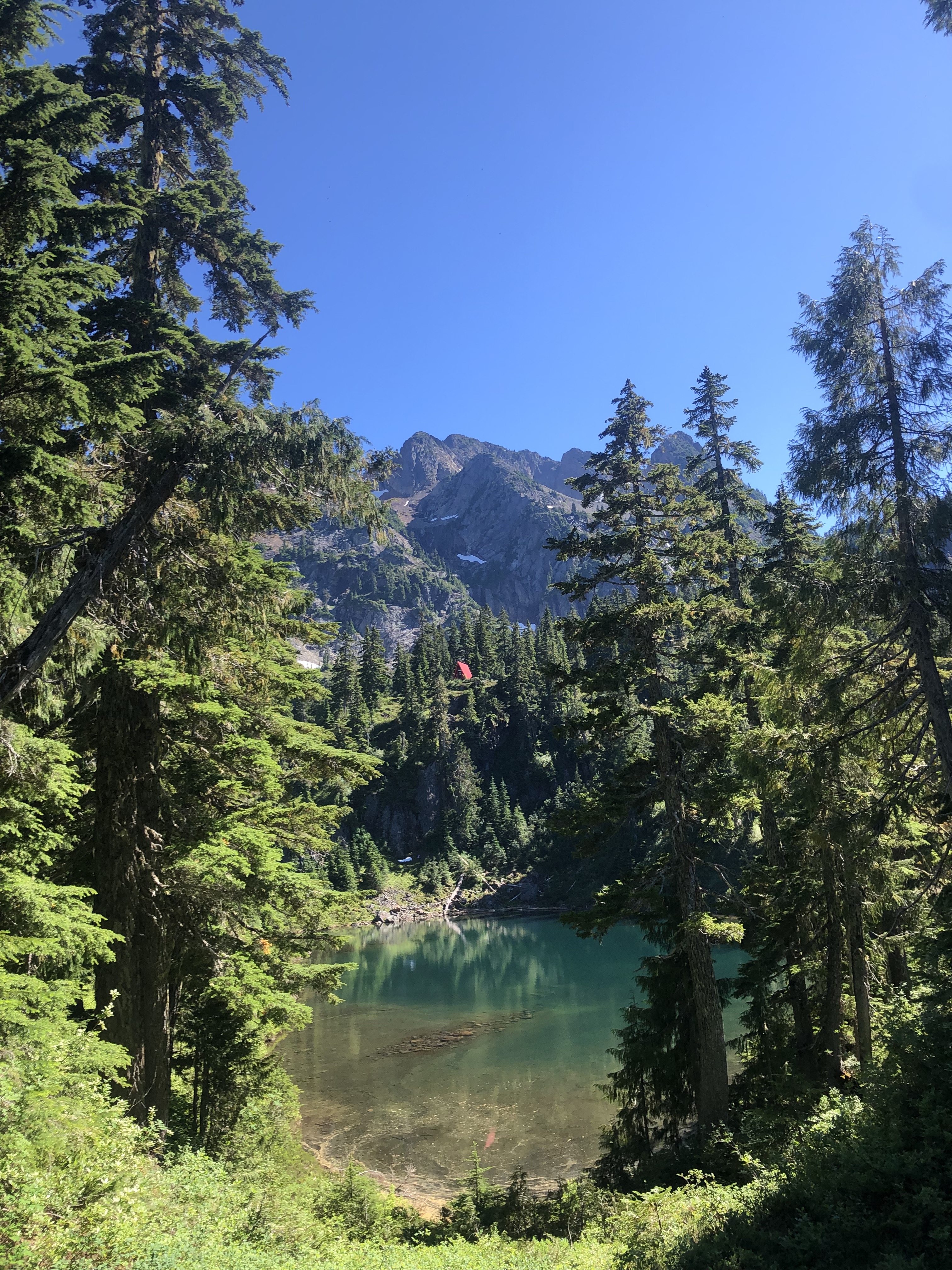
Looking back at Brunswick Emerg shelter
It was all downhill from there and while this may have been the physically easier section of the hike, it was definitely the toughest mentally as there is a lot of hill to get down. After several water/knee-saver breaks, we made it back to our car around 7pm. After savouring the taste of sweet, sweet redemption from re-completing the hike, we vowed to not do this hike again any time soon as it left us both quite zoinked.
All said and done, the HSCT is an unreal taste of mountains-meet-the-sea right in the backyard of Vancouver with great technical, challenging hiking that is sure to leave you sore for a few days.
hoping to do this hike next weekend! You mentioned last year you did the HSCT in some rain… how was your experience? asking cuz the forecast looks rainy next weekend :/