Mt Birdwood is a limestone mountain in the Canadian Rockies located in the Kananaskis area. The peak stands at 3097m in elevation. There are two established routes to the summit, The NW Ridge (II, 5.5) and the less common Lizzie’s Ridge (III, 5.7). The following trip report details Duncan Pawson (author) and Mark Pawson’s (Father) ascent of Lizzie’s Ridge.
….
38 years ago at the base of Lizzie’s Ridge:
….
Dad: “Whoa where’d those storm clouds come from? That wasn’t in the forecast.”
Dad’s buddy: “Probably shouldn’t send the route. Don’t want the weather to ruin my onsight.”
Dad: “Man, if only there was an electronic medium for information exchange, where you could just know the weather on a given day for a given location.”
Dad’s buddy: “And where you can look at cat photos.”
…..
Present Day
…..
Dad: “Ahhh Lizzie’s ridge, the one that got away.”
Duncan: “Dude. Dad. Let’s send it!”
Dad: “Nah I’m too old.”
Duncan: “But we have the internet now, I’ll get a super accurate weather forecast. Nothing will be unexpected.”
Dad: “Yeah I’m down. Realistically I was just having high-gravity day in 79”
(Not exactly how it happened, but that’s the Sparknotes version)
Send Day – July 21, 2017:
3:30 am: Wake up, eat, get ready.
Sleeping in at the trailhead in your car, is often not very comfortable and usually leaves you feeling not all that rested. Not this time. When your Dad brings out the minivan loaded with a proper queen-sized mattress, a good sleep is easy to come by.
Having fallen asleep to sound of rain pattering on the van, we were hoping the forecast would hold the following day. Waking up to a sky filled with stars was a good sign. The only hope that remained was that the sky stayed (relatively) clear and the route wasn’t too wet.
4am: GO
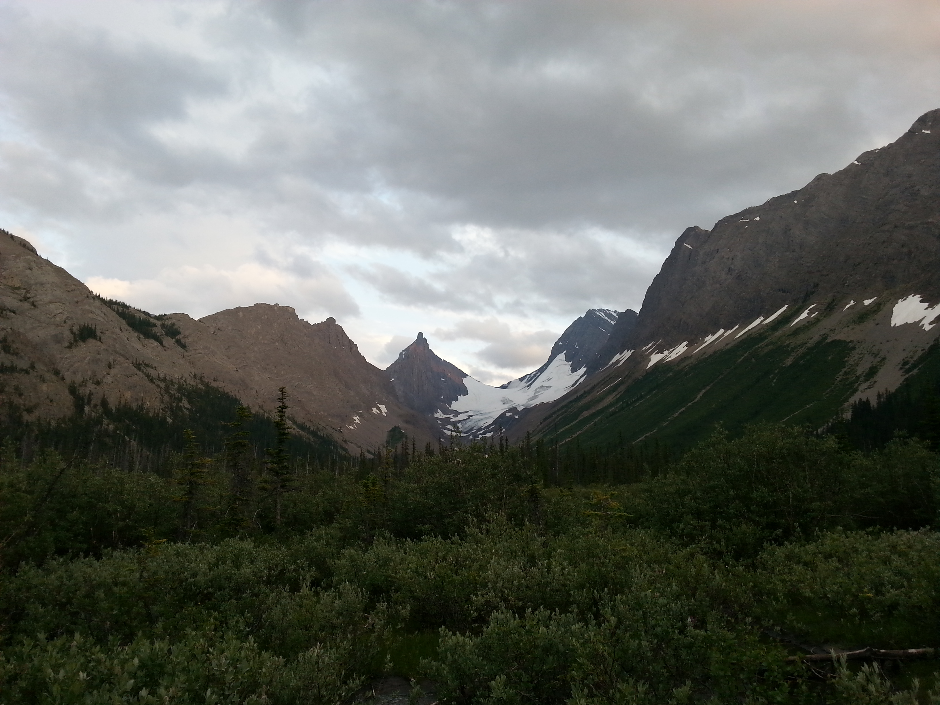
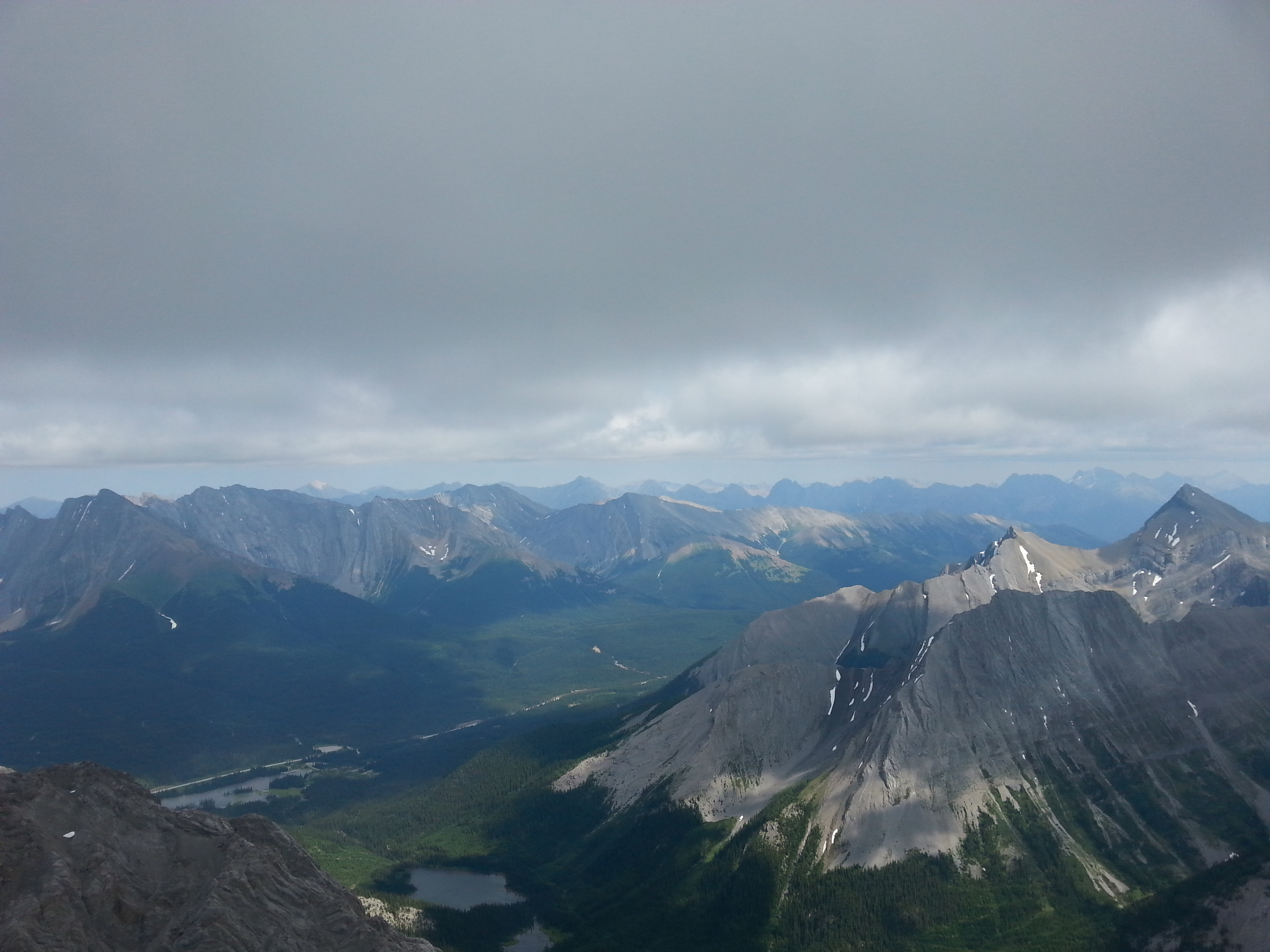
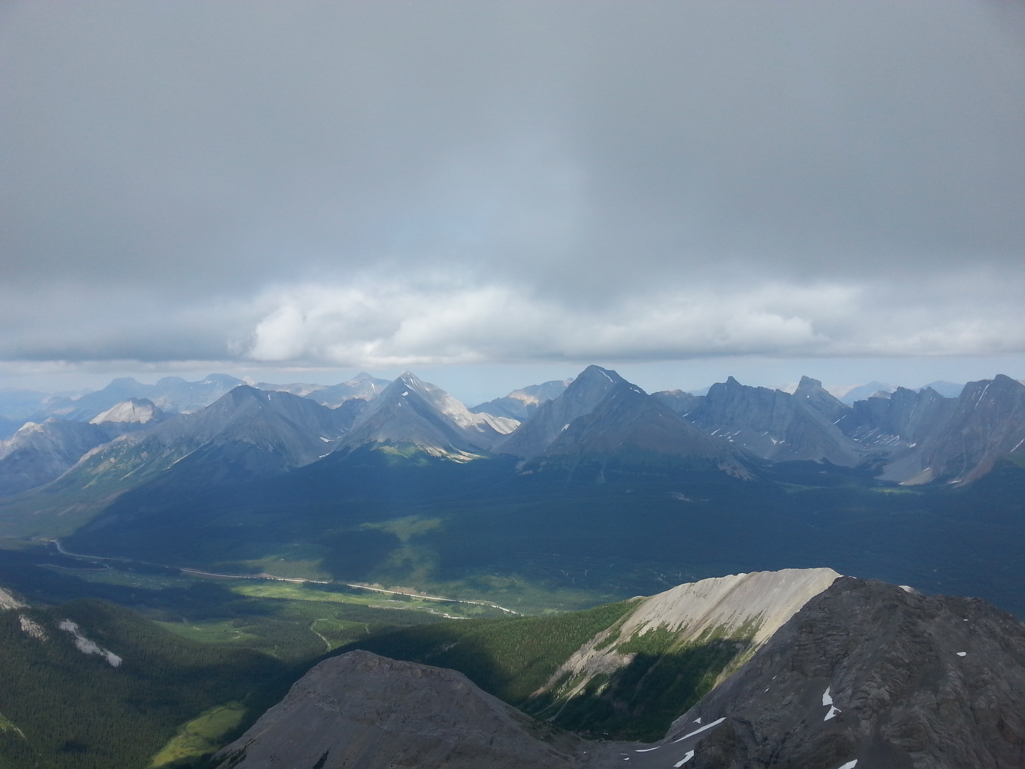
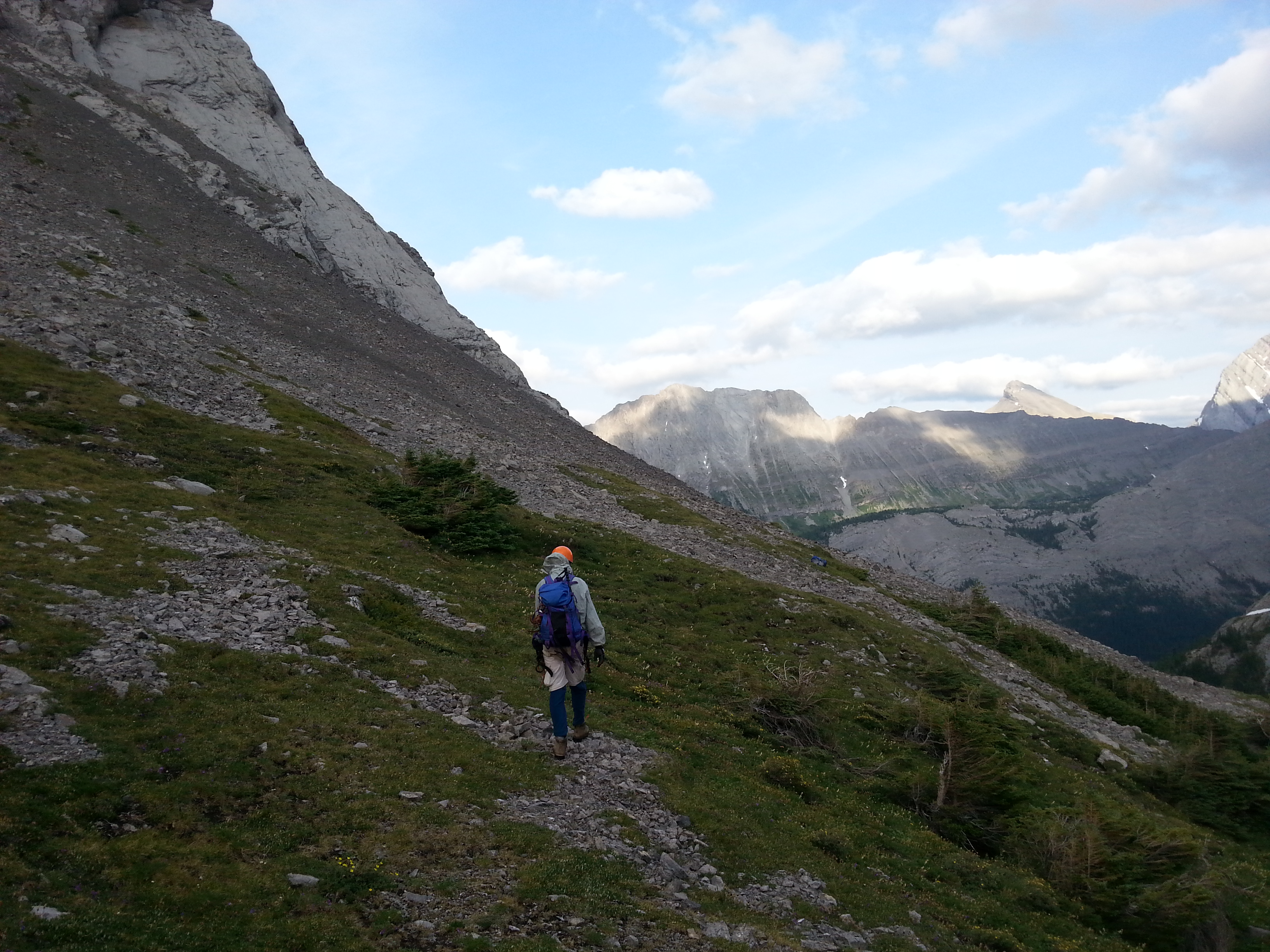
After packing up, we hopped on our bikes and cruised the 4km old road to the Burstall Lakes washout. It being a popular area for grizzlies, I was a bit nervous when I heard a loud rustling sound in the nearby marsh as we were locking our bikes – nothing was spotted however. We quickly crossed to the far end of the washout, only to realize that we had lost the trail. We spend about 30 mins trying to find the trail in thick bushes and very wet ground. Eventually we picked it up. For reference, the trail is much further West than expected. There is a bit of stream jumping and log crossing required until you finally cross the washout and enter the trees once again. We started up the nice, not too steep trail, until we reached Burstall Meadows. After which, we cut north off the trail and through the trees until we reached the scree slope (a couple hundred meters). We were now standing directly in front Birdwood and had a perfect view of the SSE Ridge (Lizzie’s Ridge). The orange glow of rising sun was just beginning to surface; I was stoked.
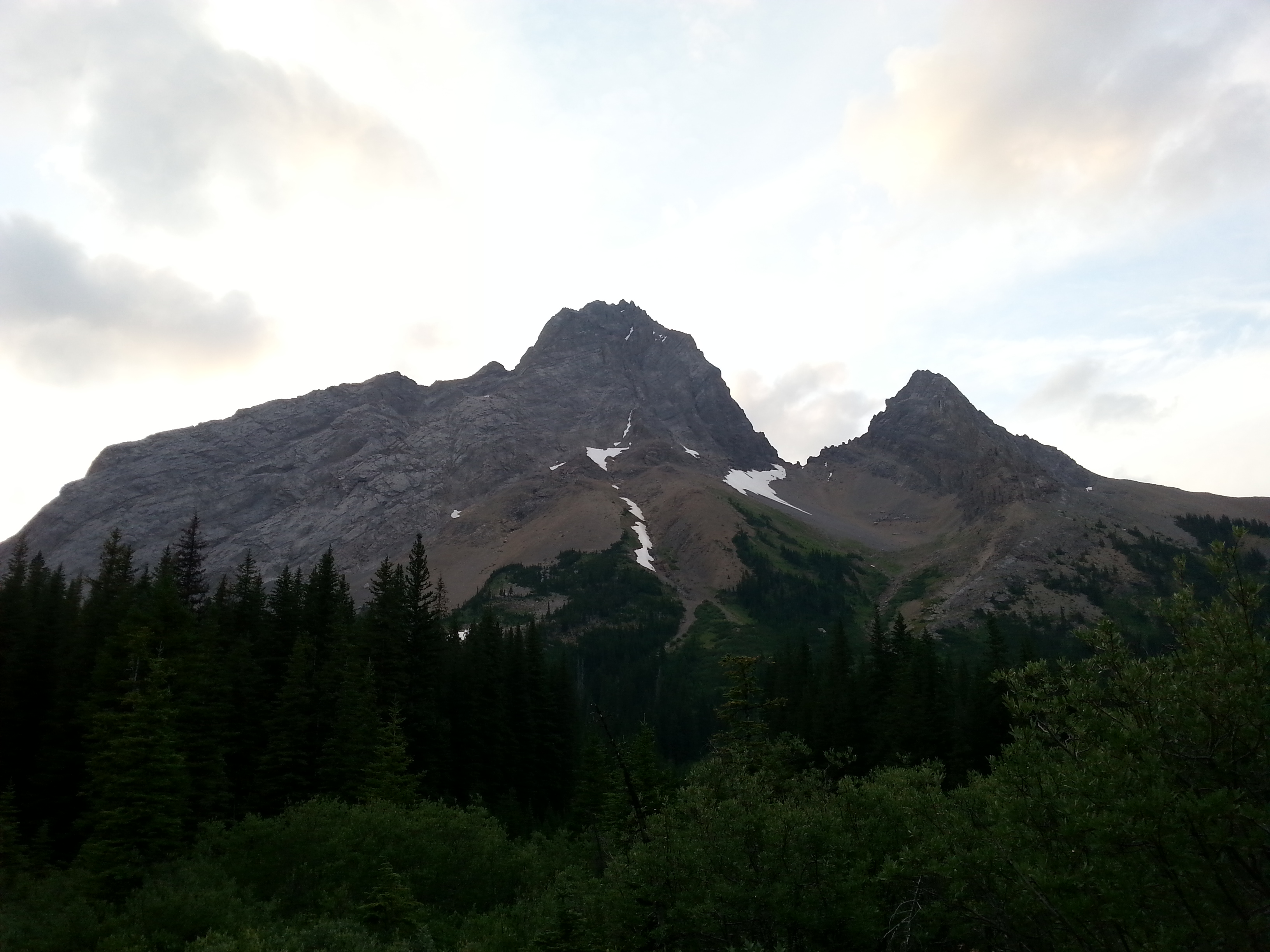
First view of the mountain
Burstall Lake Washout – Looking towards Mt. Roberston
Our intended route – Lizzie’s Ridge, on the right
We strapped on our helmets and started up the scree slope in the classic two steps forward, one step back Rockies fashion. I got to the base of the route around 6am where I waited for my dad as he continued up the scree. Arriving to the base at 6:20am, he let me know that he found that quite tiring and wasn’t sure if he was up for a long day of climbing. After a quick break, we decided we’d only climb the initial 200m, where it was essentially just scrambling and easy to retreat if need be.
6:30am: CLIMB
Although initially slow and tired during the scrambling portion, my dad soon found his second wind and at the point of no return, decided to go for the send. Although I kept telling him “I honestly don’t mind turning around if you’re tired. Now is the time to do it”, I was secretly stoked to continue – the ridge ahead looked super fun with some relatively easy climbing and decent exposure. After I quickly refreshed my dad on how to remove nuts, we roped up and began simul-climbing with myself leading (both of us in mountaineering boots – my dad’s weighing 3 times as much as mine).
Two mistakes were made.
One: We used the full 70m length of my rope, which translates to not seeing each other and not hearing each other as we climbed. Oh and the wind decided to really pick up at this point (so much for that super accurate weather forecast which called for 10km/hr winds).
Two: I didn’t tell my dad the difference between a cam and a nut (cam’s weren’t a thing back in the day). At one point I could faintly hear him yelling something about how he couldn’t get a nut out. “What, I didn’t place any nuts. He must’ve found one left behind by another party”, I thought.
After a section of more moderate climbing (5.6 or so), I figured I should probably build an anchor and belay my dad. Due to the runout nature of the route, poor rock quality, and the fact that we were simuling with a minimalist rack (4 cams, 4 nuts), I really didn’t want him to fall and have us both take a huge whipper. After building an anchor, I kept screaming against the howling wind “I’m secure, you’re on belay!” I couldn’t hear much of what he was saying except something about this stuck nut. “Just leave it”, I yelled. He eventually came around the corner and up to the anchor. He was telling me that he couldn’t get one of my nuts out.
Duncan: “I didn’t place any nuts.”
Dad: “Yeah your silver one”
Duncan: “You mean my silver cam?”
Dad: “Sure”
Duncan: “Did you pull the trigger [demos pulling the trigger]”
Dad: “Ohhh I didn’t know there was a trigger. You didn’t show me that”
Duncan: “I thought you knew…How did you get the other ones out??”
Dad: “With the nut tool, as you showed me”
…..
Duncan: “Haha well that’s impressive. I guess that’s my fault for not showing you. Also my bad for choosing to do a full rope length simul, I couldn’t hear/see you at all. Let’s do 20m from now on :p”
After a discussion as to whether or not I should go back for the stuck cam, I decided it best if we push on; I had read a TR about a party taking 16hrs and bivying on route, so I was slightly concerned with time. That being said, I didn’t see how it would take us that long.
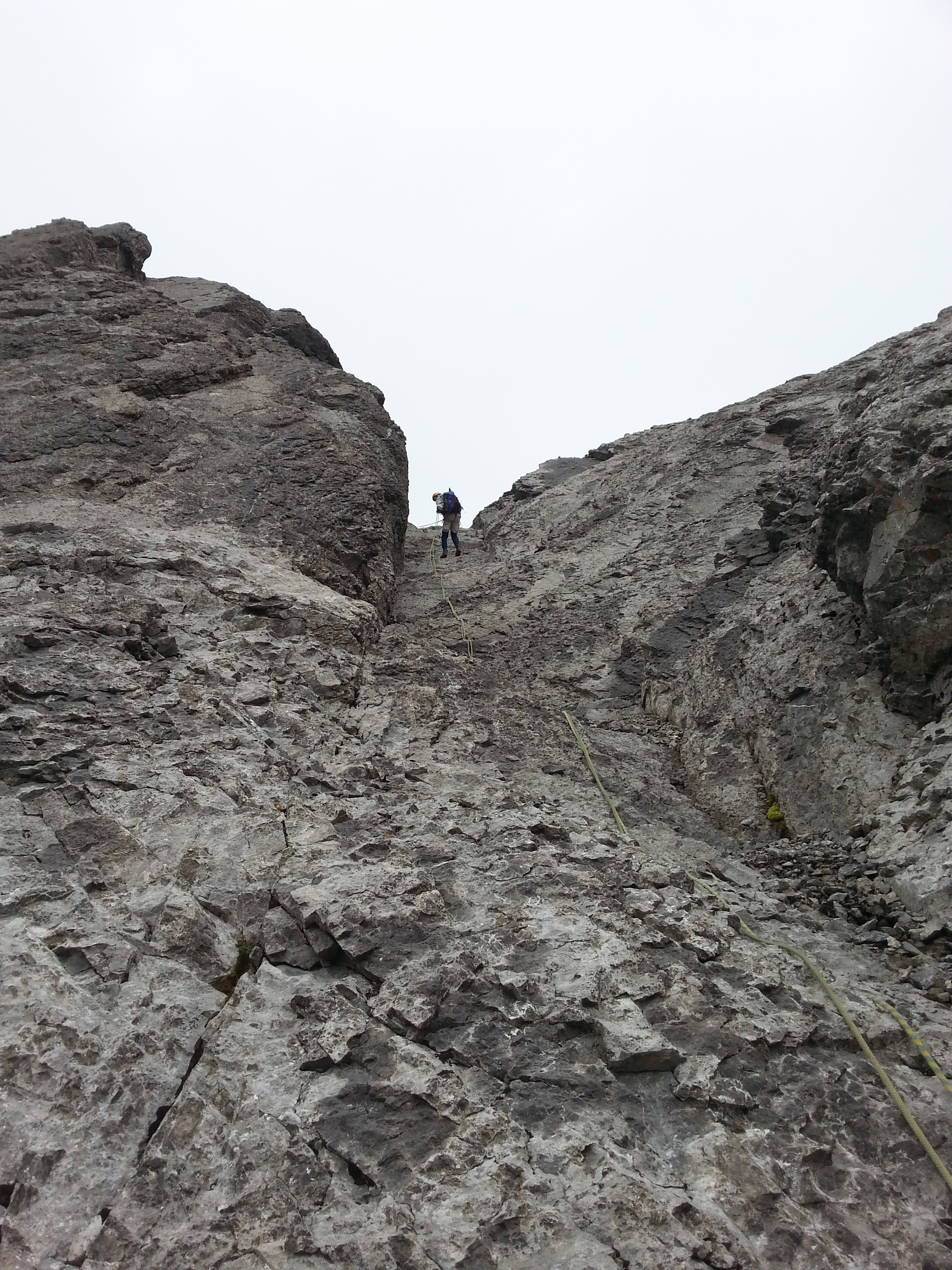
We set off again with a 20m leash. Although a chossnanza, I found the climbing super enjoyable with some easy chimney moves, lots of exposure, and a beautiful view of Mt Robertson/Robertson Glacier. We continued to simul-climb with intermittent anchors built at difficult sections or when I was running low on gear. Slinging horns were the most useful anchors, as good placements were few and far between. In the case where I would place pro for anchors, standard 3-point anchors had to go out the window, as often only one or two solid placements could be found. I think there were only two fixed anchors on the route (one comprising cordallette and rap-rings, and the other two pitons).
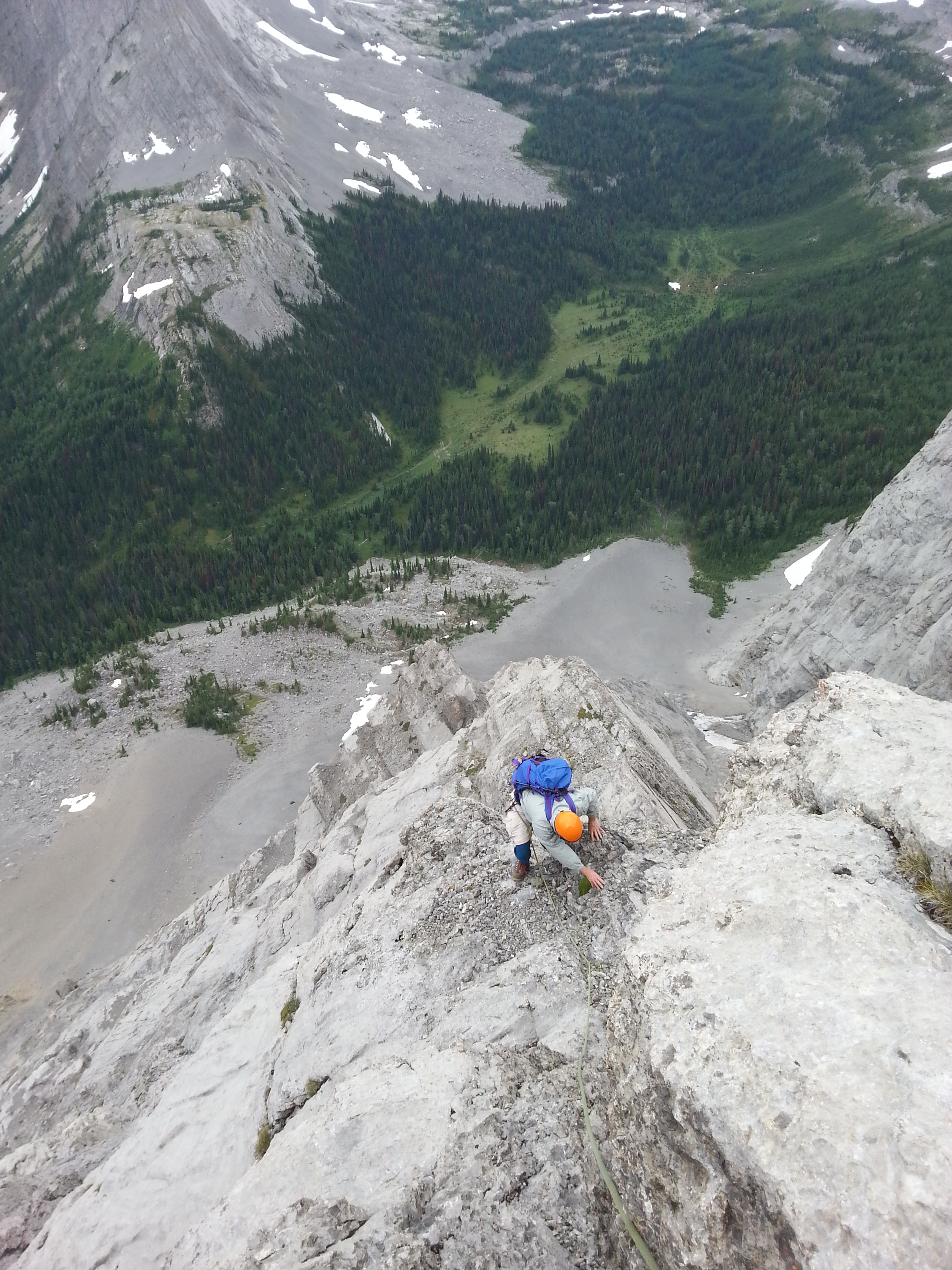
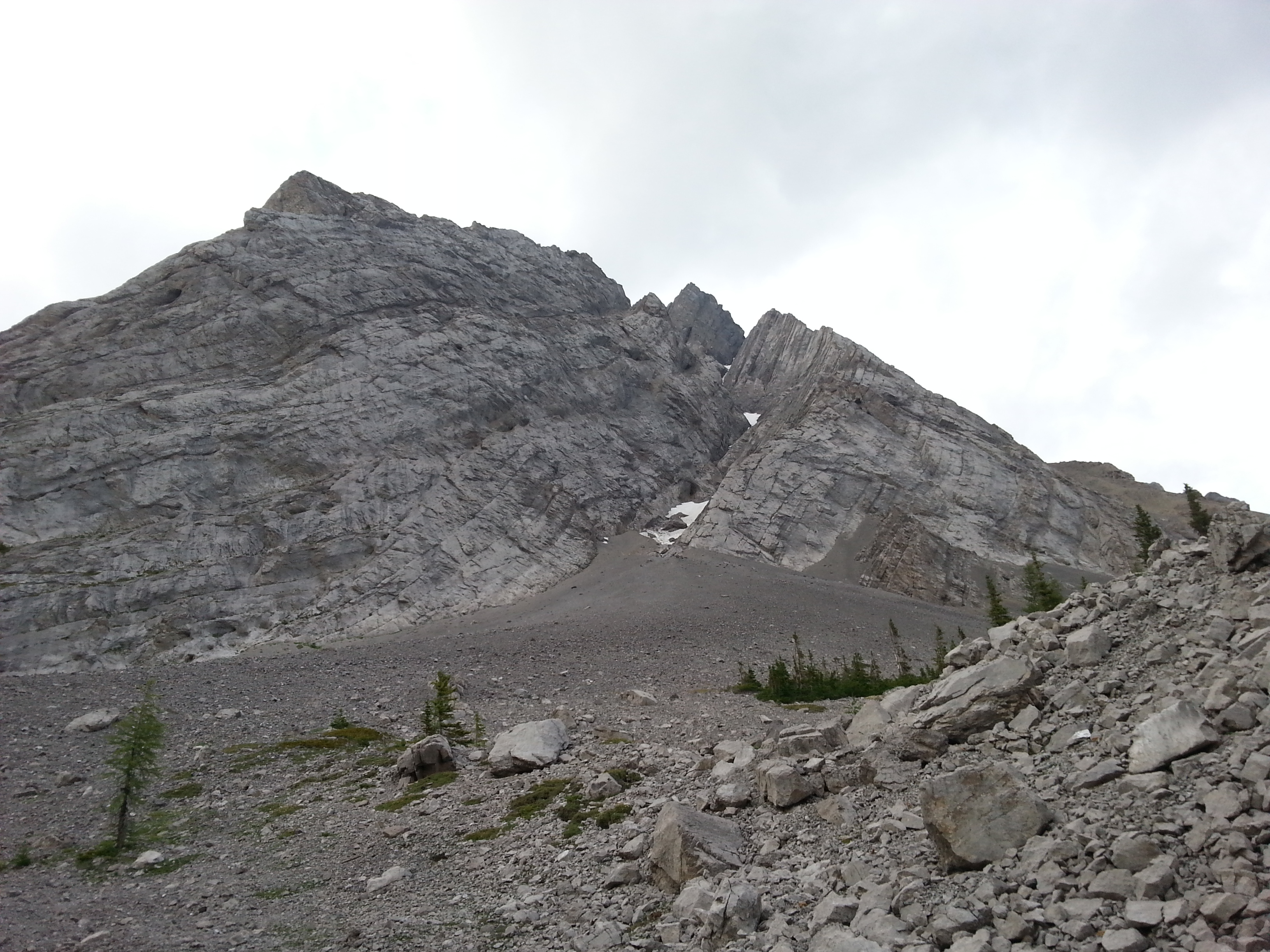
Beginning the climb
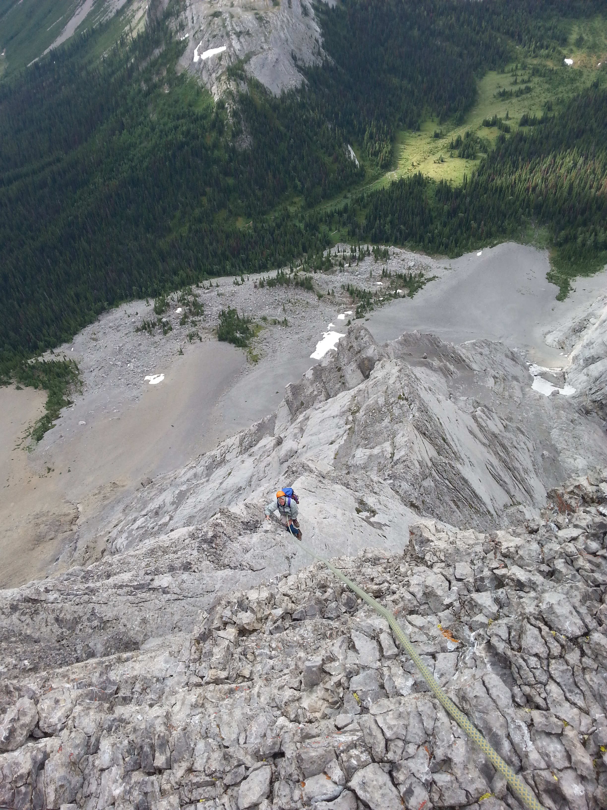
Continuing the climb
We eventually reached the crux – a couple 5.7 moves over a steep section ending in a short vertical wall (protected by a piton). I asked my dad for a belay on this pitch. In hindsight, both my dad and I agreed that we didn’t really feel there was a crux move on the route. The rock quality was more of a crux than anything. Nonetheless, I decided to put on my rock shoes just in case. Also my mountaineering boots were ravaging my ankles, so climbing shoes were oddly comfortable in comparison. My dad kept the mountaineering boots on the whole climb as he claimed he was more used to climbing in those than rock shoes. At this point, we switched to pitching out the climb as my dad was getting tired (still sticking to a shorter length of rope for communication purposes).
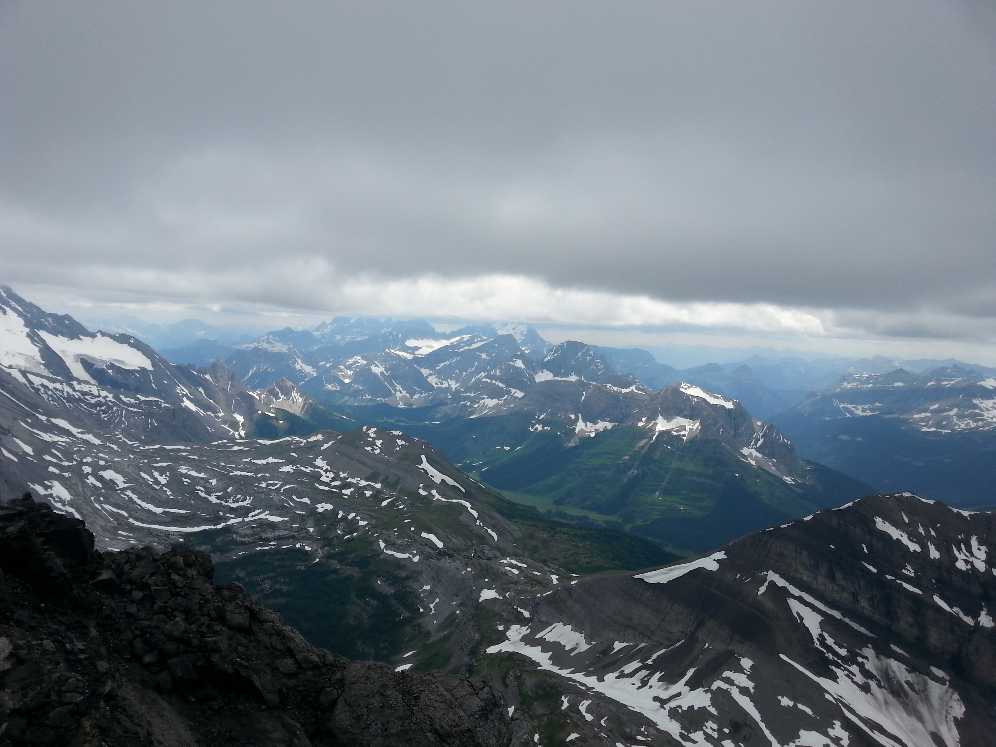
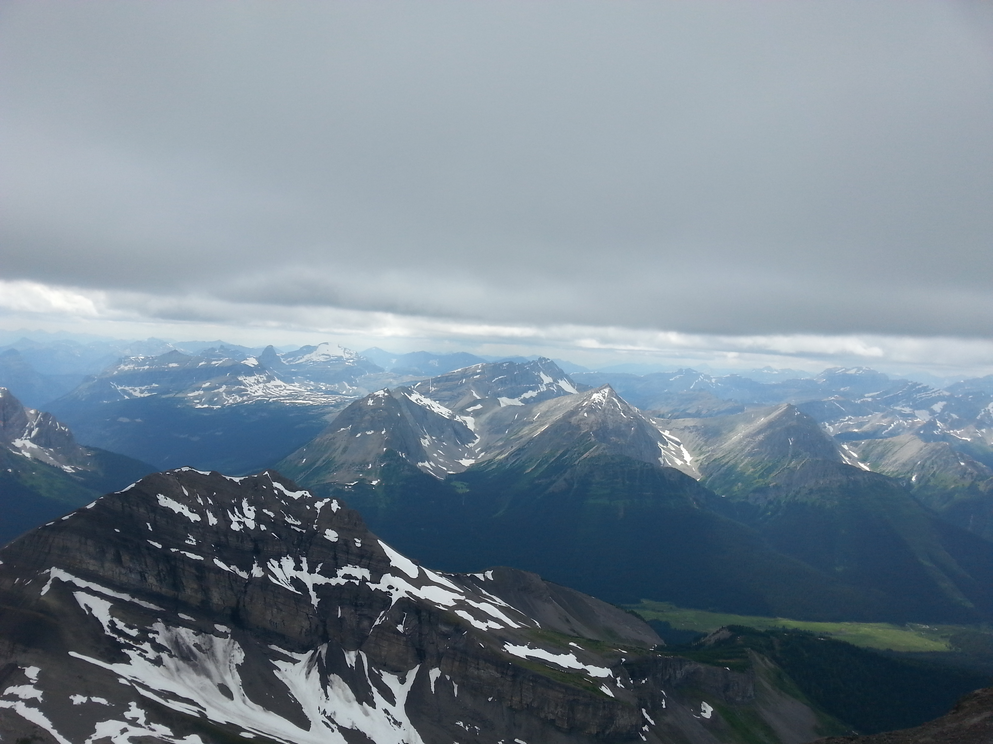
Some more climbing and we reached the ridge leading to the junction with SE face. The ridge was incredible! Skinny, loose rock, exposure, beautiful views, straightforward, walk-able. The next bit of climbing up the face involved a steep snow gully. We had read that this gully often contains snow early season, so we brought our crampons in preparation – we didn’t, however, bring an ice axe. I asked my dad if he’d like to lead the snow pitch, to which he said “yes”. Unfortunately, his crampons didn’t provide him much traction in the slushy snow, so I took the lead once again. Unable, to really protect the pitch, I dug my hands in the cold, wet snow to provide extra traction as I made my way to the top, where I built an anchor in the rock to belay my dad up. We were getting close now.
Dad taking a break on the ridge

No longer taking a break on the ridge
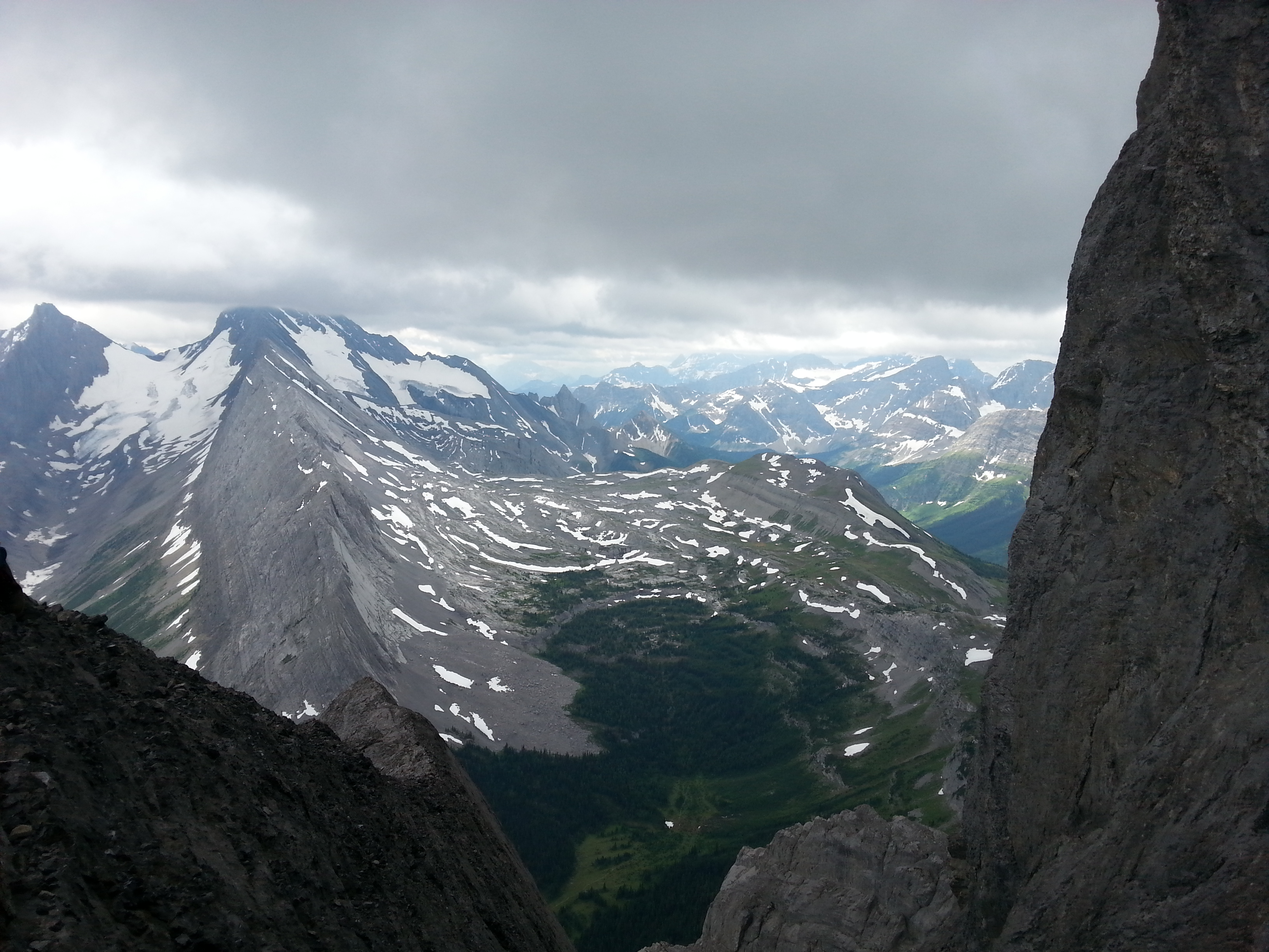
Nice views at the junction with the SE face
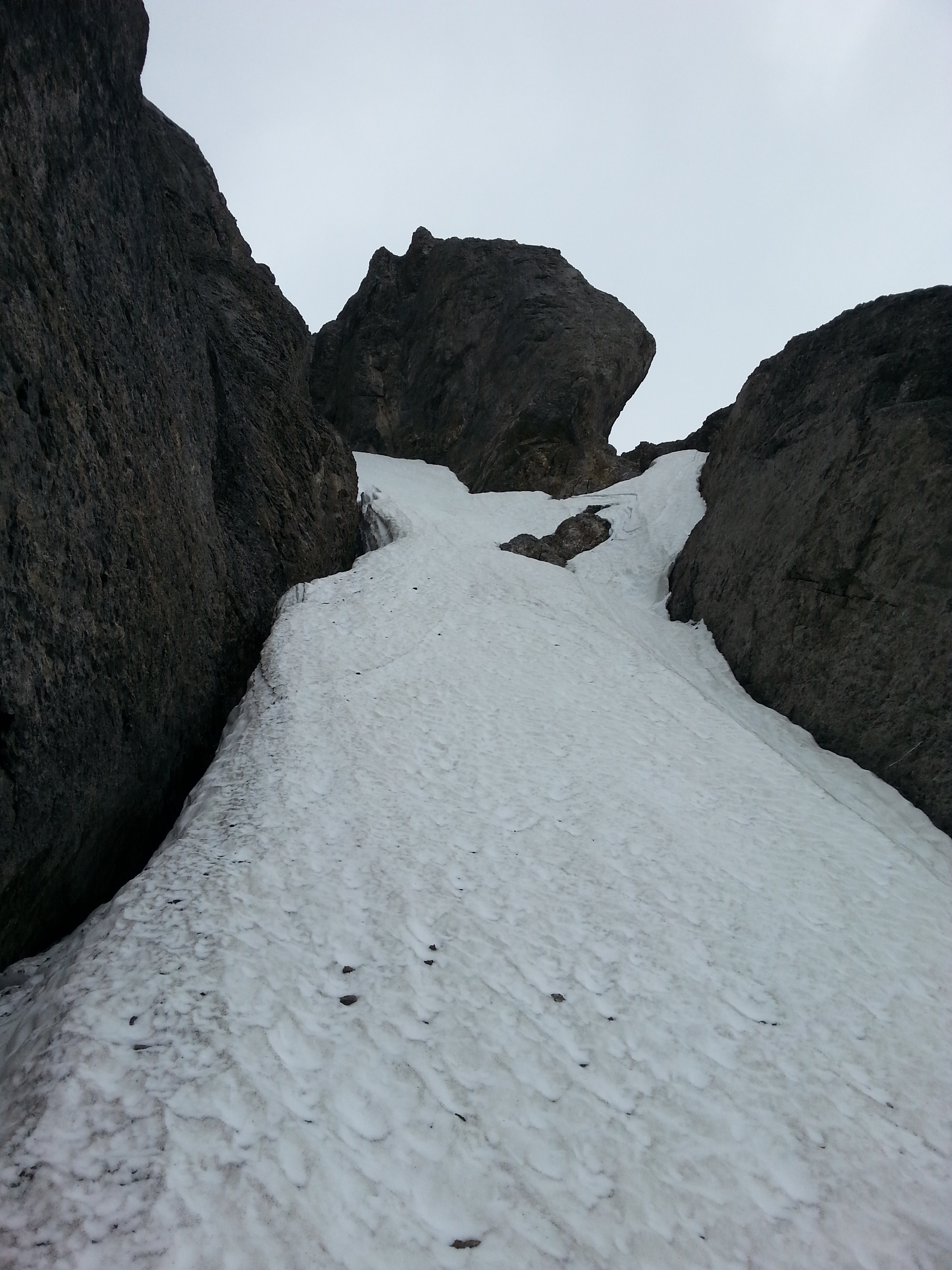
The snow pitch
Although technically easy, the next bit of climbing seemed the gnarliest for me. I once again asked my dad for a belay, as the next bit of climbing had verglass covering most of the rock, with water trickling alongside. To add to the spice factor, there were zero good placements (maybe I didn’t look hard enough). After a full 70m, zero pro-placement pitch on slippery terrain, I was able to build an anchor. My dad agreed that that pitch was the worst.
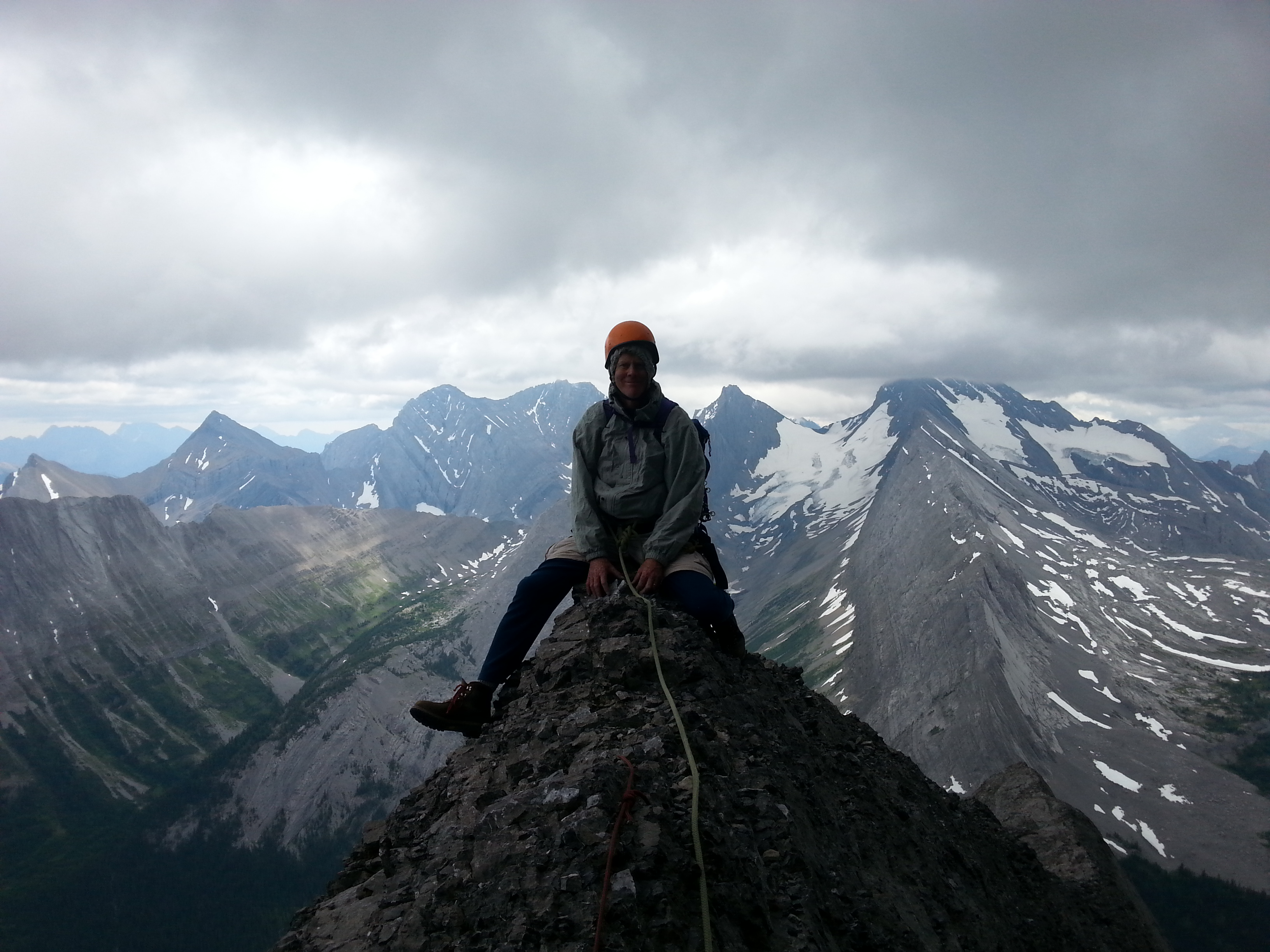
3:30pm: SUMMIT!
One more pitch and we were beginning the ascent up the summit ridge. The rock quality was never amazing, but here it was horrible (even by Rockies standards). That being said, it was more of a scramble so we didn’t really mind. After walking over the loose rocks, up a short gulley, and across a skinny ridge, we were standing on the summit. After 9hrs of climbing, and having wanted to do the route for a while, it felt amazing! Unfortunately, the clouds never really cleared all day (nor did the wind stop) so weather conditions/views were average. However, the climb for me was the best part. I think my dad was just glad it was over. He admitted there were sections where he was scared, but he kept it together (he didn’t seem scared to me).
Summit views


Yours truly on the summit
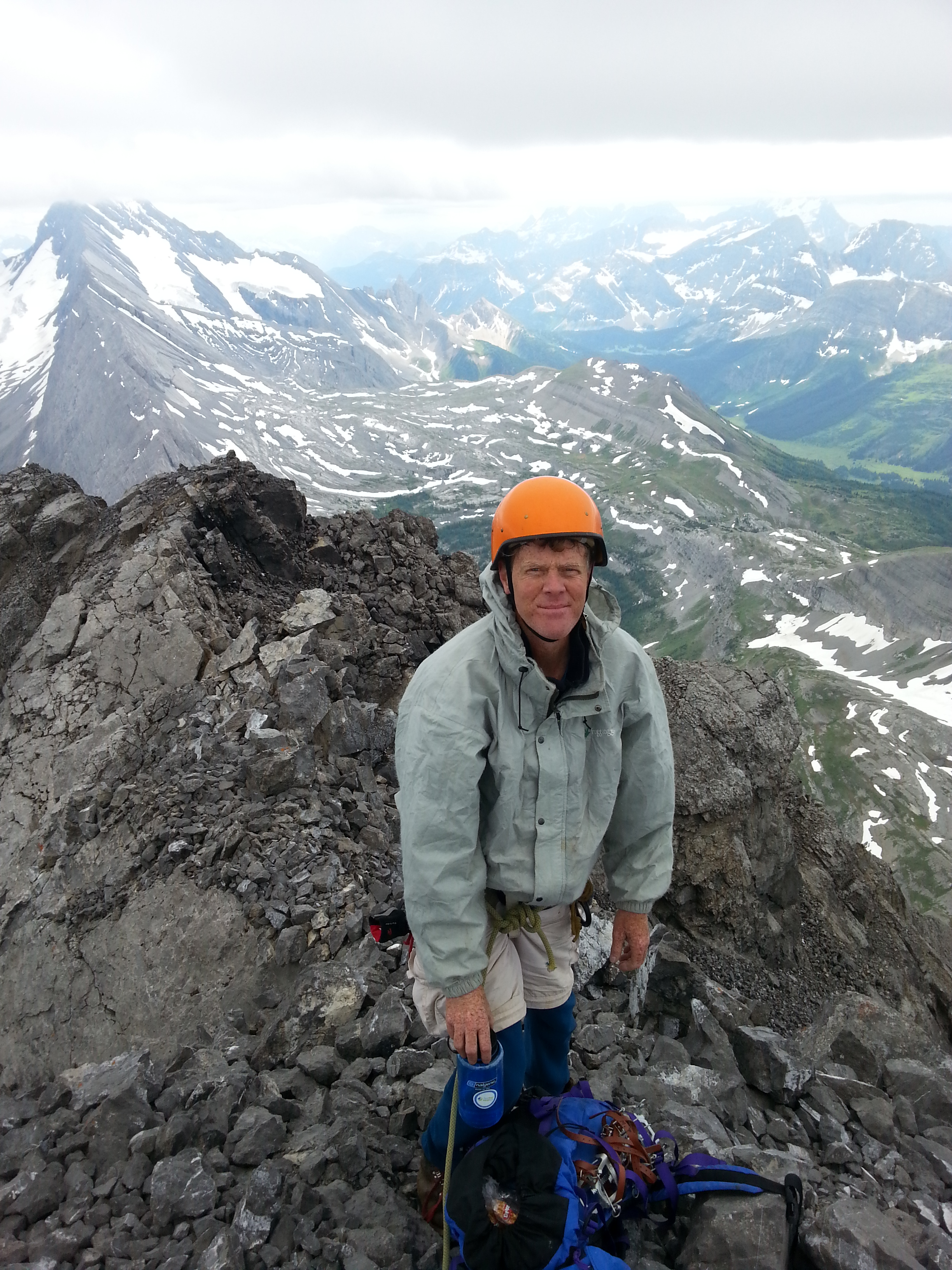
Rocking the JB helmet on the summit
4pm: DESCEND
A bit of down climbing back to the loose section and we were at the first rap station (on the north side of the mountain). In general, the descent was quite enjoyable with some easy down climbing/scrambling and four well placed rap stations (we rapped the full 35m). Three of the four stations were cordallette slung around horns, with station number 3 being three pitons (always a bit nerve-racking). This particular station involved rapping down a snow gully, which is always a slap in the face. The cord on the last rap station was quite tattered, so I left one of my pieces of cordallette and a biner. After this final rap we reached the north scree slope and began the scree ski (good in some spots, terrible in others).
Beginning the raps

Coming down the scree
Once down the scree, my dad suggested we walk over to Burstall Pass and descend to the trail that way (quite far away). I thought there must be a quicker way, so we walked around the SW side of the mountain, following a goat trail until we got cliffed out. My dad thought we could find a trail through the trees, but it looked quite steep and bushwacky, so I suggested just doing two raps and I would down climb. Unfortunately, the second “horn” that I spotted for setting up a rap was not well suited for a stable anchor, so we soloed up relatively easy terrain back up to the original goat trail – wasting about 45mins. Quite tired and a little scared my dad did not enjoy this unexpected climb at all. Admittedly, it wasn’t very fun. I offered to climb ahead and build an anchor, but he didn’t want to wait on the steep slope (there were no placements to be had for protection while he waited).
We went with my dad’s idea of looking for a route through the trees, again following what looked like a goat trail. Of course, this was a much better idea. We were able to easily descend through the trees, where we picked up a trail back to the meadow. From here, we followed the trail back out to our bikes and where an incredible final descent back to the car awaited us. Perhaps it was the stoke, or the dark shroud of the early morning, but we hadn’t realized that we were going slightly uphill during the approach in the morning. This meant it was downhill, on bikes, the whole way back to the car. It was the perfect end to the day.
Wrapping around the SW side of the mountain to our final descent through the trees
10pm: WAHOO!
Back at the car, as the sun was setting, we quickly loaded up the van and were off – Birdwood in the bag.
Ha! Ha! Great TR Duncan … your dad sounds hilarious.
Haha thanks man!