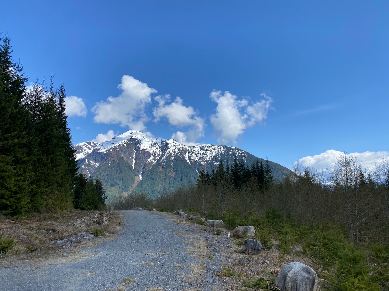
Mount Wrottesley is the large dome-shaped peak visible across Howe Sound from the Sea-to-Sky Highway, Cypress Mountain resort, most of the Howe Sound Crest Trail, and the UBC area. Like most Vancouverites, I’d seen it hundreds of times, but never really noticed it. It caught my attention while looking at maps and I decided to climb it. It forms a ridge jutting out into Howe Sound, promising some rarely seen views of the fjord and its surrounding peaks.
The standard route involves kayaking across Howe Sound to Camp Potlatch, at the end of the valley to the east of the peak, and ascending a faintly defined route from there. Crossing Howe Sound would be risky as a solo paddler; in January 2006 two VOCers almost perished in a surprise storm when returning from Wrottesley. On top of this, the kayak rental would be expensive. I also considered taking a water taxi, but this would have to be a charter, with prices starting at $720 for the round trip (this fits up to 12 people, but extra fees apply for larger groups). Water access would be out of my budget.
The only alternate route that made sense was from the McNab Creek valley to the west. I could drive from the Langdale ferry to the pulp mill at Port Mellon, then continue driving uphill as far as possible toward Box Canyon Pass. A gas pipeline crosses this pass at an elevation of 1,150 metres and connects to logging roads in the McNab valley. From there, it would be a 12-kilometre walk along logging roads to the base of Mount Wrottesley. This would be a long slog with over 3,250 metres of elevation gain, over twice the height of Mount Wrottesley itself, and I couldn’t find any trip reports online. Satellite images indicated that the road was probably somewhat clear so I decided to go for it.
The original plan was to go on Friday/Saturday of the Easter long weekend, but due to some completely unpredictable factors such as scheduled maintenance and the upcoming long weekend, the ferries were the busiest I’d ever seen. I arrived about an hour and a half before the first ferry and the line already stretched onto the highway for several kilometres. Without a reservation, I bailed and returned on Monday, this time with a booking. The ferry was much less crowded, and I made the 7:30 a.m. sailing.
The next obstacle was getting past the Port Mellon pulp mill, the only way to access the Rainy River FSR by vehicle. There is a gatekeeper at the entrance. Entry and exit are only allowed during daylight hours. Camping is allowed, but you’re supposed to let them know of your plans to camp. There were no problems with the gatekeeper and I was allowed past the gate.
Like on previous visits, the main Rainy River FSR was in good shape, and would be accessible for a careful 2WD driver. After about 8km I turned right on a new spur road not shown on most online maps. This was steeper and had many loose rocks but I was able to get to a creek at 480m elevation. There was a large rock in the creek that would’ve damaged the car so I decided to park there. (The rock was gone when I returned.)

I’d hoped to drive a bit further up the road, but that wasn’t an option so I just started walking. The road continued to be in OK shape with several more steep, loose sections. Snow started just below 700m, so on came the snowshoes. It was cloudy but I still got some decent views of the surprisingly large cliffs below Stolterfoht Peak. The FSR walk was straightforward, except for a few annoying creek crossings where water had washed the snow away.
Around 940 metres, I left the FSR and began ascending the pipeline right-of-way. It was a bit of a grind, but the snow was well-consolidated, and I soon reached Box Canyon Pass. I descended the other side, glissading in spots, until I hit a snow-covered logging road. It reminded me of Zoa Peak’s pipeline, only steeper.

In hindsight it would’ve been more efficient to arrive slightly earlier in the season (to avoid creek crossings), ski down the pass, and stash the skis by the snowline on the east side. Alternatively, you could probably push a bike along the pipeline swath in the summer.
I kept walking down the road, navigating even larger creek crossings until the snow stopped. There were cliffs all around me, and in the distance I could see the mountains on the other side of the valley, partially hidden in the clouds.

From this point onward, the road was in excellent condition. I guess it gets regular maintenance for the pipeline and hydro projects.
Eventually this road joined the main McNab FSR. Another spur road led me to a bridge over McNab Creek. I‘d gone from 1150 metres at the top of the pass to under 100 metres at the bridge…

Next up was a long uphill plod. Once again, the road was absolutely immaculate by logging road standards. It clearly gets some ATV use and maintenance by people with cabins at the McNab estuary, and recent logging has helped things.

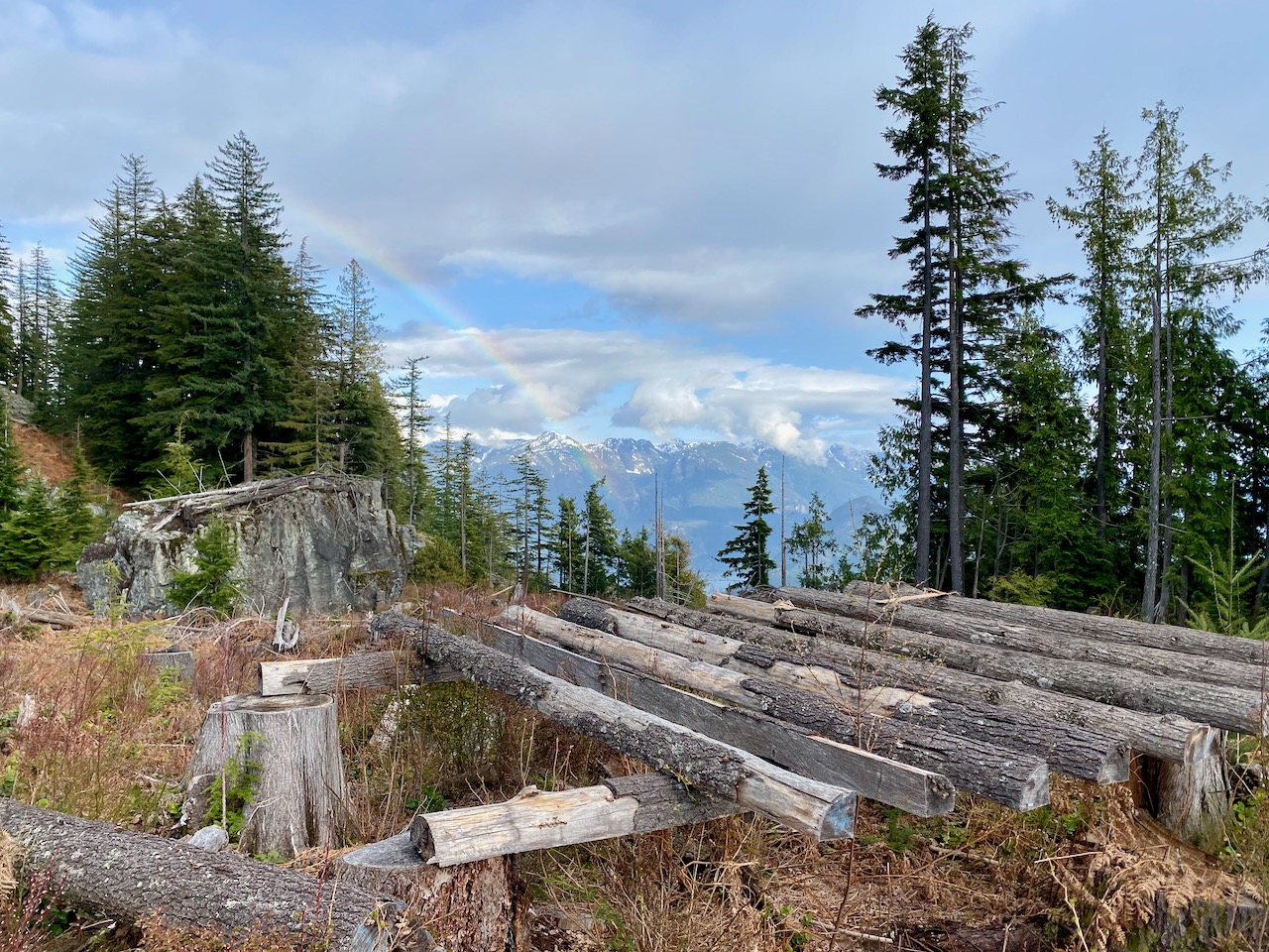
Light rain fell for most of the plod. When I’d gained some altitude, the clouds cleared, revealing some views across Howe Sound to the North Shore mountains.
When I planned this trip, it seemed like the least steep route would involve leaving the FSR at 650 metres. However, a large cliff band blocked my progress almost immediately after leaving the road. I navigated through some thick bushes to reach a precarious boulder field, which took me around the cliffs. (I found a better route on the way down.)
Eventually, I reached the base of another cliff. I looked for a bypass to the west and ended up in a relatively recent cutblock. There was a wooden helicopter pad there, likely used to fly in tree planters. The views of Howe Sound were quite nice. Above the cutblock, yet another cliff band loomed, but this time there was an obvious weakness, allowing access to the forest above with only some class 2 scrambling.
From there, the forest was surprisingly open, and travel became easier. I found a few pink flag markers along a creek at one point, but they faded out after a few metres.
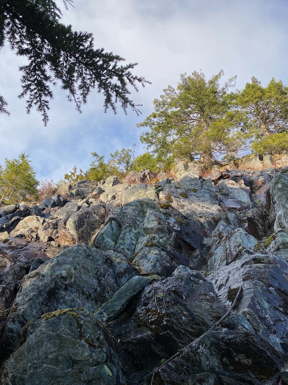
At 1,050 metres, there was one final cliff to navigate, guarded by a ring of dense alders. Once again, I found a weakness in the rock and reached the top via some class 3 scrambling over wet, mossy stones.
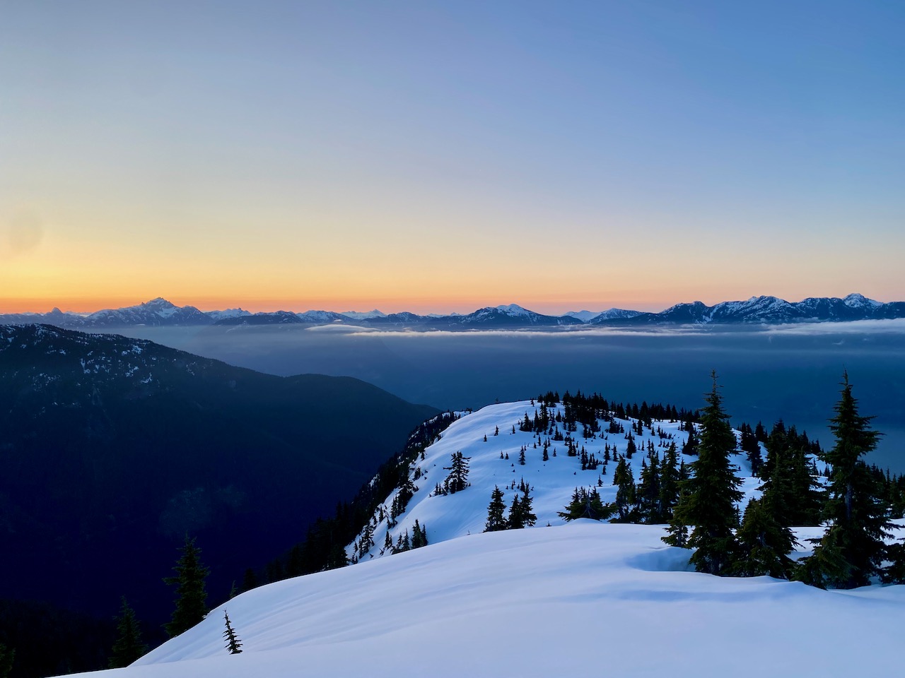
I had finally reached the subalpine zone, and the snowshoes went back on. After a bit more ascending, the trees began to thin, and some views could be seen through the mist. I traversed around a false summit and found myself on a bench at 1350m. Sunset approached so I set up camp here.


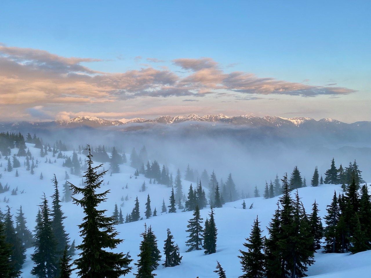
I woke up around 5:30am and began the ascent, stopping to admire the sunrise.

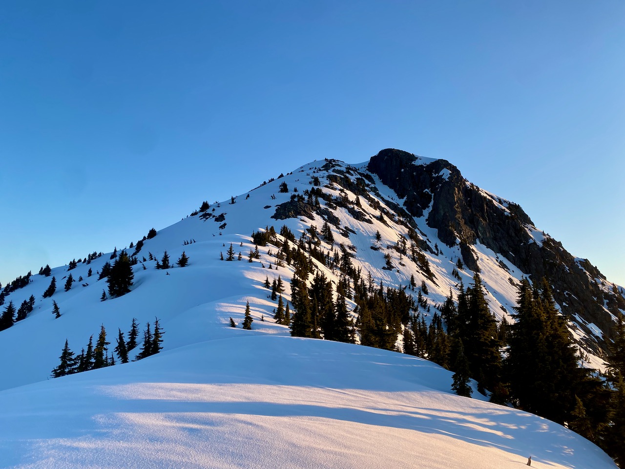
Past 1400m there were some surprisingly steep sections for such a dome-shaped mountain. The steepest part was about 50 vertical metres between 1450 and 1500m, which rose at around 35 to 40 degrees with a gully far below. Not quite a no-fall zone, but if you didn’t self-arrest in time, things would not end well. Crampons and an ice axe were needed here. This would probably be an easy class 2 scramble in the summer.
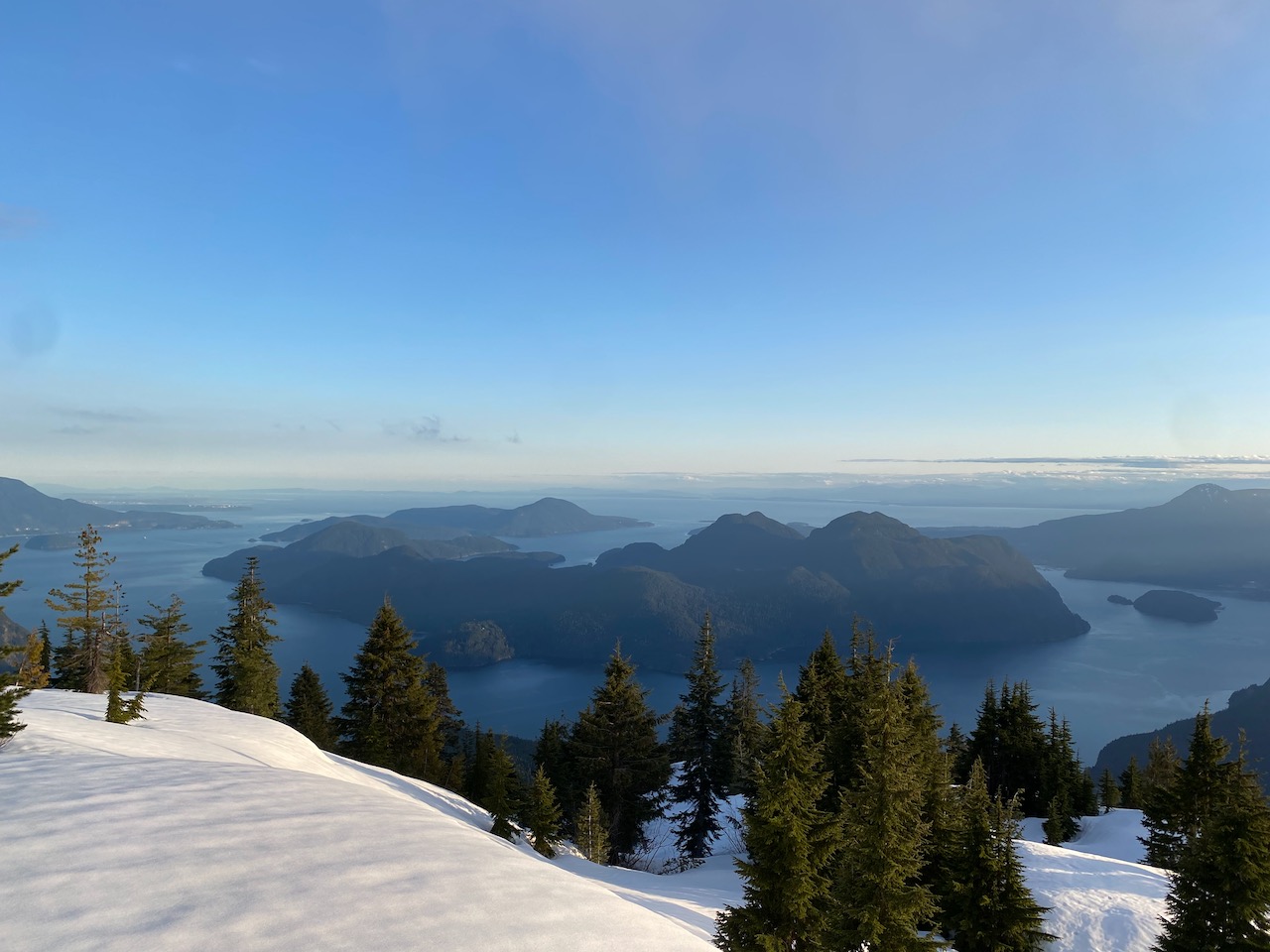
I was well above treeline at this point and the views were excellent. I had a bird’s eye view of the Howe Sound Islands, shrouded in wisps of fog. Across the fjord were the familiar Howe Sound Crest peaks at a completely unfamiliar angle. Garibaldi and Tantalus made appearances.


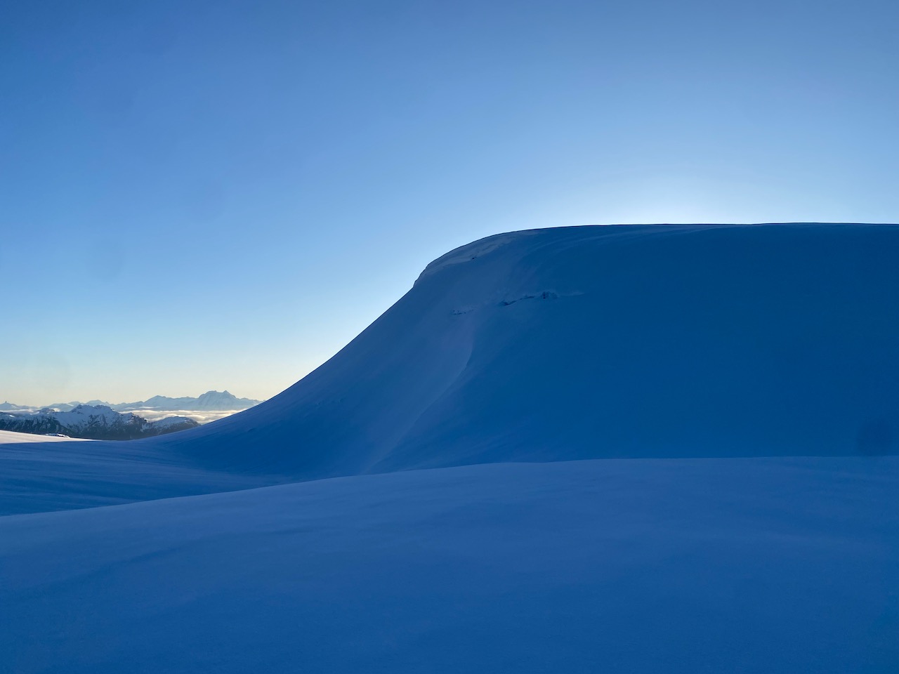
Eventually I reached the summit, a large, relatively flat area. Here there were new views north to Squamish and west to the more remote reaches of the Lower Sunshine Coast.


It was going to be a warm day so I didn’t want to linger. As I descended, the clouds cleared completely, revealing UBC, Point Grey, and Tsawwassen behind the islands. It’s a surreal feeling, seeing a major city in the distance while still feeling like you’re in the absolute middle of nowhere.


I packed up my camp and had breakfast while taking one last glance at the scenery. I could see Box Canyon Pass far, far away.
The highest cliff band was icy but manageable. I quickly reached the cutblock. I wasn’t looking forward to descending the boulder field, so I found a usable route from the southeastern corner of the block to another cutblock. Deadfall and thorny bushes abounded here.

After some searching, I found a faint elk trail heading west from the southwestern corner of this lower cutblock. This led me above some bluffs to a slope gentle enough to let me descend. I emerged onto an alder-filled but still navigable FSR which soon reached the original FSR. This route will get quite nasty in a decade or so once the replanted trees grow back (or maybe not; the density didn’t seem that high).
Another FSR plod began. All around me, grouse constantly made “whump-whump-whump” sounds. Through the trees I saw glimpses of the mountains to the west of McNab Creek, especially the McNab Lions. Once on the west side of McNab Creek, Wrottesley could be seen.

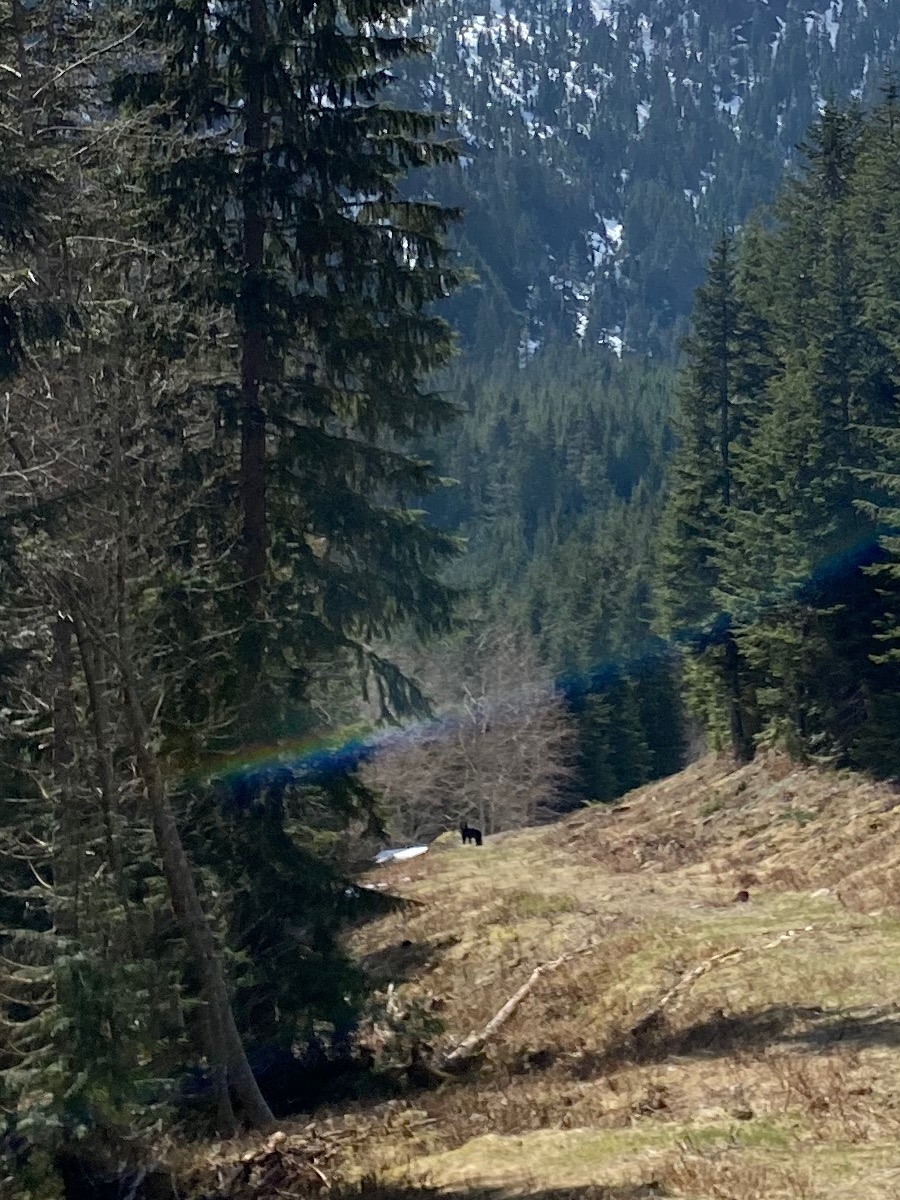
At one point I saw something that was the size, shape, and colour of a cougar, but upon further inspection turned out to be a large orange rock from one of the abandoned quarries. Another time, I heard a large animal in the forest, and looked up to see a massive herd of elk running across the road. Near the snowline my way was blocked by a bear, but I made my presence known with a firm voice and it moved out of the way. The final climb up the pipeline route was tedious, and the soft snow didn’t help, but I eventually made it to the pass.
I took a quick detour to Box Canyon Peak, the peak to the north of the pass. Francis Bailey’s trip report was useful here. The summit of the peak is a wide, treed plateau, but it offers surprisingly good viewpoints in several directions, especially into the Rainy River Valley. Panther, Tetrahedron, and Rainy Peaks towered over the scene. This would be a nice ski touring destination earlier in the season when the creek crossings on the FSR are covered.


At this point I realized I might make the 6:40pm ferry if I hustled. I snowshoe-skied down the pipeline swath, wishing I had my actual skis, then jogged down the FSR. At one point I was passed by a family in a Jeep, surprisingly enough. Once at the car, the drive to Port Mellon and the discussion with the gatekeeper went by quickly. I was passed by several cars going at very high speeds, clearly in the same boat as me (literally). I arrived just in time to miss the 6:40 ferry, but was able to board another one less than an hour later.
Would I recommend Wrottesley? There’s no denying that it’s a bit of a slog. However, in my opinion the completely new perspective on familiar places made the adventure worth it.
(This report was also posted to my website: https://adventuresinelevation.com/wrottesley/)
Great adventure! I appreciate the new perspectives on familiar places.