** Brief aside about the TR title: Too much “in-doctor-nation” (pre-medical and medical schooling) has conditioned my mind to only think “SURGE” after LH… Since waters can surge just like hormones, and we completed this trip relatively quickly, I thought the title was doubly fitting. No more thought was put into this title. All trip participants were male.**
Trip Participants: Michal Rosworski, Nicholas Gobin, Olek Splawinski, Skyler DesRoches
2017/18 was a great snow year in the Coast Mountains.
Early in March, Michal started scheming a late April ski traverse. He quickly convinced Nick and I to commit to the week of April 21-27. He even convinced Skyler to fly over from Calgary to join us.
Choosing a destination was our first crux. We entertained ideas of a Hurley Horseshoe traverse, skiing in Vayu Pass, and even a Bugaboos to Rogers traverse. We had trouble deciding between “traverse mode” or “steep skiing/ peak bagging mode”.
Exceedingly hot temperatures, and a blue-bird forecast beckoned us to choose “traverse mode”. We opted for our self-proclaimed “ambitious” option: a traverse of the Lillooet headwaters, starting at Salal Creek. John Baldwin’s guidebook calls for 14 days. We had 6.5.
Hydro workers gave us confirmation that the Upper Lillooet FSR was plowed and drivable to km 49. They requested that we not park in the km 49 turning circle, since large machinery needed the space to turn.
Day 1: Lilooet FSR to Salal Creek.
(Saturday, April 21)
An afternoon drive up the Upper Lillooet FSR was punctuated by a black bear sighting, as well as the first division between “older and younger” millennials.
A sign on the road marked the indefinite closure of keyhole hotsprings, due to bear activity. Persistent human traffic, and untidy campsites have habituated bears to the area. The main culprits are undoubtedly, millennials: the generation of people born between ~1981 and 1996. This generation are purported to display traits of confidence and tolerance. They are also notorious for possessing a strong sense of self-entitlement and narcissism (Wikipedia).
All of the trip participants were born into the millennial generation. However, the “older millennials” claimed that “younger millennials” were the bulk of the problem. As the only trip participant who was born into the 1990’s, I was part of the worse half of millenials.
We kept driving. There was very little snow along the road until ~km 43. Almost instantaneously afterwards there were ~2m snowbanks. The dirt road was pristinely graded, even 2wd low clearance friendly.
Around km 46, we passed an unplowed FSR branch towards Salal Creek. We parked outside the independent power plant (IPP) intake at ~ km 49.
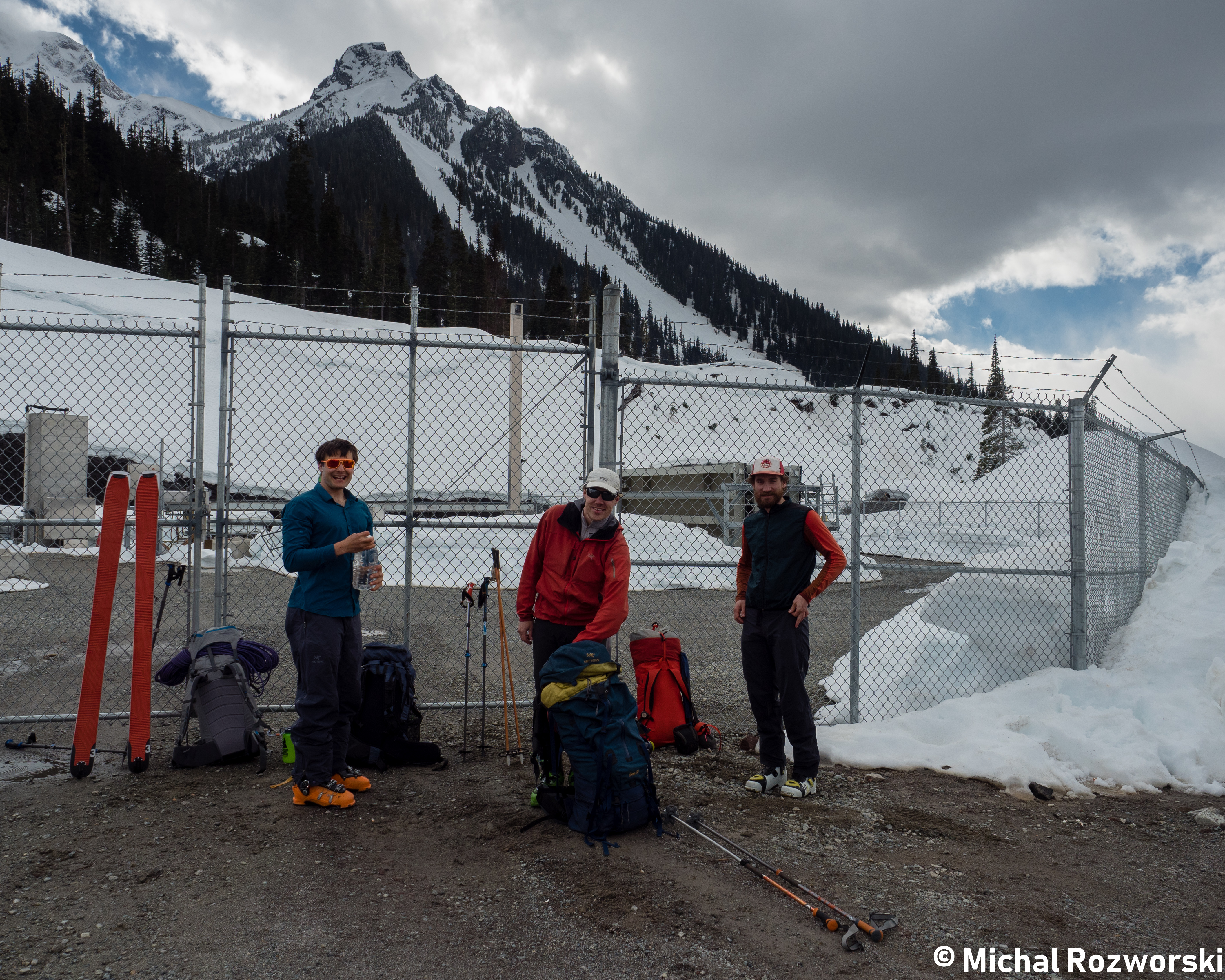
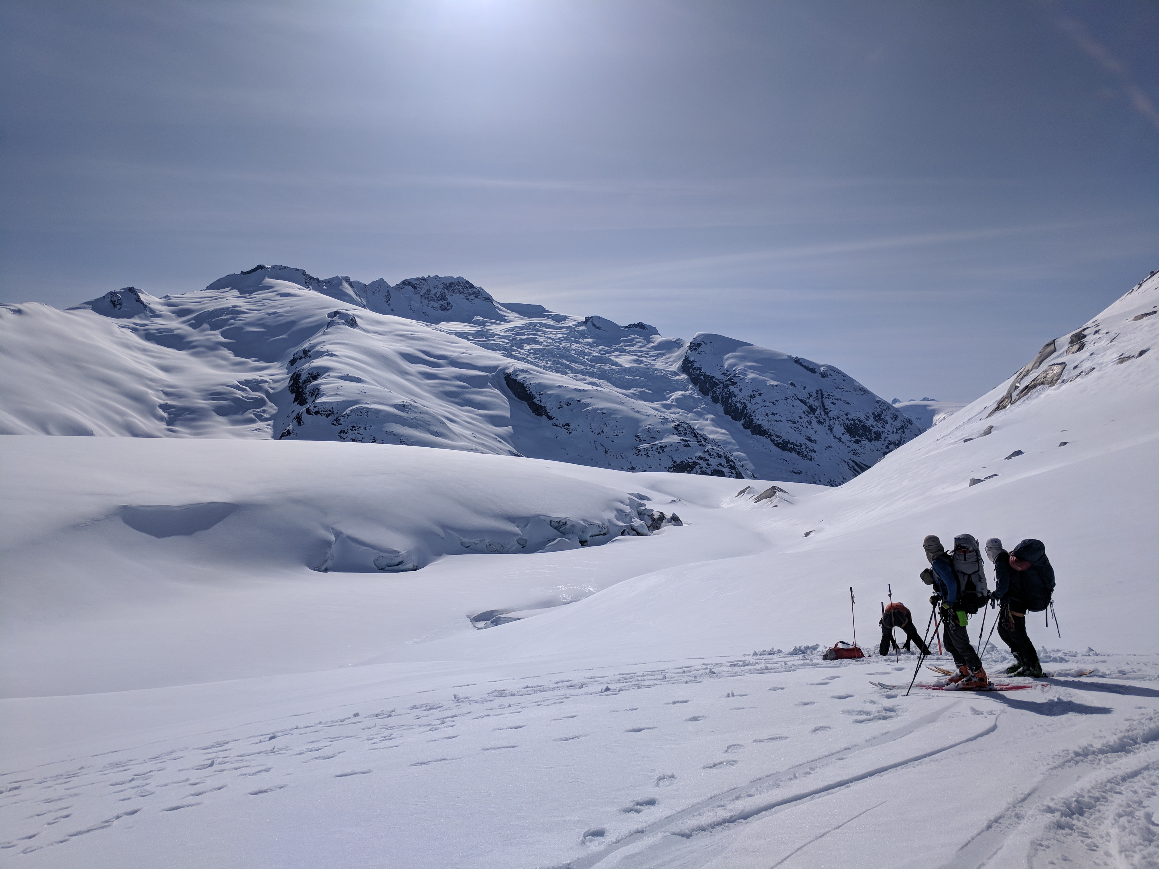
Olek, Nick and Skyler. Getting ready to traverse the Lillooet Headwaters. Photo: Michal Rozworski
With fully laden 6.5-day packs we retraced the road, back towards the Salal Creek spur. We scolded ourselves for lacking the presence of mind to drop off our stuff at km 46.
Nick discovered that a bolt was missing from the top buckle of his Dynafit Vulcan ski boots, rendering downhill mode useless. Fortunately, Skyler pointed out that Nick could rob a bolt from one of the boot’s power-strap attachment points. — With only uphill travel in the 24 hour horizon, we postponed boot-surgery for later.
Discussion about power-straps revealed that Skyler didn’t have any on his Dynafit TLT-5 boots. He had deemed them “not worth their weight,” and removed them. The rest of the party were power-strap proponents.
Slushy skinning proceeded without incident. At dusk, we stopped. We set up camp before reaching Salal Creek.
Just after we had set up our tents, a curious combination of hooting noises serenaded us. Two owls mating; that was our best explanation.
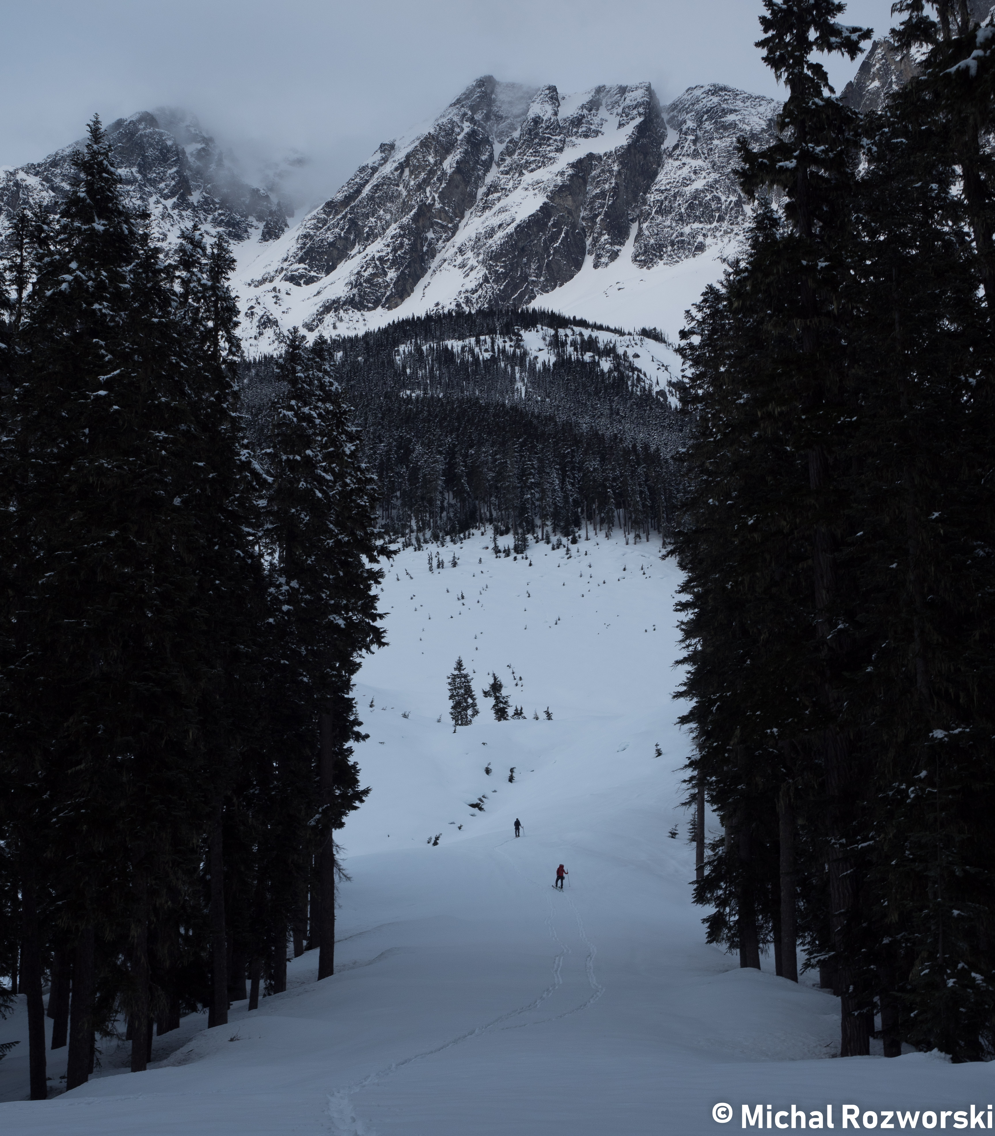
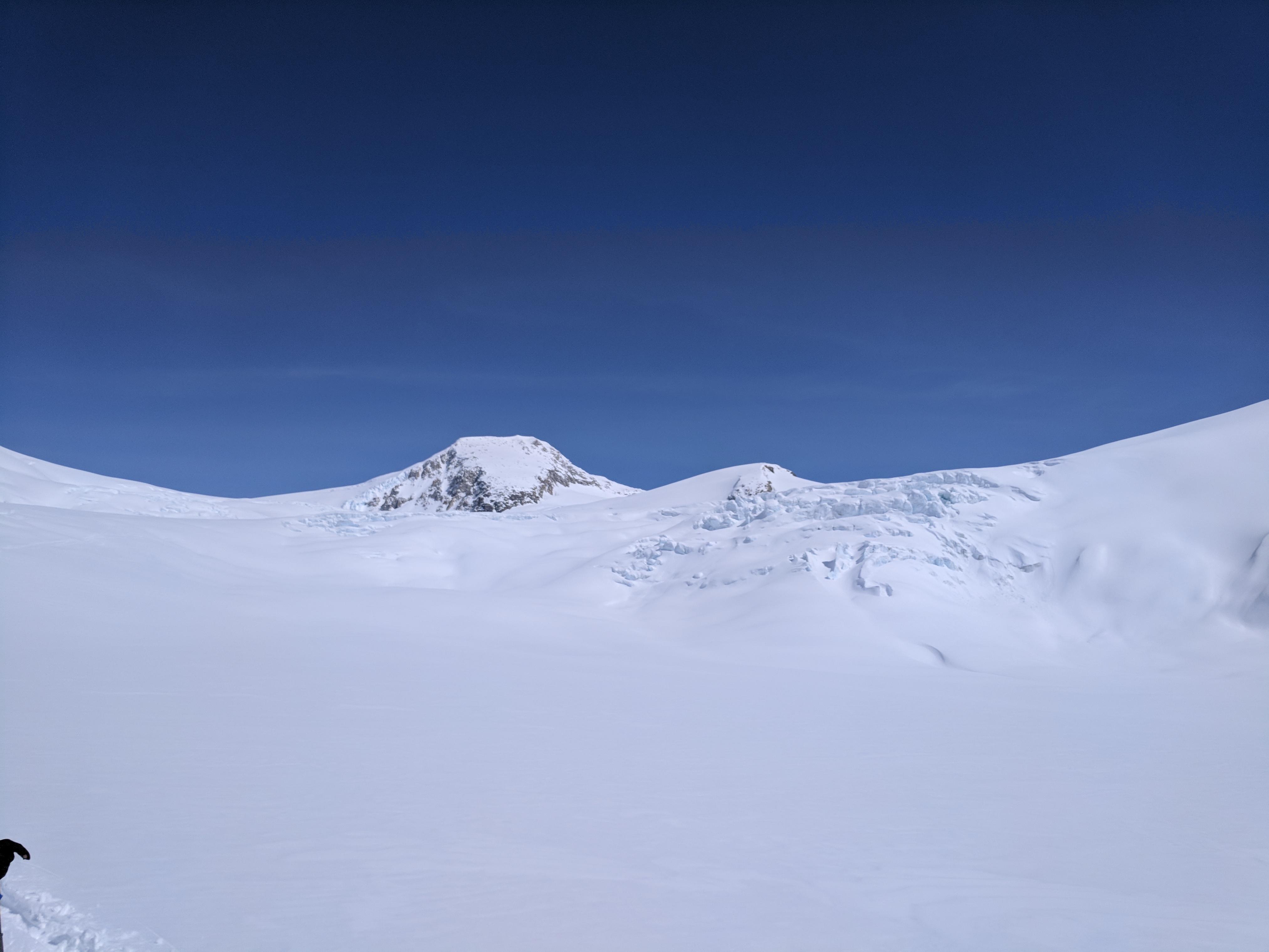
Down into the Salal valley, Athelstan up ahead.
Photo: Michal Rosworski
Day 2: Salal Creek to Bridge Glacier.
(Sunday, April 22)
5am. Designated alarm clock (myself), woke the team. My optimistic alarm tone, the “Arthur” theme song, fell on to deaf ears. The “older millennials” didn’t recognize the tune. They were also nowhere near as keen to wake up as I was.
Most of the day was spent skinning up Salal Creek. We travelled directly beside the creek until travel became easier along the Eastern slope. In the alpine, we returned to following the snowy creek bed.
Michal’s meal from the previous night provided musical accompaniment, and a small amount of propulsion.
After 1.5 days of uphill travel, we finally made a short descent on to the Bridge Glacier. Nick’s Dynafit Vulcan boot buckle still needed to be fixed. -Power strap to buckle- bolt-transplant surgery was successful. Nick was well equipped for the gentle downhill cruise.
We set up camp on a windy col along the Bridge Glacier.
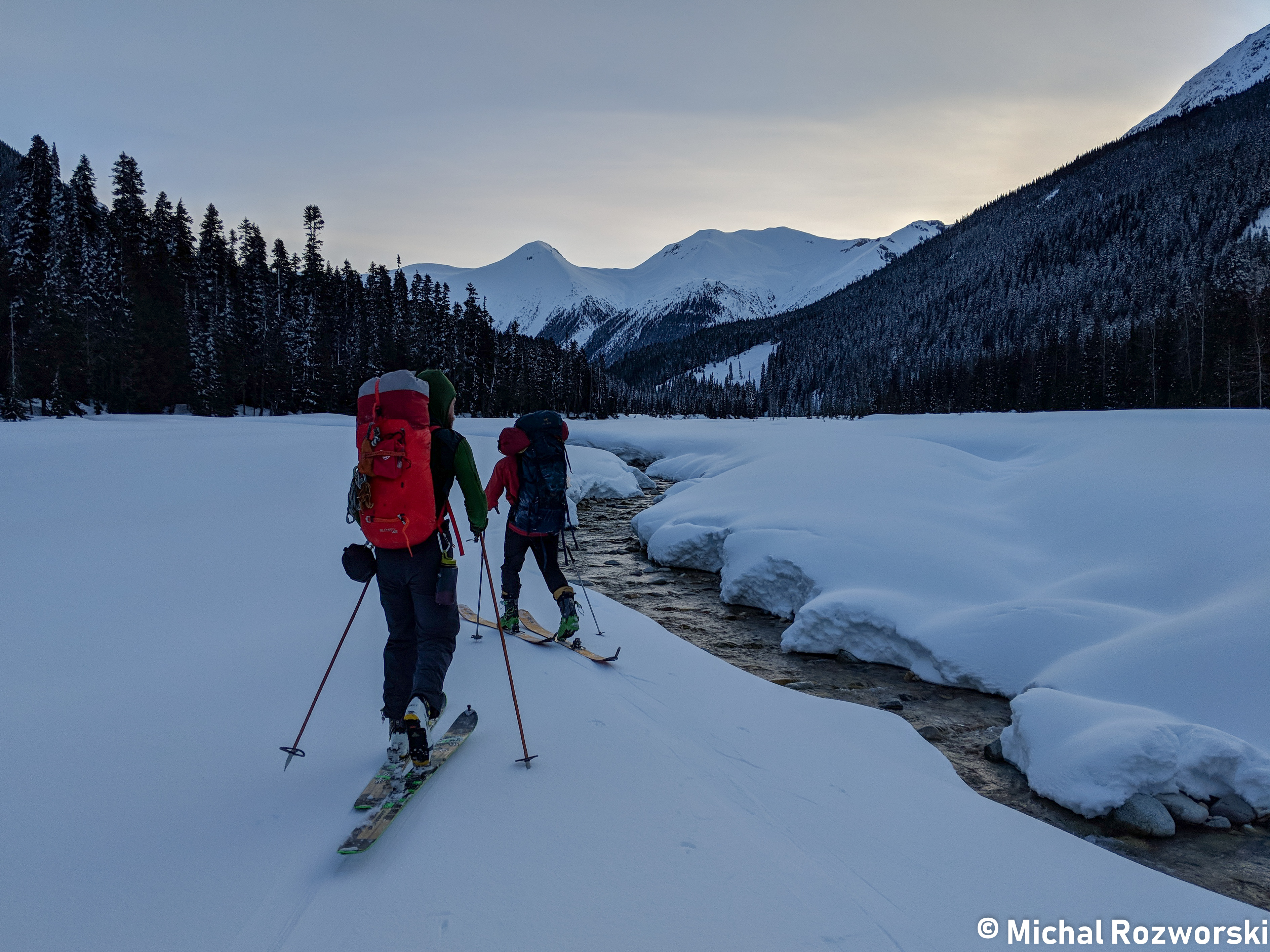
Nick and Skyler, skinning beside Salal Creek. Photo: Michal Rosworski
Continuing up the snowed over bed of Salal Creek. En route to the Bridge Glacier. Photo: Michal Rosworski
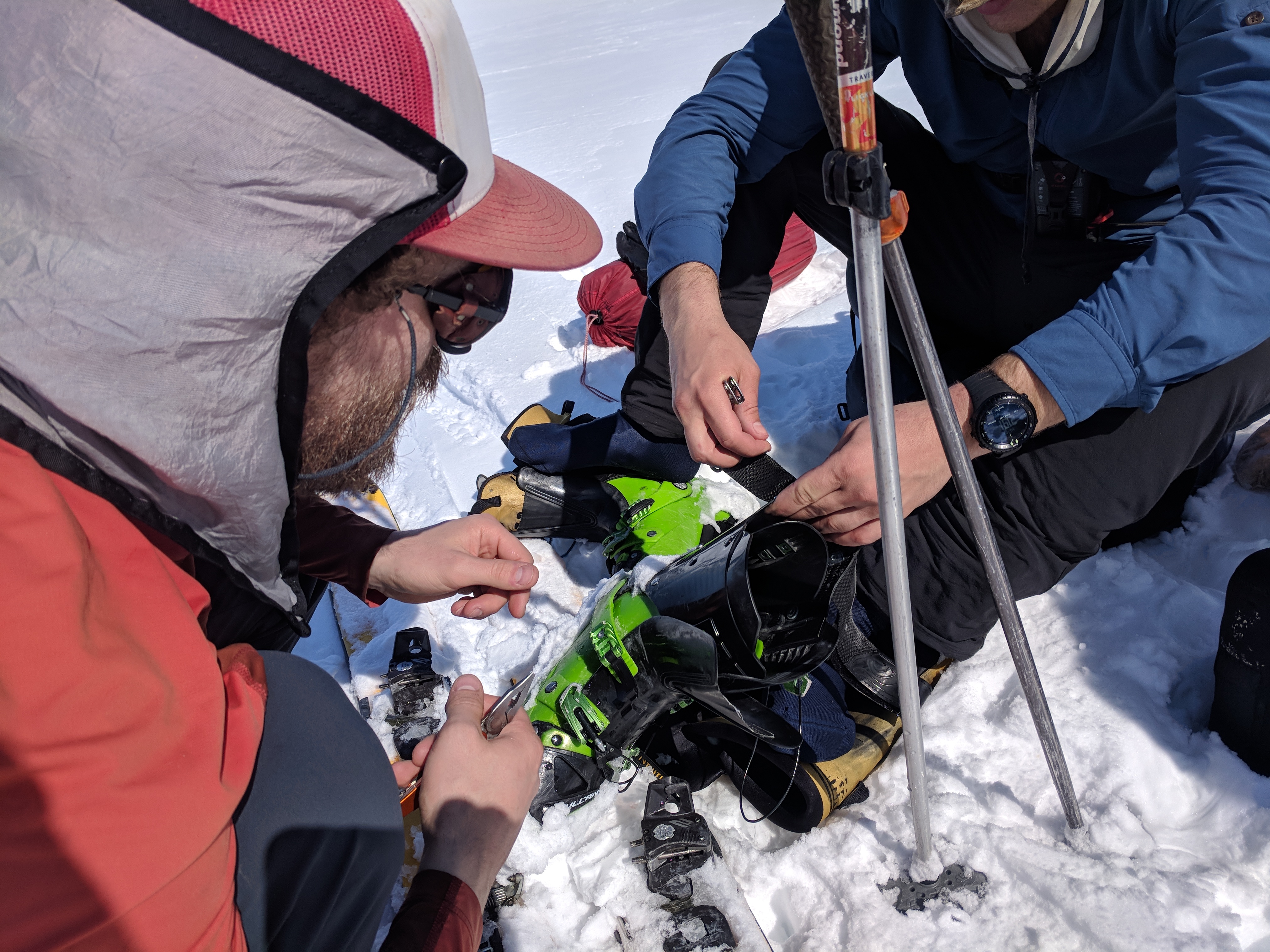
Skyler and Nick perform a bit of boot surgery to repair a detached upper buckle. Photo: Olek Splawinski
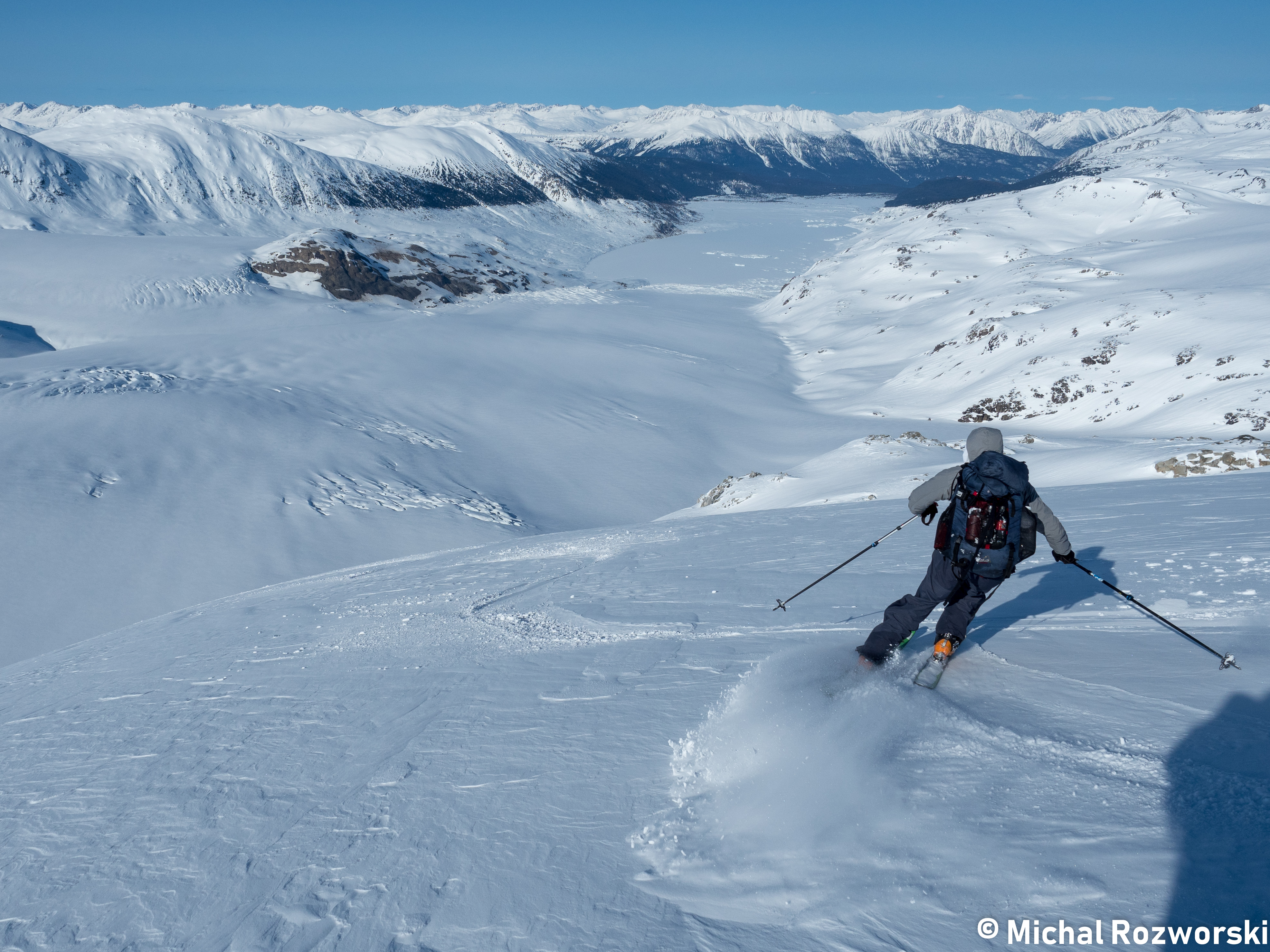
Olek skiing down the Bridge Glacier. The lake below the glacier is a recent climate change creation. We dubbed it: “Troubled Water Lake”
Day 3: Bridge Glacier to Lillooet Glacier
(Monday, April 23)
5am. Designated alarm clock (myself) tried to wake team. It was surprisingly cold. My water bottle had ice in it. Alarm postponed by 30 minutes. 5:30am became the new trip-standard wakeup time.
Lots of skiing. Lots of receding glaciers. Moraines ~500m above the level of the Bridge Glacier testified to a snowier past.
Recession of the Bridge Glacier has led to the creation of a whole new lake at one of its outlets. So new, that hasn’t been named. It is known simply as “Bridge Terminal Lake”. We proposed a new name for it: “Troubled Water Lake” – A testament to climate change, and a reference to the Simon and Garfunkel song: “Bridge Over Troubled Water”.
Despite the shrinkage, these glaciers were the largest that Skyler or I had ever skied on.
Around this time, Skyler expressed having some pain in his ankle. We were suspicious that this might be due to his “Bootstrap-Free” philosophy.
We made a wise choice on the descent into Ring Glacier. We opted to stay far right on gentle terrain, rather than weave through crevasses and steeper slopes to the left.
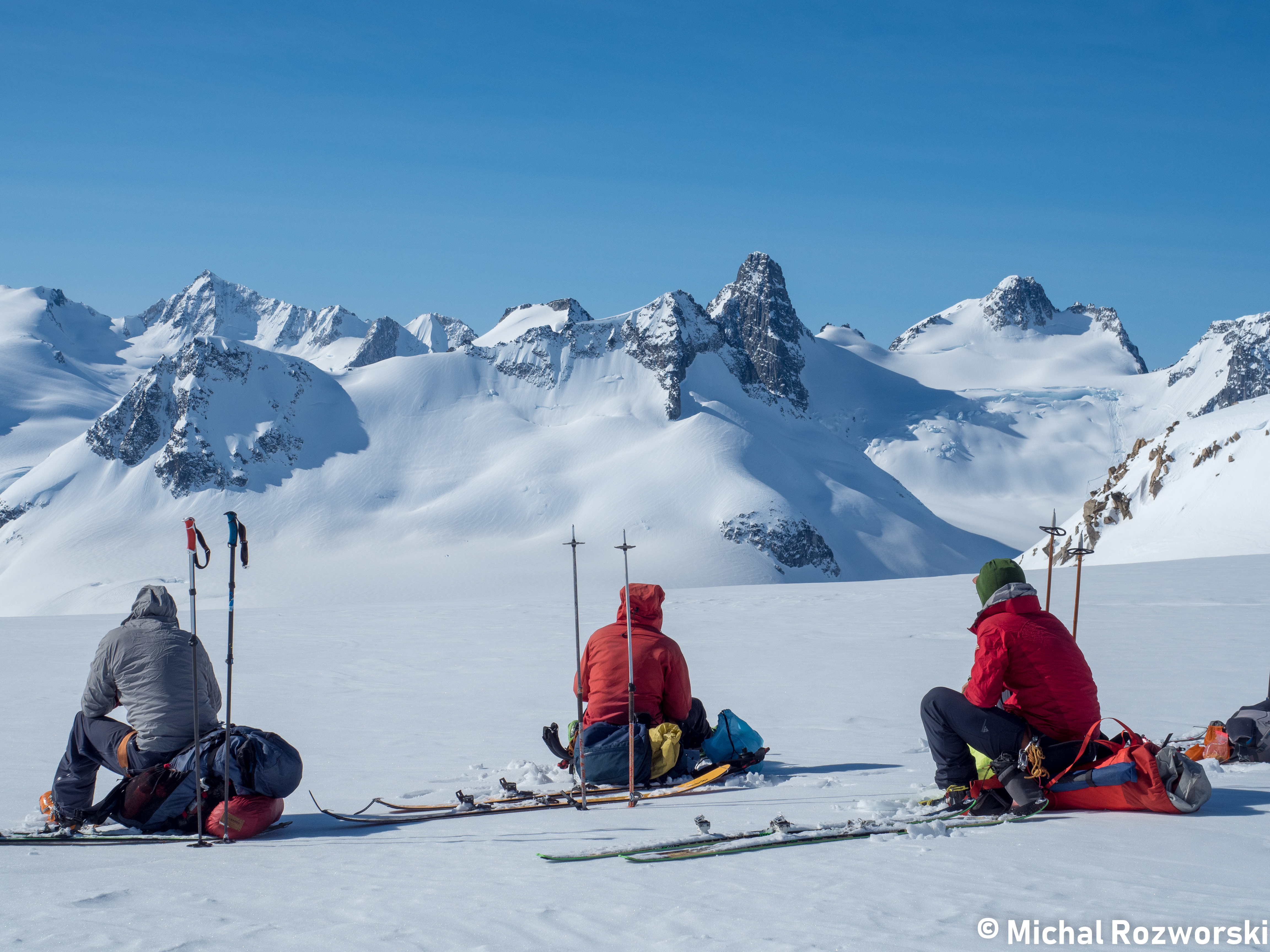
Each day was getting significantly hotter. We had our first extended lunch break/siesta below the Ring Glacier, before getting simmered by radiated and reflected sun rays.
As we skied off the Ring Glacier and on to the Lillooet Glacier, we saw the first evidence of human activity. 2 helicopter flagging poles and many footprints marked the location of a recently deposited food cache. Unfortunately, we didn’t have a pen to leave a note in the food cache. We wondered where the other party was planning to traverse.
Close to the food cache, and just below the Lillooet Glacier, we found running water. We decided to cook an early dinner at 5:30pm.
After dinner, pleasant sunset skinning took us to the base of Lillooet Mountain. A spectacular north face, replete with ice. The best campsite of the trip. We excavated an impressive snow fortress. ~1.5m walls encircled both tents.
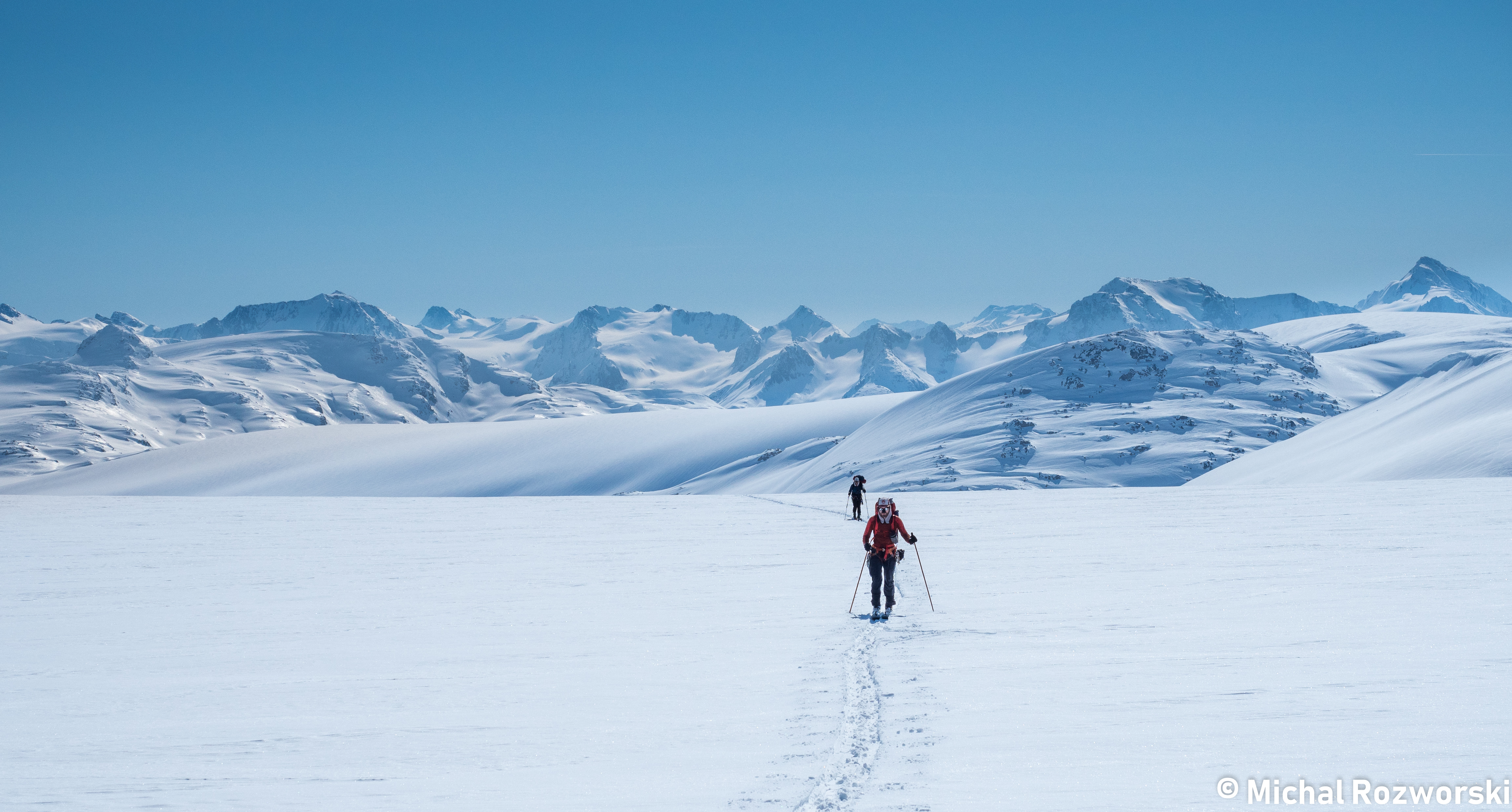
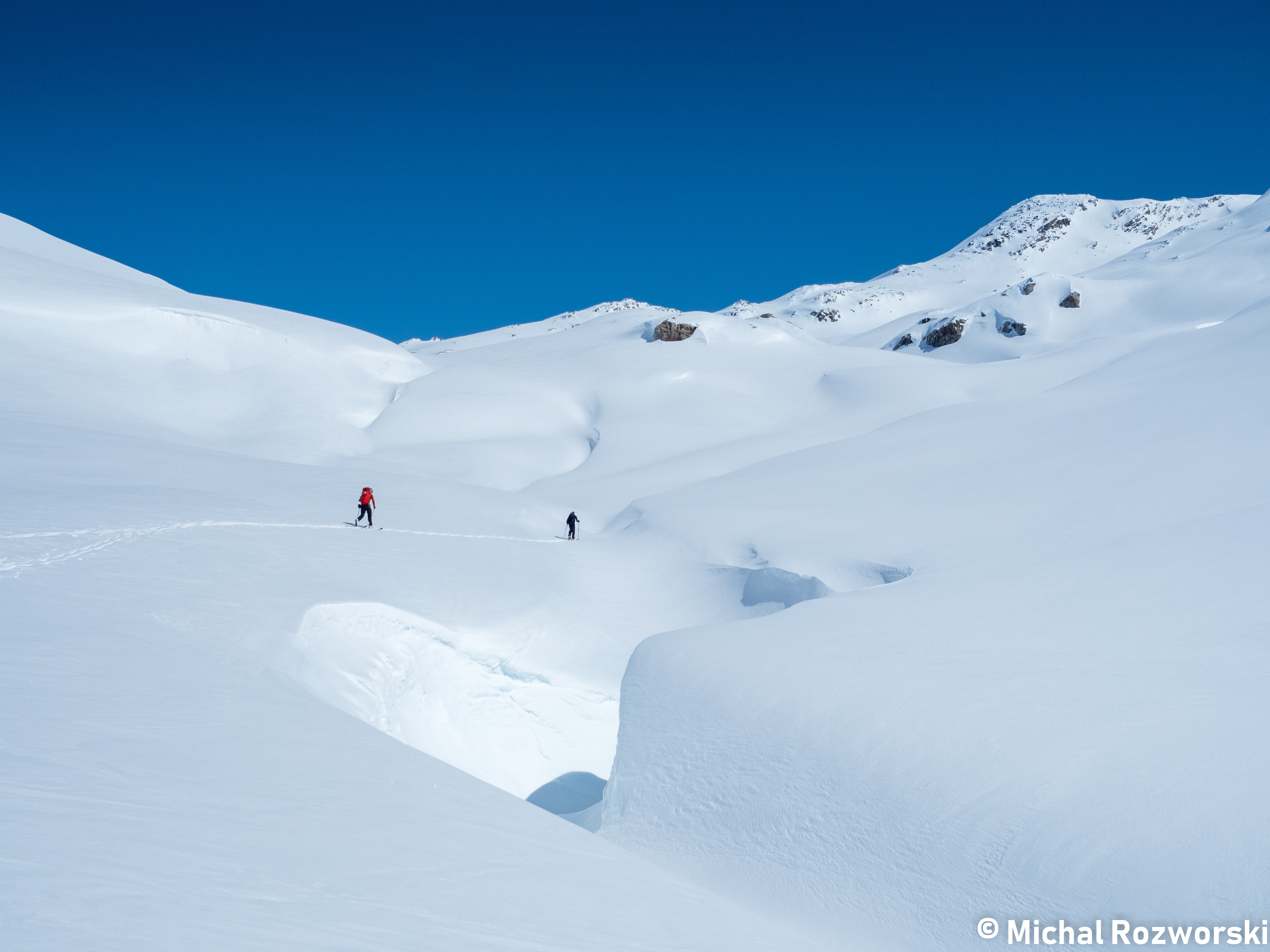
Skyler in the foreground. The vast expanse of the Bridge Glacier behind. Photo: Michal Rosworski
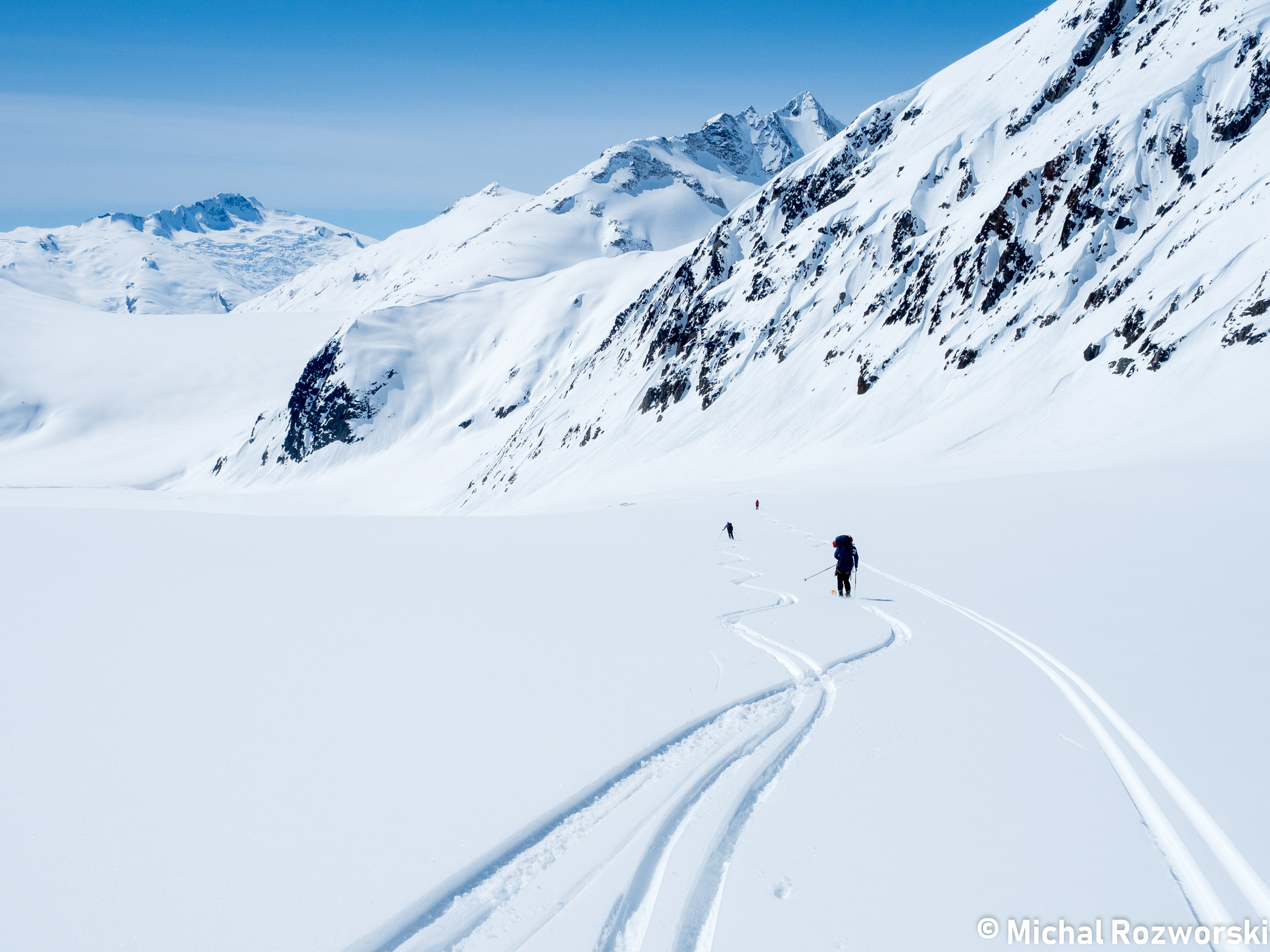
Skiing down to the Ring Glacier. We wisely chose to keep right. Photo: Michal Rosworski
The steep snow slope and crevasses that we avoided by staying on skier’s right. Photo: Olek Splawinski
Human Activity! Skyler inspects a food cache. Michal and Nick observe. Photo: Olek Splawinski
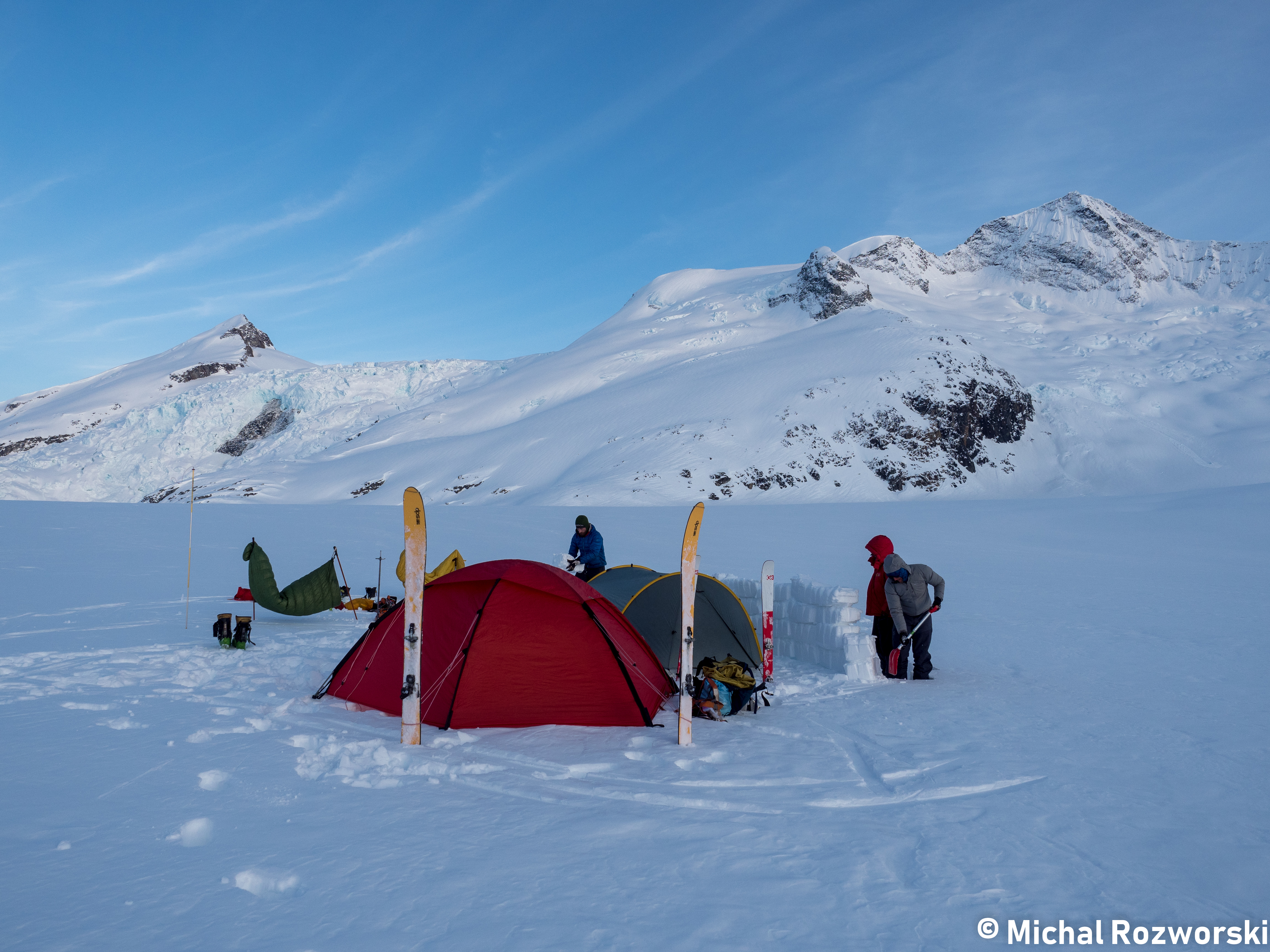
Building a snow fortress, and drying a couple sleeping bags. Impressive icefall, and north face of Lillooet Mountian behind. Photo: Michal Rosworski
Day 4: Lillooet Glacier past Mu peak to a low col between Mu and Obelia
(Tuesday, April 24)
5:30am wakeup. Efficient skinning around Lillooet peak.
Still early in the morning, we decided to summit Lillooet Mountain. We dropped our food/overnight gear at the base of the south slope. Unburdened, we surprised ourselves with our rate of ascent. 400m of climbing to the summit was accomplished in under an hour. We reached the summit before noon.
No bootpacking was necessary to reach the summit block. It was nonetheless, very impressive. Extremely exposed on 3 sides, with beautiful views of the Lillooet Icefield, Toba Icefield, and many mountains, including BC’s tallest, Mount Waddington.
Some fun spring turns down Lillooet were followed by a leisurely lunch break.
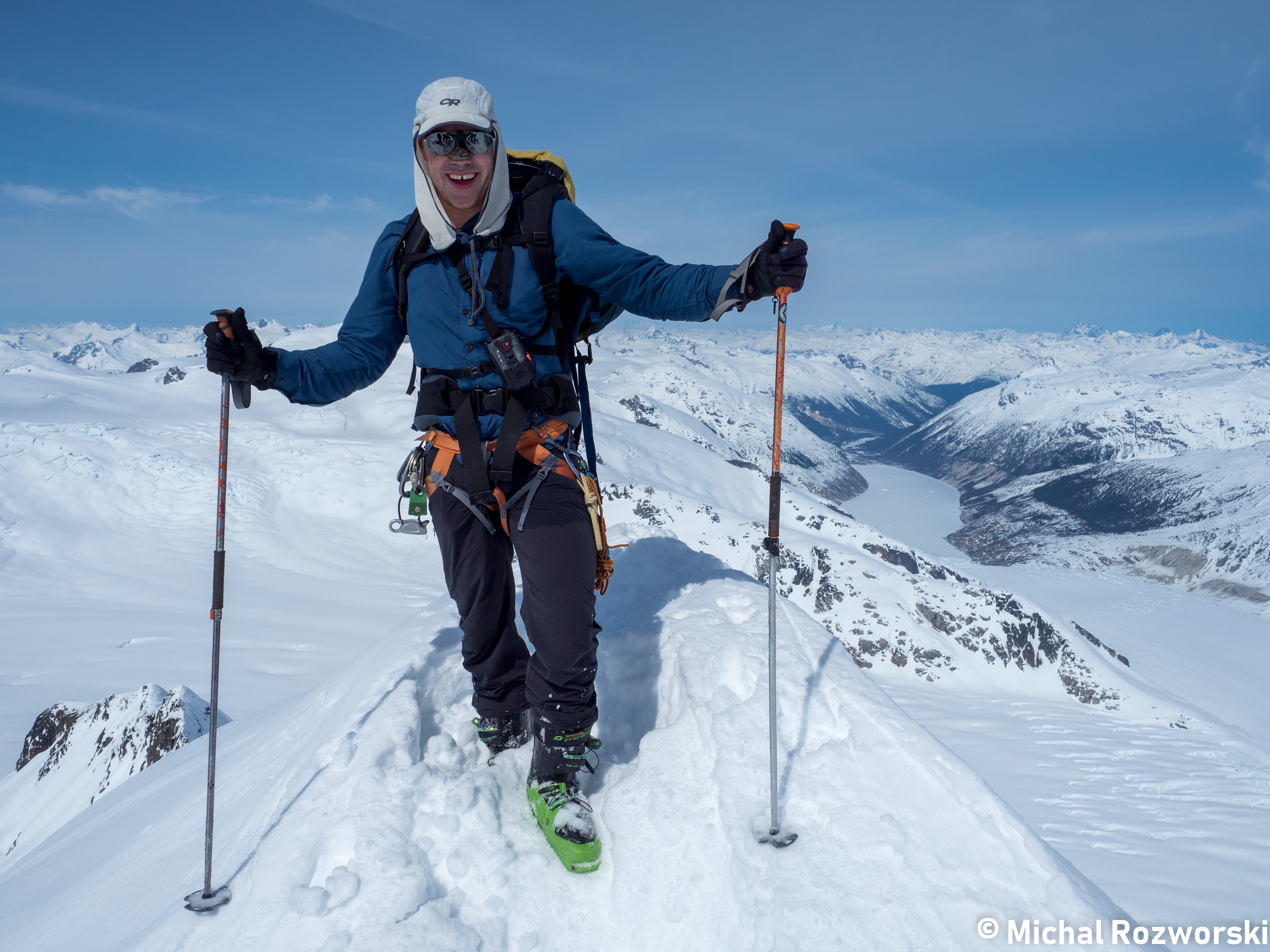
Nick on the summit of Lillooet Mountain. The “scalp” of the headwaters. Photo: Michal Rosworski
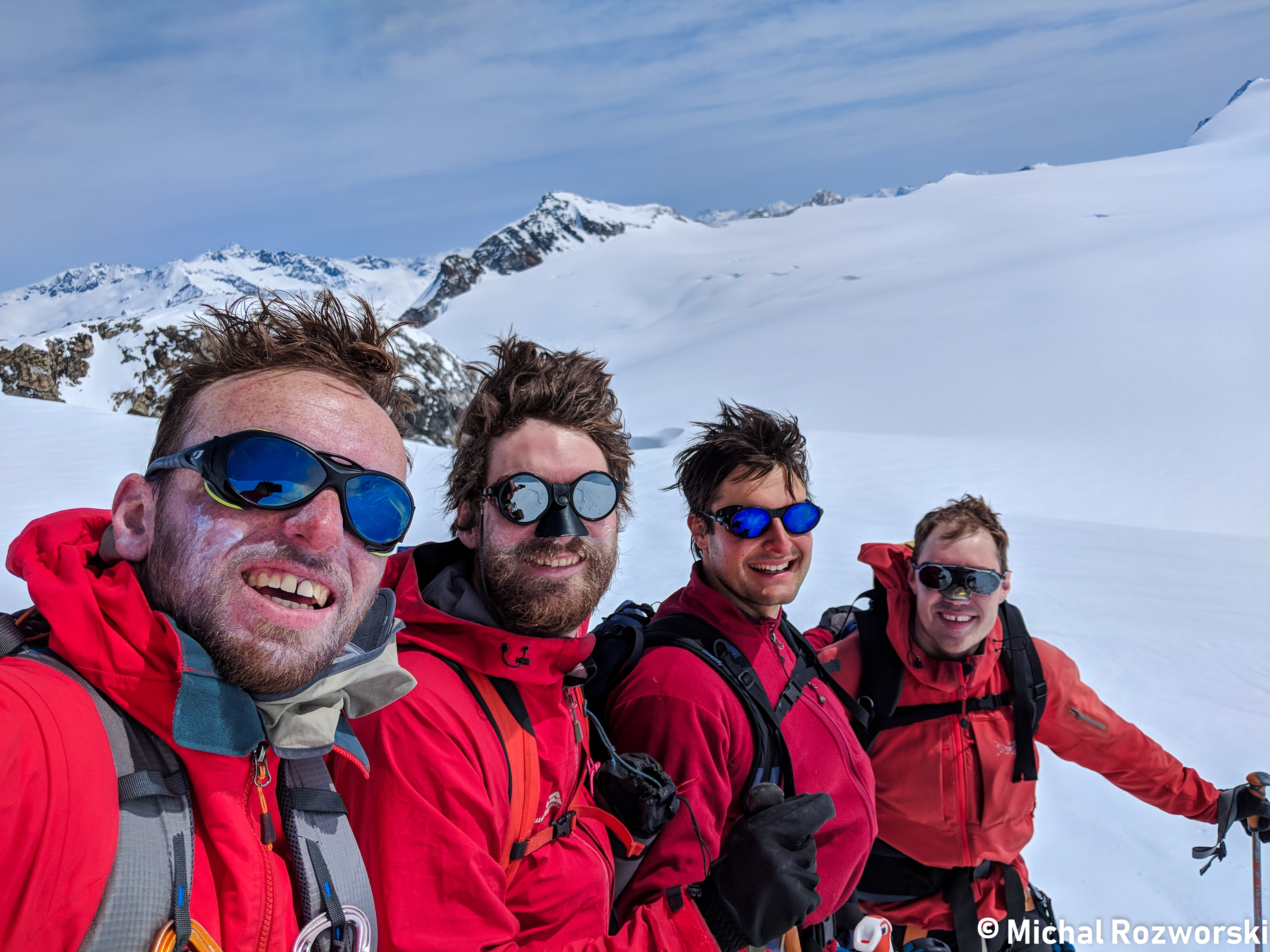
Team red team showing off their bad hair on the way off of Lillooet Mountain. Photo: Michal Rosworski
Conditions were cooler than expected. Only about 3-5cm of snow was isothermal. We reached Mu peak and decided conditions were stable enough to descend the col. It was about 5pm, and a crust was already forming. Nick and I skied directly off the col, while Michal and Skyler boot-packed down a short section.
Below Mu peak, is an extended, exposed, ridgeline traverse. Most of the sidehill traversing required is moderate, <30 degrees. Never the less, this portion of the trip is definitely a “no fall” zone. We locked our Dynafit toe-pieces. A lost ski would be tragic. It would likely not stop for another 1000m until it reached valley bottom.
The views of the Manatee range were stellar. Especially the imposing rock face of Wahoo Tower. Having been to the area in the summer, it was familiar sight for me.
We made camp at the first of two major cols along the ridge between Mu and Obelia peak. Once again, a large snow palace was excavated. This one included a kitchen platform, with a gorgeous view of the sunset.
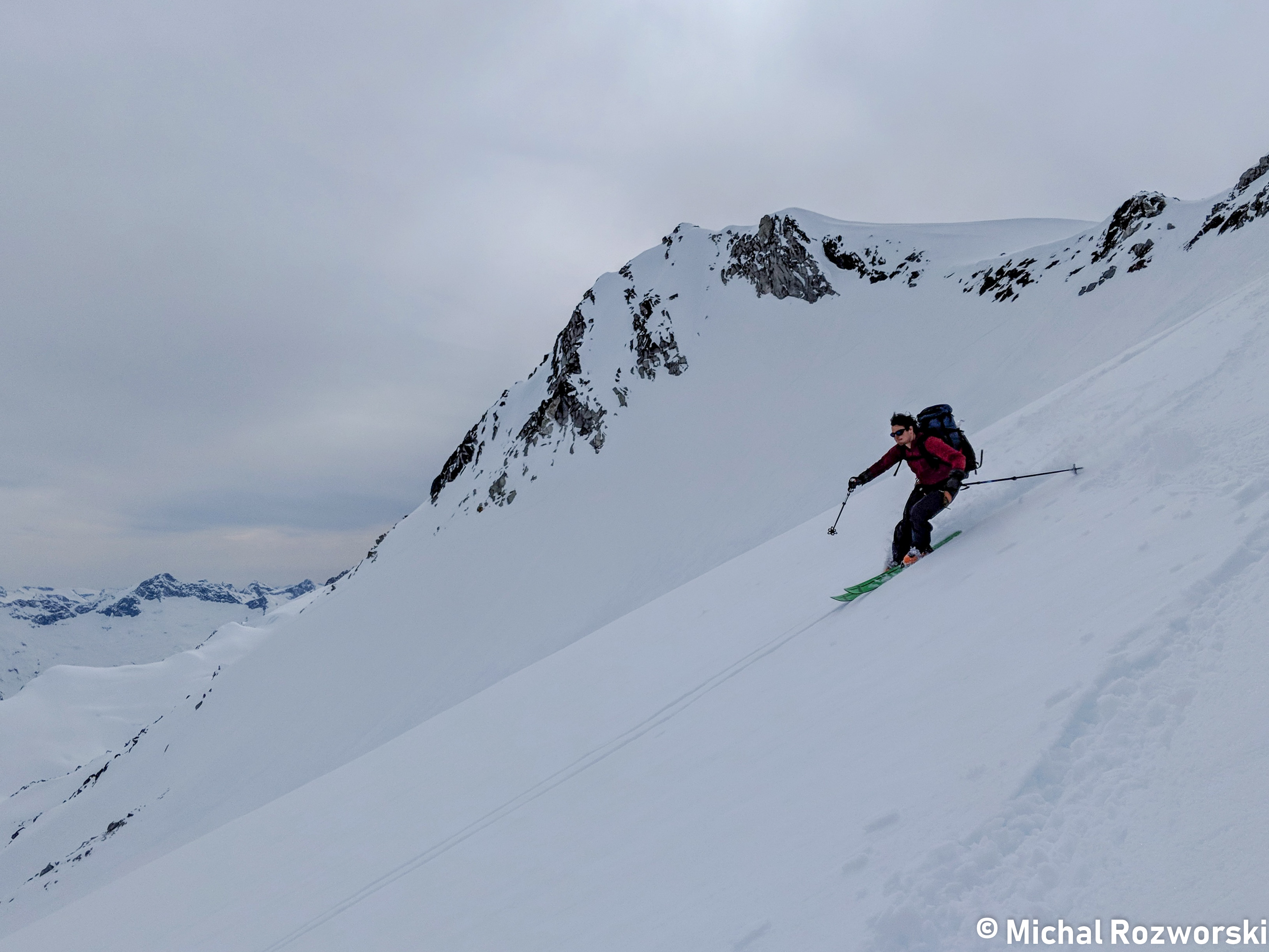
Olek skiing the exposed traverse down from the Mu peak col. Our route descended the snow gulley in the top right corner of the photo. Photo: Michal Rosworski
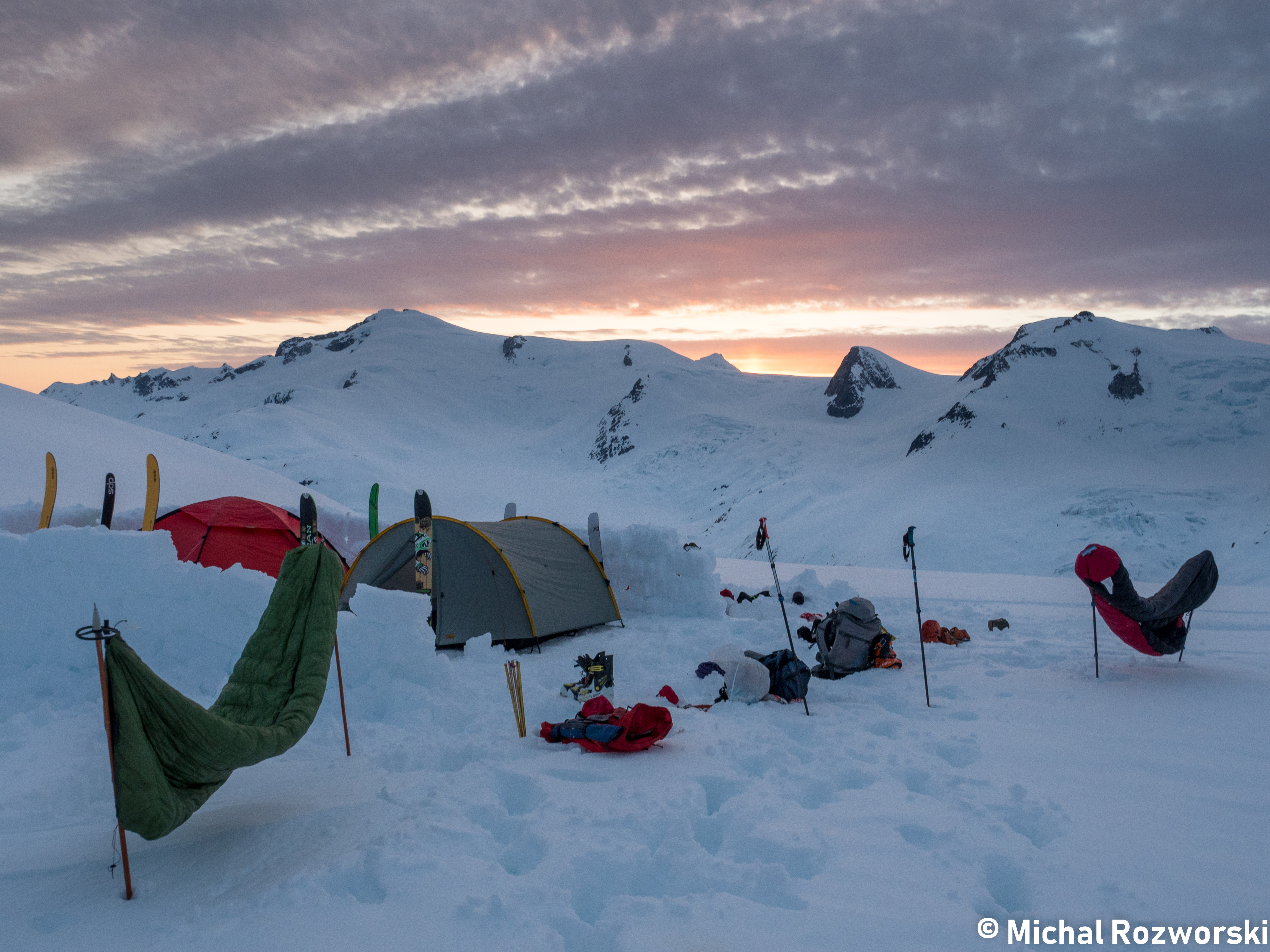
Another stellar campsite along the ridge between Mu and Obelia Peak. Photo: Michal Rosworski
Day 5 : Mu Obelia Col to Lillooet FSR
(Wednesday, April 25)
Another 5:30am start. Bluebird weather for the 4th consecutive morning. A warmer night than the previous two. We quickly reached the col below Obelia peak and had a tough decision to make. Not a dilemma though. Both of the options were good ones. We could stick to our original route and likely complete the traverse 2 days early. Alternatively, we could exploit the good weather and detour into the Manatee range. We still had 2 extra days of food and fuel.
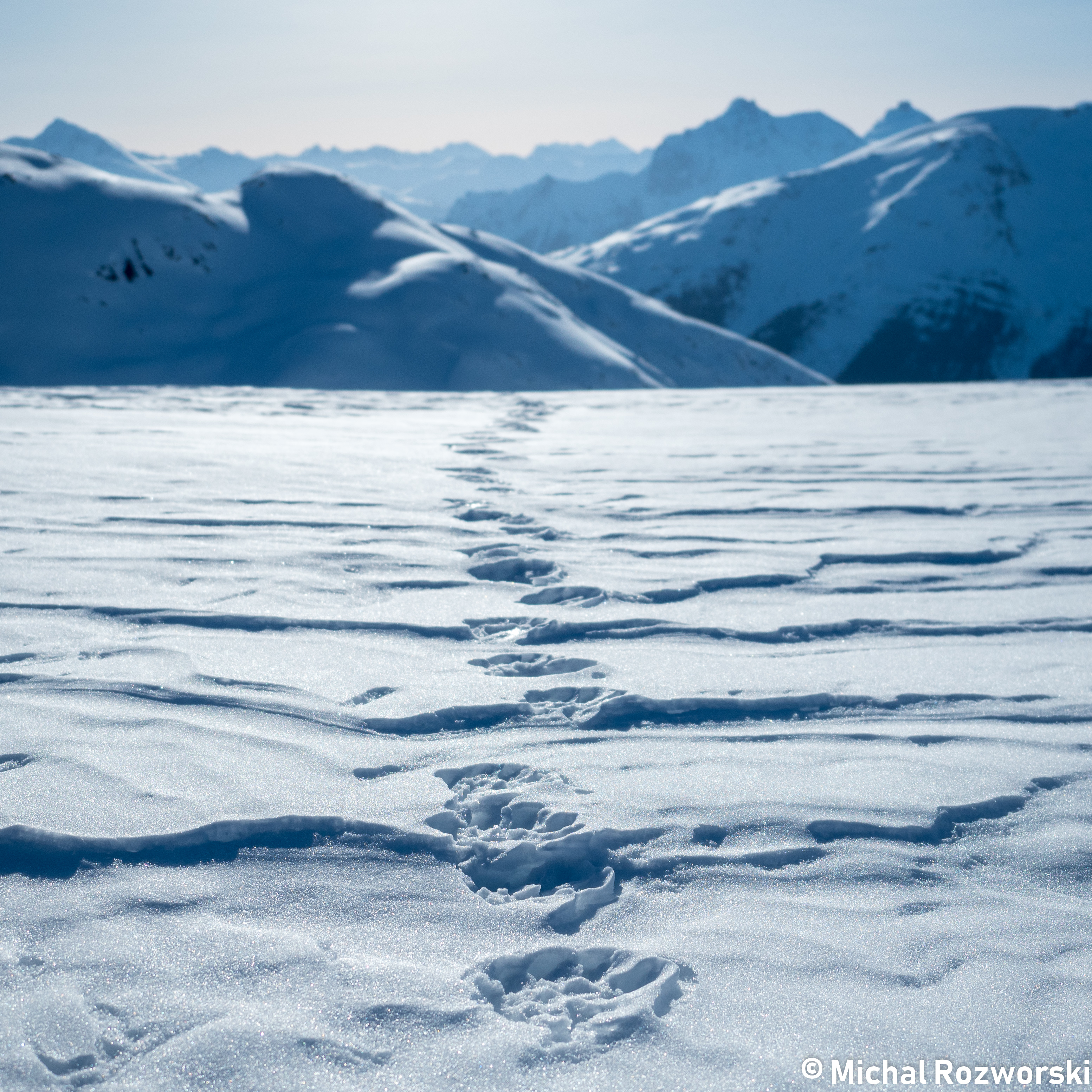
Fresh wolverine tracks in the morning. One col over from our campsite. Photo: Michal Rosworski
A snack overlooking the Manatee Range, deciding if we want to make a detour in. The iconic Wahoo Tower dominates the background. Photo: Michal Rosworski
We deliberated a while but decided against the detour. Not many of the peaks in the Manatee range offered trivial ski ascents. We hadn’t brought ice axes or crampons and were not equipped for technical climbing.
The long descent down from Obelia provided the best skiing of the trip. 3cm of isothermal snow on top of unbreakable crust. Fast and predictable.
After a long descent. We finally reached tree line. We were greeted by a pungent sulfuric smell. At first, Skyler accused somebody of farting. Eventually we realized that we were within the smell radius of the volcanically active Plinth/Meager group.
Our final major ascent followed a gradual path up around Polychrome Mountain. Nick and I had the ingenious idea of removing our ski pants and skinning up in just underwear and shirts. We lathered copious amounts of sunscreen onto our legs, not wanting to be burned because of our decision.
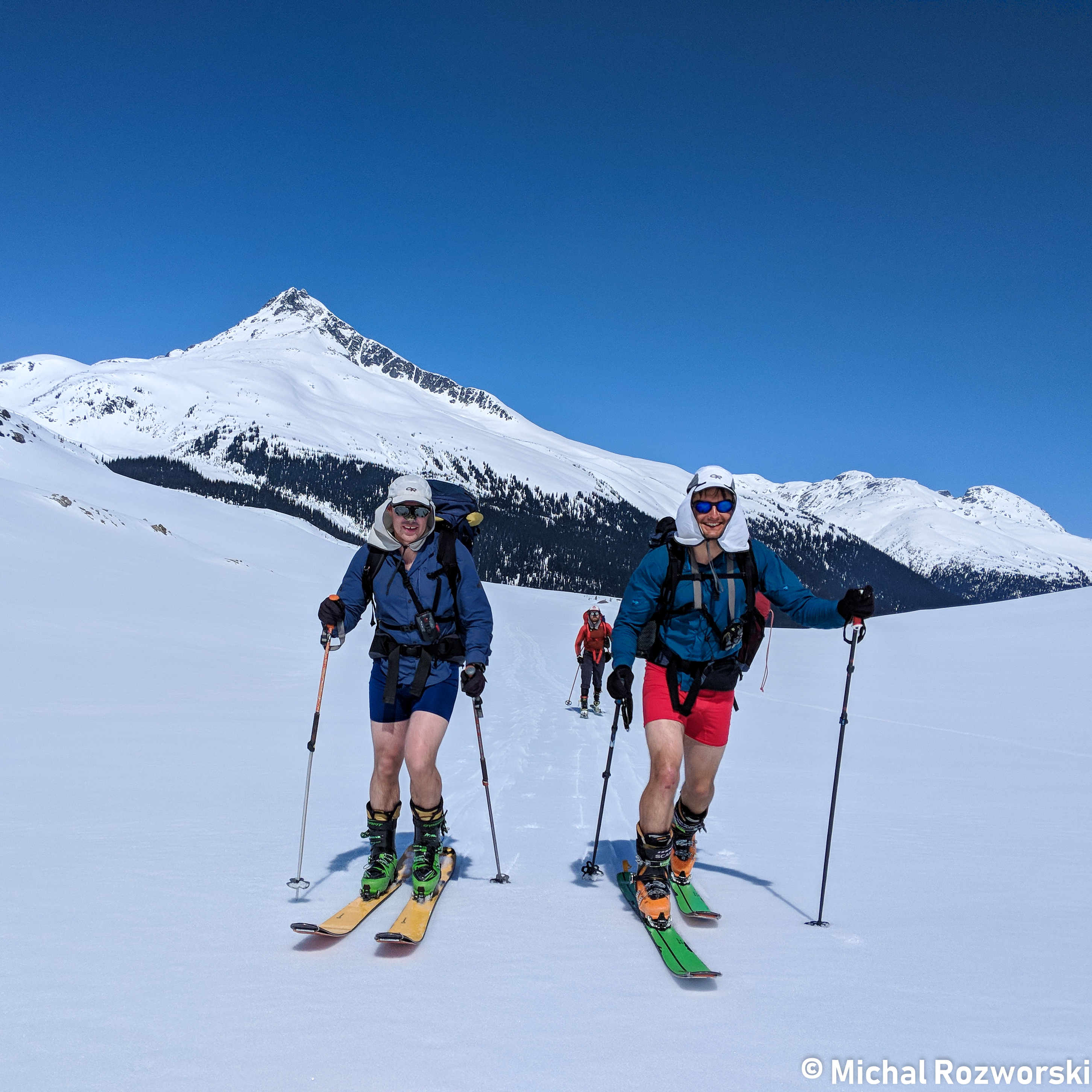
Nick and Olek opt for maximum comfort during the climb up to Polychrome Ridge. Lots of sunscreen was applied. Photo: Michal Rosworski
We took a long lunch break after our ascent. It was relieving to put pants back on.
At the col, we did our best to consume 3 days of food in one day. Pesto and Cheese on everything! This had unfortunate repercussions. One consequence for Skyler was acid reflux. Michal had the antidote. He produced some Pepto-Bismol from his pack. Skyler was ready to eat more.
After an extended lunch break, we had a small amount of skinning ahead to gain the ridge. Here we made an unwise route-finding decision. We attempted to traverse to a low point of the ridge line. Unfortunately, this led to us skinning across a sunbaked slope for 5 minutes. In retrospect we should have skinned above to gain the top of the ridge ~200m higher.
From the ridge, it was skins off travel until Job Creek. We weaved through nicely spaced trees. If we still had winter snow conditions, these gladed trees would have made for excellent turns. Alas, we didn’t quite have winter conditions. It was still really fast travel though.

Nick descents the ridge to the west of Job Creek. What’s a traverse on the Coast without a ski out in crappy snow through some steep, dense trees? Photo: Michal Rosworski
We put skins on to contour below Plinth Mountain, towards the abandoned pumice mine. One last technical crux lay ahead, a technical creek/bog crossing. We found a log bridge, and Skyler led the way across. A few kicked steps were required to gain the snowbank on the far side.
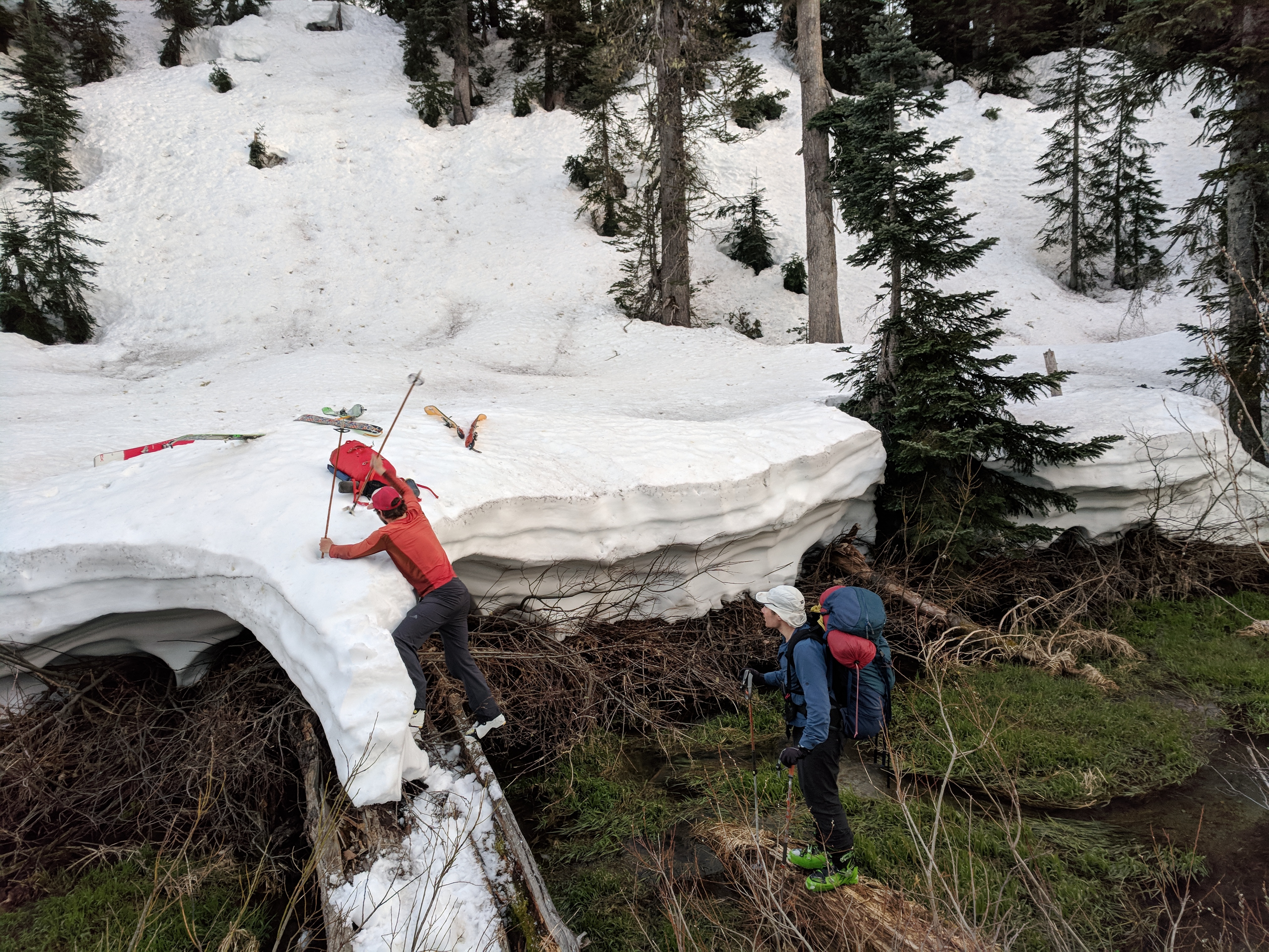
Skyler leads the way across a final crux: A technical bog/creek crossing. Photo: Olek Splawinski
It only took us about 4 hours to get from the top of the ridge by Polychrome Mountain to the pumice mine. 4 years prior, I had hiked up the same path in summer to climb in the Manatee Range. The bushwhacking was horrendous. Uphill, and without skis, it had taken us 2 days to cover the same distance. Yay for snow.
From the pumice mine, we were able to glide with skins off down to the IPP where our car was parked. We traversed across the debris field of one large wet avalanche—the first significant avalanche that we had seen all trip.
We made it back just before 9pm. No headlamps required. Parked beside our truck, was a car with Alberta plates. Likely it belonged to the party who had left the food cache at the bottom of the Lillooet Glacier.
We were excited to be done the trip, but we did have a slight twinge of regret because the weather was still perfect, and we still had so much leftover food. 2 days of food and ~1.8L of white gas. Oh well. First world problems.
Cruising through Whistler at 12am, we decided to stop for dinner at “El Furniture Warehouse” and treat ourselves to $5.95 entrees.
Before getting in to the restaurant, we were pulled over by an RCMP officer. Turns out, Nick had put his license plates on backwards – his insurance expiration sticker was on his front license plate, rather than the back one. The cop seemed un-phased when we told him where we had just come from – “the Lillooet Icefield”.
Lastly, we made it to the restaurant. We were quite sunburnt and tired. With squinted eyes and obscure orders (“2x beet and goat cheese salads for me please!”), we were quickly deemed to be stoners. Nonetheless, the waitress was very kind to us. We later explained to her that we had just been on glaciers for 4.5 days. This explanation seemed plausible to her. As she put it, we looked “A little worn.”
Big thanks to Michal for organizing the trip, and for taking lots of pictures. More of his pictures can be found here.
Another big thanks to Skyler for investing a bunch of time in Google Earth to earn his role as chief navigator.
Thanks to Derry Lappin for lending us his ski crampons and his glacier harness.
Finally, thanks to the 2017 party that wrote up a trip report on Bivouac. We followed a similar route, but on the final descent, elected to ski down a slope to the west of Job Creek, rather than the canyon of the creek bed.
Darn solid trip report, entertaining reading!
Great trip report!!